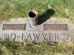
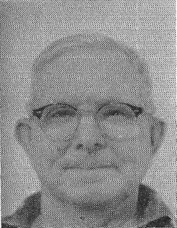
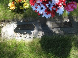
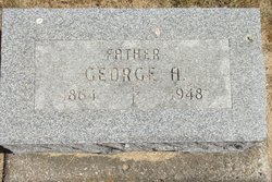
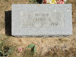
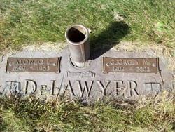
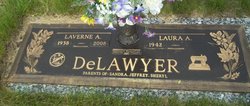
Alonzo Laverne DeLawyer
| Birth | : | 26 Jul 1899 Union County, Iowa, USA |
| Death | : | 2 May 1983 Marshalltown, Marshall County, Iowa, USA |
| Burial | : | St. Peter's Churchyard, Burnley, Burnley Borough, England |
| Coordinate | : | 53.7924450, -2.2394890 |
| Description | : | Married Georgia M. Chandler on April 27,1929 4 Children: John, Floyd, Laverne, Gary. Alonzo DeLawyer, a shop trucker, retired March 16 at the age of 66. He began working here February 28, 1952 as a second shift man in shipping. In September of that year he transferred to the large turret lathe area and remained there until recent years except for a few months temporary assignment to the assembly area in 1954. His last day at work was February 25. from The Governer (employee newsletter) published by Fisher Governer Company Marshalltown IA dated March 1966 Contributor: Elliffen (48210806) • Read More |
frequently asked questions (FAQ):
-
Where is Alonzo Laverne DeLawyer's memorial?
Alonzo Laverne DeLawyer's memorial is located at: St. Peter's Churchyard, Burnley, Burnley Borough, England.
-
When did Alonzo Laverne DeLawyer death?
Alonzo Laverne DeLawyer death on 2 May 1983 in Marshalltown, Marshall County, Iowa, USA
-
Where are the coordinates of the Alonzo Laverne DeLawyer's memorial?
Latitude: 53.7924450
Longitude: -2.2394890
Family Members:
Parent
Spouse
Siblings
Children
Flowers:
Nearby Cemetories:
1. St. Peter's Churchyard
Burnley, Burnley Borough, England
Coordinate: 53.7924450, -2.2394890
2. St. James' Churchyard
Burnley, Burnley Borough, England
Coordinate: 53.7905590, -2.2458280
3. Ebenezer Baptist Chapel Chapelyard
Burnley, Burnley Borough, England
Coordinate: 53.7975120, -2.2397260
4. Holy Trinity Churchyard
Burnley, Burnley Borough, England
Coordinate: 53.7898290, -2.2574200
5. Burnley Cemetery
Burnley, Burnley Borough, England
Coordinate: 53.7821730, -2.2795070
6. Burnley Crematorium
Burnley, Burnley Borough, England
Coordinate: 53.7821730, -2.2795070
7. St. James' Churchyard
Briercliffe, Burnley Borough, England
Coordinate: 53.8107700, -2.2031800
8. St. John the Evangelist Churchyard
Worsthorne, Burnley Borough, England
Coordinate: 53.7877640, -2.1887420
9. All Saints Churchyard
Habergham Eaves, Burnley Borough, England
Coordinate: 53.7971060, -2.2913770
10. Marsden Friends Burial Ground
Marsden, Metropolitan Borough of Kirklees, England
Coordinate: 53.8241910, -2.2197410
11. Haggate Baptist Church Burial Ground
Burnley Borough, England
Coordinate: 53.8145048, -2.1960725
12. Hill Lane Baptist Church Churchyard
Briercliffe, Burnley Borough, England
Coordinate: 53.8161467, -2.1875368
13. St. Paul's Churchyard
Nelson, Pendle Borough, England
Coordinate: 53.8289250, -2.2157520
14. St. Anne Churchyard
Fence, Pendle Borough, England
Coordinate: 53.8304372, -2.2679552
15. Wheatley Lane Methodist Churchyard
Fence, Pendle Borough, England
Coordinate: 53.8341457, -2.2596202
16. St John Churchyard
Higham, Pendle Borough, England
Coordinate: 53.8251420, -2.2898120
17. St. John's Cemetery
Padiham, Burnley Borough, England
Coordinate: 53.7948720, -2.3145290
18. St. Leonard's Churchyard
Padiham, Burnley Borough, England
Coordinate: 53.8022600, -2.3164300
19. St Margaret Churchyard
Hapton, Burnley Borough, England
Coordinate: 53.7802400, -2.3169230
20. Wesleyan Methodist Chapel Chapelyard
Padiham, Burnley Borough, England
Coordinate: 53.8018980, -2.3181730
21. Wheatley Lane Inghamite Church Churchyard
Wheatley Lane, Pendle Borough, England
Coordinate: 53.8412800, -2.2457100
22. St. John the Divine Churchyard
Cliviger, Burnley Borough, England
Coordinate: 53.7533610, -2.1895090
23. St Leonard Churchyard Extension
Padiham, Burnley Borough, England
Coordinate: 53.7991800, -2.3222000
24. John Ecroyd's Orchard
Lancaster, City of Lancaster, England
Coordinate: 53.8201990, -2.1697920

