

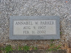
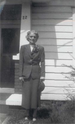
Annabell Walker Parker
| Birth | : | 9 Aug 1907 Greenville County, South Carolina, USA |
| Death | : | 11 Feb 2002 Birmingham, Jefferson County, Alabama, USA |
| Burial | : | St. Andrew's Churchyard, Chew Stoke, Bath and North East Somerset Unitary Authority, England |
| Coordinate | : | 51.3548580, -2.6379190 |
| Description | : | Annabell Walker Buchanan Parker, 94, formerly of Greenville, died Monday, Feb. 11, 2002, at Jefferson County Nursing Home in Birmingham. A native of South Carolina, she was a daughter of the late Silas Edward and Alice Coker Walker. Mrs. Parker retired from Hotel Greenville as a clerk. Surviving are a son, Richard E. Parker, of Mount Olive, Ala.; a brother, Larry Walker, of Anderson; five grandchildren; one great-grandchild; and three great-great-grandchildren. In addition to her parents she was predeceased by a son, S.W. Buchanan. Graveside service: 11 a.m. today at Rose Hill Cemetery, Piedmont. — Westville Memorial Funeral Home, Greenville. Published... Read More |
frequently asked questions (FAQ):
-
Where is Annabell Walker Parker's memorial?
Annabell Walker Parker's memorial is located at: St. Andrew's Churchyard, Chew Stoke, Bath and North East Somerset Unitary Authority, England.
-
When did Annabell Walker Parker death?
Annabell Walker Parker death on 11 Feb 2002 in Birmingham, Jefferson County, Alabama, USA
-
Where are the coordinates of the Annabell Walker Parker's memorial?
Latitude: 51.3548580
Longitude: -2.6379190
Family Members:
Parent

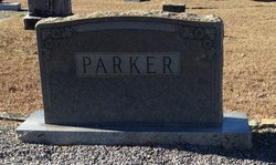
Spouse
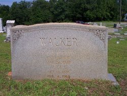
Siblings
Children
Flowers:


Nearby Cemetories:
1. St. Andrew's Churchyard
Chew Stoke, Bath and North East Somerset Unitary Authority, England
Coordinate: 51.3548580, -2.6379190
2. Chew Stoke Methodist Churchyard
Chew Stoke, Bath and North East Somerset Unitary Authority, England
Coordinate: 51.3518196, -2.6332706
3. Chew Magna Baptist Churchyard
Chew Magna, Bath and North East Somerset Unitary Authority, England
Coordinate: 51.3648736, -2.6094282
4. St. Andrew's Churchyard
Chew Magna, Bath and North East Somerset Unitary Authority, England
Coordinate: 51.3664560, -2.6089140
5. The Blessed Virgin Mary Churchyard
Nempnett Thrubwell, Bath and North East Somerset Unitary Authority, England
Coordinate: 51.3407560, -2.6720673
6. Blessed Virgin Mary Churchyard
Nempnett Thrubwell, Bath and North East Somerset Unitary Authority, England
Coordinate: 51.3407790, -2.6721100
7. Church of St. Mary and St. Peter
Winford, North Somerset Unitary Authority, England
Coordinate: 51.3820870, -2.6580510
8. Bishop's Sutton Holy Trinity Churchyard
Bath and North East Somerset Unitary Authority, England
Coordinate: 51.3341900, -2.5958300
9. St. Michael and All Angels Churchyard
Butcombe, North Somerset Unitary Authority, England
Coordinate: 51.3538470, -2.6973670
10. St Mary the Virgin Churchyard
Stanton Drew, Bath and North East Somerset Unitary Authority, England
Coordinate: 51.3657390, -2.5788440
11. St. Bartholomew Churchyard
Ubley, Bath and North East Somerset Unitary Authority, England
Coordinate: 51.3214600, -2.6766900
12. St. Michael Churchyard
Dundry, North Somerset Unitary Authority, England
Coordinate: 51.3990510, -2.6374330
13. St Nicholas & the Blessed Virgin Mary
Stowey Sutton, Bath and North East Somerset Unitary Authority, England
Coordinate: 51.3329190, -2.5764850
14. St Michael the Archangel Churchyard
Compton Martin, Bath and North East Somerset Unitary Authority, England
Coordinate: 51.3107380, -2.6534510
15. St Katharine and The Noble Army Churchyard
Felton, North Somerset Unitary Authority, England
Coordinate: 51.3876440, -2.6979950
16. Harptree Cemetery
East Harptree, Bath and North East Somerset Unitary Authority, England
Coordinate: 51.3056390, -2.6238890
17. Holy Trinity Churchyard
Norton Malreward, Bath and North East Somerset Unitary Authority, England
Coordinate: 51.3831750, -2.5711360
18. St. Mary's Churchyard
West Harptree, Bath and North East Somerset Unitary Authority, England
Coordinate: 51.3032530, -2.6582110
19. St Andrew Churchyard
Blagdon, North Somerset Unitary Authority, England
Coordinate: 51.3275610, -2.7127710
20. Saint Laurence Churchyard
East Harptree, Bath and North East Somerset Unitary Authority, England
Coordinate: 51.3011730, -2.6245740
21. Christ Church Churchyard
Redhill, North Somerset Unitary Authority, England
Coordinate: 51.3657790, -2.7245240
22. St Margarets Churchyard
Hinton Blewett, Bath and North East Somerset Unitary Authority, England
Coordinate: 51.3104000, -2.5834000
23. Pensford Methodist Churchyard
Pensford, Bath and North East Somerset Unitary Authority, England
Coordinate: 51.3731030, -2.5506730
24. Saint Thomas Churchyard
Pensford, Bath and North East Somerset Unitary Authority, England
Coordinate: 51.3710450, -2.5495820