
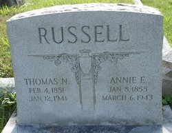
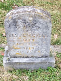
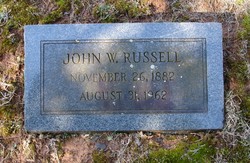
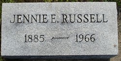
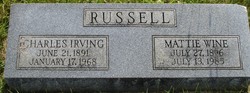
Annie Eliza Holmes Russell
| Birth | : | 8 Jan 1855 Fauquier County, Virginia, USA |
| Death | : | 6 Mar 1943 Marshall, Fauquier County, Virginia, USA |
| Burial | : | St Andrew George Haydock Roman Catholic Churchyard, Cottam, City of Preston, England |
| Coordinate | : | 53.7879280, -2.7591570 |
| Description | : | Daughter of John Holmes and Catherine "Kitty" Ann Strother |
frequently asked questions (FAQ):
-
Where is Annie Eliza Holmes Russell's memorial?
Annie Eliza Holmes Russell's memorial is located at: St Andrew George Haydock Roman Catholic Churchyard, Cottam, City of Preston, England.
-
When did Annie Eliza Holmes Russell death?
Annie Eliza Holmes Russell death on 6 Mar 1943 in Marshall, Fauquier County, Virginia, USA
-
Where are the coordinates of the Annie Eliza Holmes Russell's memorial?
Latitude: 53.7879280
Longitude: -2.7591570
Family Members:
Spouse

Children
Flowers:


Nearby Cemetories:
1. St Andrew George Haydock Roman Catholic Churchyard
Cottam, City of Preston, England
Coordinate: 53.7879280, -2.7591570
2. Saint Anne's Church
Woodplumpton, City of Preston, England
Coordinate: 53.8038130, -2.7621940
3. St. Andrew's Churchyard
Ashton-on-Ribble, City of Preston, England
Coordinate: 53.7687030, -2.7359180
4. St. Mary's Churchyard
Lea, City of Preston, England
Coordinate: 53.7733810, -2.7942770
5. St. John Baptist Churchyard
Broughton-in-Amounderness, City of Preston, England
Coordinate: 53.8033700, -2.7170400
6. St Mary's Newhouse
Barton, City of Preston, England
Coordinate: 53.8205240, -2.7406500
7. Christ Church Churchyard
Fulwood, City of Preston, England
Coordinate: 53.7771920, -2.7028700
8. St. John the Evangelist Churchyard
Clifton, Fylde Borough, England
Coordinate: 53.7758600, -2.8158500
9. St Walburge's RC Church
Preston, City of Preston, England
Coordinate: 53.7629690, -2.7149620
10. Saint Peter Churchyard
Preston, City of Preston, England
Coordinate: 53.7634100, -2.7080700
11. St Mary Churchyard
Penwortham, South Ribble Borough, England
Coordinate: 53.7551800, -2.7234210
12. Grey Friars' Church
Preston, City of Preston, England
Coordinate: 53.7601480, -2.7084600
13. Christ Church Churchyard
Preston, City of Preston, England
Coordinate: 53.7573210, -2.7103080
14. Holy Trinity
Preston, City of Preston, England
Coordinate: 53.7613030, -2.7030580
15. Friends Meeting House Burial Ground (Defunct)
Preston, City of Preston, England
Coordinate: 53.7610250, -2.7030380
16. St. Lawrence Churchyard
Barton, City of Preston, England
Coordinate: 53.8289213, -2.7366654
17. St. Wilfrid's Catholic Cemetery
Preston, City of Preston, England
Coordinate: 53.7581670, -2.7044930
18. St. George the Martyr
Preston, City of Preston, England
Coordinate: 53.7591220, -2.7025660
19. St. Ignatius RC Churchyard
Preston, City of Preston, England
Coordinate: 53.7635270, -2.6965870
20. St. Paul Churchyard
Preston, City of Preston, England
Coordinate: 53.7625360, -2.6947080
21. St John Churchyard
Preston, City of Preston, England
Coordinate: 53.7582080, -2.6959750
22. Penwortham Cemetery
Penwortham, South Ribble Borough, England
Coordinate: 53.7452590, -2.7209190
23. St. James' Churchyard
Preston, City of Preston, England
Coordinate: 53.7566010, -2.6941110
24. St. Mary's Churchyard
Preston, City of Preston, England
Coordinate: 53.8010830, -2.6779600