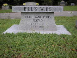
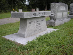
Bettie Jane Perry Floyd
| Birth | : | 9 Feb 1936 Friendship, Crockett County, Tennessee, USA |
| Death | : | 4 Jun 2013 Jackson, Madison County, Tennessee, USA |
| Burial | : | Bellevernon Cemetery, Friendship, Crockett County, USA |
| Coordinate | : | 35.9135830, -89.2495910 |
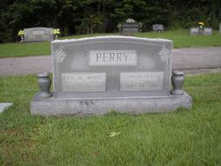
| Description | : | Palo Verde Valley Times, Blythe, California Bettie Jane Perry Floyd passed this life on June 4, 2013 in Jackson, Tenn. She was born Feb. 9, 1936, in Friendship, Tenn. At an early age she moved with her parents, Mack and Era White Perry, to Southern California. She graduated from Palo Verde High School in Blythe where she was selected as a Job's Daughters queen. Bettie was a graduate of Stephens College in Columbia, Mo. with a major in fashion and design. She studied business at the University of Southern California, Imperial Valley College, Palo Verde College and the University of Hawaii. She graduated... Read More |
frequently asked questions (FAQ):
-
Where is Bettie Jane Perry Floyd's memorial?
Bettie Jane Perry Floyd's memorial is located at: Bellevernon Cemetery, Friendship, Crockett County, USA.
-
When did Bettie Jane Perry Floyd death?
Bettie Jane Perry Floyd death on 4 Jun 2013 in Jackson, Madison County, Tennessee, USA
-
Where are the coordinates of the Bettie Jane Perry Floyd's memorial?
Latitude: 35.9135830
Longitude: -89.2495910
Family Members:
Parent
Flowers:
Nearby Cemetories:
1. Bellevernon Cemetery
Friendship, Crockett County, USA
Coordinate: 35.9135830, -89.2495910
2. Friendship Cemetery
Friendship, Crockett County, USA
Coordinate: 35.9146430, -89.2381450
3. Mount Moriah Cemetery
Friendship, Crockett County, USA
Coordinate: 35.8955420, -89.2576300
4. Bowen Chapel Cemetery
Friendship, Dyer County, USA
Coordinate: 35.9311810, -89.2353720
5. Mose M. Thompson Cemetery
Friendship, Dyer County, USA
Coordinate: 35.9243680, -89.2765870
6. Hardin Cemetery
Friendship, Dyer County, USA
Coordinate: 35.9243270, -89.2766430
7. Nash Cemetery
Dyersburg, Dyer County, USA
Coordinate: 35.9252500, -89.2822230
8. Robertson-Warren Cemetery
Friendship, Crockett County, USA
Coordinate: 35.8830700, -89.2427200
9. Mount Pisgah Cemetery
Friendship, Dyer County, USA
Coordinate: 35.9162470, -89.2901740
10. Zion Hill Church Cemetery
Friendship, Dyer County, USA
Coordinate: 35.9095110, -89.2900760
11. Edwards Cemetery
Friendship, Crockett County, USA
Coordinate: 35.9314120, -89.2146810
12. Deaton Cemetery
Friendship, Crockett County, USA
Coordinate: 35.9350080, -89.2122640
13. Mount Zion Cemetery
Friendship, Crockett County, USA
Coordinate: 35.9131950, -89.2032590
14. Staggs Cemetery
Friendship, Dyer County, USA
Coordinate: 35.9397930, -89.2896620
15. Old Dyer Church Cemetery
Friendship, Crockett County, USA
Coordinate: 35.8844600, -89.2101900
16. Allen Chapel Cemetery
Tigrett, Dyer County, USA
Coordinate: 35.9511400, -89.2207500
17. Hendrix Cemetery
Tigrett, Dyer County, USA
Coordinate: 35.9511500, -89.2206950
18. Cock and Irvin Cemetery
Hawkinsville, Dyer County, USA
Coordinate: 35.9104430, -89.3046210
19. Mays Chapel Cemetery
Friendship, Crockett County, USA
Coordinate: 35.9363540, -89.2006050
20. Jones Cemetery
Tigrett, Dyer County, USA
Coordinate: 35.9552230, -89.2747450
21. Saint Peter Cemetery
Tigrett, Dyer County, USA
Coordinate: 35.9616440, -89.2520140
22. Williams Chapel Baptist Church Cemetery
Friendship, Crockett County, USA
Coordinate: 35.9258940, -89.1916320
23. Browder Family Cemetery
Broadview, Crockett County, USA
Coordinate: 35.8646890, -89.2623010
24. McGary Family Cemetery
Tigrett, Dyer County, USA
Coordinate: 35.9649530, -89.2501520


