
| Memorials | : | 0 |
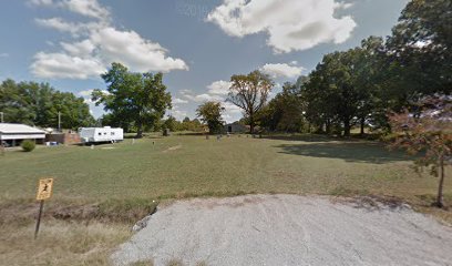
| Location | : | Tigrett, Dyer County, USA |
| Coordinate | : | 35.9511500, -89.2206950 |
| Description | : | From the intersection of TN-210 N/Old Hwy 20 & US-412/TN-20 S, SE of Dyersburg, travel east on TN-210 N/Old Hwy 20 for 5.0 mi.; keeping east (left) to go onto Dyersburg Eaton Rd., going 0.2 mi. Stokes Rd., going 0.4 mi.; continue onto Iron Bridge Rd., going 0.7 mi.; turning north (left) onto Green Hill Bottom, going 150 yards, to the cemetery on the east (right) side, just past Beaver Ln. |
frequently asked questions (FAQ):
-
Where is Hendrix Cemetery?
Hendrix Cemetery is located at 516 Green Hill Bottom Road Tigrett, Dyer County ,Tennessee ,USA.
-
Hendrix Cemetery cemetery's updated grave count on graveviews.com?
0 memorials
-
Where are the coordinates of the Hendrix Cemetery?
Latitude: 35.9511500
Longitude: -89.2206950
Nearby Cemetories:
1. Allen Chapel Cemetery
Tigrett, Dyer County, USA
Coordinate: 35.9511400, -89.2207500
2. Deaton Cemetery
Friendship, Crockett County, USA
Coordinate: 35.9350080, -89.2122640
3. Edwards Cemetery
Friendship, Crockett County, USA
Coordinate: 35.9314120, -89.2146810
4. Mays Chapel Cemetery
Friendship, Crockett County, USA
Coordinate: 35.9363540, -89.2006050
5. Bowen Chapel Cemetery
Friendship, Dyer County, USA
Coordinate: 35.9311810, -89.2353720
6. Saint Peter Cemetery
Tigrett, Dyer County, USA
Coordinate: 35.9616440, -89.2520140
7. McGary Family Cemetery
Tigrett, Dyer County, USA
Coordinate: 35.9649530, -89.2501520
8. Young & Williams Cemetery
Elizabeth, Crockett County, USA
Coordinate: 35.9707990, -89.1937240
9. Williams Chapel Baptist Church Cemetery
Friendship, Crockett County, USA
Coordinate: 35.9258940, -89.1916320
10. Elizabeth Methodist Church Cemetery
Elizabeth, Crockett County, USA
Coordinate: 35.9605010, -89.1770140
11. Friendship Cemetery
Friendship, Crockett County, USA
Coordinate: 35.9146430, -89.2381450
12. Mount Zion Cemetery
Friendship, Crockett County, USA
Coordinate: 35.9131950, -89.2032590
13. Jones Cemetery
Tigrett, Dyer County, USA
Coordinate: 35.9552230, -89.2747450
14. Bellevernon Cemetery
Friendship, Crockett County, USA
Coordinate: 35.9135830, -89.2495910
15. Mose M. Thompson Cemetery
Friendship, Dyer County, USA
Coordinate: 35.9243680, -89.2765870
16. Hardin Cemetery
Friendship, Dyer County, USA
Coordinate: 35.9243270, -89.2766430
17. Bethesda Cemetery
Wilcox, Crockett County, USA
Coordinate: 35.9361230, -89.1557970
18. Nash Cemetery
Dyersburg, Dyer County, USA
Coordinate: 35.9252500, -89.2822230
19. Staggs Cemetery
Friendship, Dyer County, USA
Coordinate: 35.9397930, -89.2896620
20. Bell-Walker Cemetery
Tigrett, Dyer County, USA
Coordinate: 35.9581400, -89.2913360
21. Old Mayfield Cemetery
Eaton, Gibson County, USA
Coordinate: 35.9894960, -89.1666780
22. Mayfield Cemetery
Eaton, Gibson County, USA
Coordinate: 35.9910230, -89.1678300
23. Murray Cemetery
Bonicord, Dyer County, USA
Coordinate: 35.9485000, -89.2969000
24. Mount Moriah Cemetery
Friendship, Crockett County, USA
Coordinate: 35.8955420, -89.2576300