
| Birth | : | 10 Dec 1877 Pottawattamie County, Iowa, USA |
| Death | : | 4 Jan 1927 Council Bluffs, Pottawattamie County, Iowa, USA |
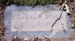
| Burial | : | Branson Cemetery, Loveland, Pottawattamie County, USA |
| Coordinate | : | 41.4846992, -95.8606033 |
| Description | : | Bert Jones. Bert Jones, 49, 17 South Sixteenth street, died at a local hospital Tuesday noon. He is survived by four sons; Earl, Richard and William of this city and Fred of Kansas City and one daughter, Helen of Omaha. His body was removed to Beem-Bedford funeral home. Funeral arrangements will announced later. Mr. Jones was superintendent of the. Updike elevator at Missouri Valley for twenty years. He came to Council Bluffs about six months ago. source of obituary (verbatim transcription): Council Bluffs Nonpareil (Council Bluffs, Iowa),... Read More |
frequently asked questions (FAQ):
-
Where is Burton Robert “Bert” Jones's memorial?
Burton Robert “Bert” Jones's memorial is located at: Branson Cemetery, Loveland, Pottawattamie County, USA.
-
When did Burton Robert “Bert” Jones death?
Burton Robert “Bert” Jones death on 4 Jan 1927 in Council Bluffs, Pottawattamie County, Iowa, USA
-
Where are the coordinates of the Burton Robert “Bert” Jones's memorial?
Latitude: 41.4846992
Longitude: -95.8606033
Family Members:

Spouse
Siblings
Children
Flowers:


Nearby Cemetories:
1. Branson Cemetery
Loveland, Pottawattamie County, USA
Coordinate: 41.4846992, -95.8606033
2. Crook Cemetery
Honey Creek, Pottawattamie County, USA
Coordinate: 41.4581330, -95.8737000
3. Saint Bridgets Cemetery
Honey Creek, Pottawattamie County, USA
Coordinate: 41.4664001, -95.8289032
4. Oak Grove Cemetery
Missouri Valley, Harrison County, USA
Coordinate: 41.5167007, -95.8649979
5. Allen Cemetery
Pottawattamie County, USA
Coordinate: 41.4427986, -95.8550034
6. Grange Cemetery
Honey Creek, Pottawattamie County, USA
Coordinate: 41.4446678, -95.8034668
7. Reels Cemetery
Crescent, Pottawattamie County, USA
Coordinate: 41.4234100, -95.8321700
8. William C McIntosh Cemetery
Crescent, Pottawattamie County, USA
Coordinate: 41.4088745, -95.8477097
9. Rose Hill Memorial Gardens
Missouri Valley, Harrison County, USA
Coordinate: 41.5656000, -95.8897000
10. Hurleys Evergreen Cemetery
Harrison County, USA
Coordinate: 41.5700989, -95.8618698
11. Mount Carmel Cemetery
Missouri Valley, Harrison County, USA
Coordinate: 41.5675011, -95.8897018
12. Saint Pauls Lutheran Cemetery
Neola, Pottawattamie County, USA
Coordinate: 41.4337000, -95.7607000
13. Champan Frazier Cemetery
Harrison County, USA
Coordinate: 41.5773500, -95.8933500
14. Frazier Cemetery
Missouri Valley, Harrison County, USA
Coordinate: 41.5932999, -95.8375015
15. Linnwood Cemetery
Harrison County, USA
Coordinate: 41.5589200, -95.7502100
16. Crescent Cemetery
Crescent, Pottawattamie County, USA
Coordinate: 41.3664894, -95.8566208
17. Shipley Cemetery
Washington County, USA
Coordinate: 41.3932991, -95.9828033
18. Fort Calhoun Cemetery
Fort Calhoun, Washington County, USA
Coordinate: 41.4581375, -96.0352020
19. Harris Grove Cemetery
Beebeetown, Harrison County, USA
Coordinate: 41.5782928, -95.7262192
20. Hazel Dell Cemetery
Council Bluffs, Pottawattamie County, USA
Coordinate: 41.3489723, -95.7939911
21. Castor Cemetery
Underwood, Pottawattamie County, USA
Coordinate: 41.4127040, -95.6887490
22. Calhoun Cemetery
Calhoun, Harrison County, USA
Coordinate: 41.6391983, -95.8938980
23. Gregg Cemetery
Weston, Pottawattamie County, USA
Coordinate: 41.3330000, -95.7931000
24. Evans Cemetery
Crescent, Pottawattamie County, USA
Coordinate: 41.3255997, -95.8368988