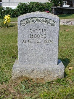
Cassie Moore
| Birth | : | 12 Aug 1904 |
| Death | : | 26 Jan 1995 Hamblen County, Tennessee, USA |
| Burial | : | Meadow Branch Cemetery, Bean Station, Grainger County, USA |
| Coordinate | : | 36.3572006, -83.2822037 |
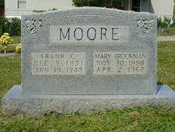
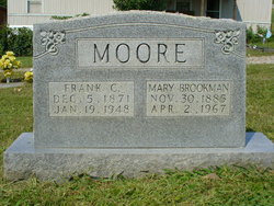
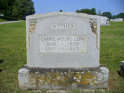
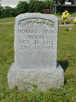
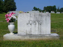
| Description | : | Grainger County News, 2 Feb, 1995: "OBITUARIES Moore Cassie Moore, 90, formerly of Bean Station, died Thursday, January 26, at Heritage Center. A member of Central United Methodist Church, she was preceded in death by her parents, Frank and Mary Brookman Moore; brother Howard Moore, and sisters, Virginia Johns and Carrie Long. Surviving are her nieces and husbands, Clarence and Donna Walker of Bean Station, Betty and Bob Hill of Maryland and Glenda and Jake Crigger of Morristown; two great-nieces; one great-nephew; one great-great-niece and three great-great-nephews. Her funeral was held Sunday at 2... Read More |
frequently asked questions (FAQ):
-
Where is Cassie Moore's memorial?
Cassie Moore's memorial is located at: Meadow Branch Cemetery, Bean Station, Grainger County, USA.
-
When did Cassie Moore death?
Cassie Moore death on 26 Jan 1995 in Hamblen County, Tennessee, USA
-
Where are the coordinates of the Cassie Moore's memorial?
Latitude: 36.3572006
Longitude: -83.2822037
Family Members:
Parent
Siblings
Flowers:
Nearby Cemetories:
1. Meadow Branch Cemetery
Bean Station, Grainger County, USA
Coordinate: 36.3572006, -83.2822037
2. Holt Cemetery #2
Bean Station, Grainger County, USA
Coordinate: 36.3630560, -83.2844440
3. Moores Chapel Cemetery
Bean Station, Grainger County, USA
Coordinate: 36.3488998, -83.2897034
4. Central United Methodist Church Cemetery
Bean Station, Grainger County, USA
Coordinate: 36.3422740, -83.2798470
5. DeBord Cemetery
Bean Station, Grainger County, USA
Coordinate: 36.3315000, -83.2834000
6. Garrett Cemetery
Grainger County, USA
Coordinate: 36.3414001, -83.3082962
7. Samsel Lakeview Cemetery
Bean Station, Grainger County, USA
Coordinate: 36.3475800, -83.3189468
8. Samsel Cemetery
Bean Station, Grainger County, USA
Coordinate: 36.3424020, -83.3167060
9. County Line Cemetery
Bean Station, Grainger County, USA
Coordinate: 36.3207700, -83.2789850
10. Meek Cemetery
Bean Station, Grainger County, USA
Coordinate: 36.3207180, -83.2797150
11. Dalton Cemetery
Bean Station, Grainger County, USA
Coordinate: 36.3428001, -83.3296967
12. First Independent Freewill Baptist Church Cemetery
Bean Station, Grainger County, USA
Coordinate: 36.3158860, -83.2855850
13. Adriel Baptist Church Cemetery
Bean Station, Grainger County, USA
Coordinate: 36.3125000, -83.2897034
14. Samsel Cemetery
Bean Station, Grainger County, USA
Coordinate: 36.3114014, -83.2925034
15. Bowlin Cemetery
Hancock County, USA
Coordinate: 36.4067001, -83.2581024
16. Bowlin Cemetery
Bray, Hancock County, USA
Coordinate: 36.4141340, -83.2956790
17. Dodson Cemetery
Bean Station, Grainger County, USA
Coordinate: 36.2989006, -83.2869034
18. Rocky Summit Cemetery
Bean Station, Grainger County, USA
Coordinate: 36.2984750, -83.2799030
19. Adams Cemetery
Hancock County, USA
Coordinate: 36.4134570, -83.3106410
20. Grantham Cemetery
Grainger County, USA
Coordinate: 36.2946860, -83.2794570
21. Harville Cemetery
Grainger County, USA
Coordinate: 36.3811802, -83.3543986
22. Harris Cemetery
Grainger County, USA
Coordinate: 36.3055992, -83.3308029
23. Greene Cemetery
Hancock County, USA
Coordinate: 36.4184400, -83.2531400
24. Armstrong Cemetery
Hawkins County, USA
Coordinate: 36.3417015, -83.2031021

