
| Memorials | : | 37 |
| Location | : | Bean Station, Grainger County, USA |
| Coordinate | : | 36.3207700, -83.2789850 |
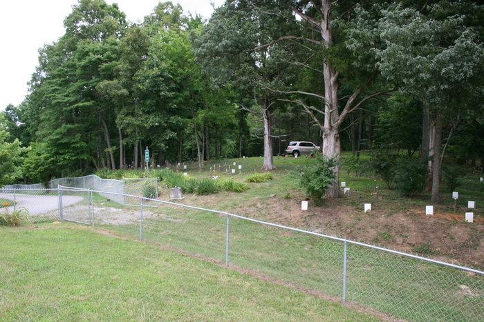
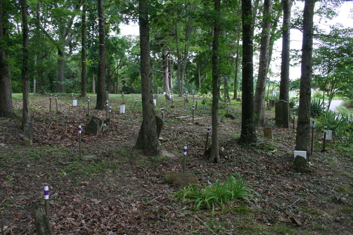
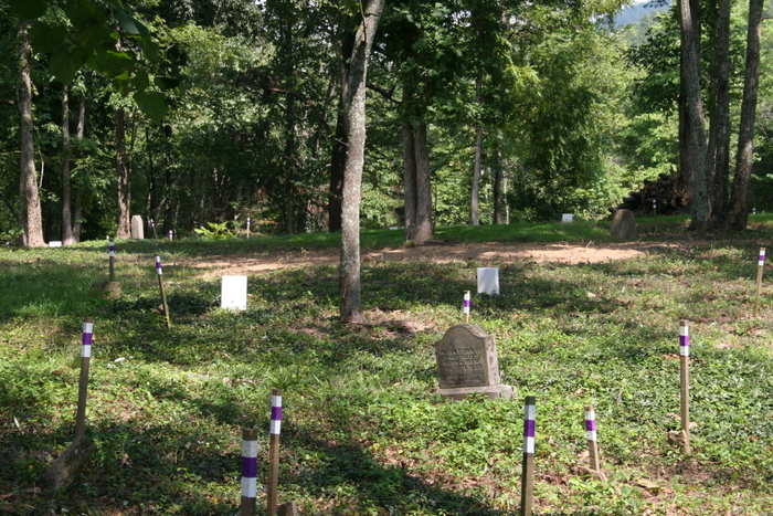
| Description | : | Abandoned and overgrown for decades, County Line Cemetery was the burying ground for County Line Church, a multi-denominational church founded in 1792, and its predecessor, Stubblefield Meeting House, mentioned as a boundary marker when Grainger County was created in 1796. The last burial in County Line probably took place before 1920. County Line Church was disbanded in 1941 when the property was taken by TVA's creation of Cherokee Lake. The cemetery is adjacent to the newer Meek Cemetery. There are very few inscribed tombstones in County Line, and some of those are now unreadable. Many... Read More |
frequently asked questions (FAQ):
-
Where is County Line Cemetery?
County Line Cemetery is located at Wyatt Village Road Bean Station, Grainger County ,Tennessee ,USA.
-
County Line Cemetery cemetery's updated grave count on graveviews.com?
37 memorials
-
Where are the coordinates of the County Line Cemetery?
Latitude: 36.3207700
Longitude: -83.2789850
Nearby Cemetories:
1. Meek Cemetery
Bean Station, Grainger County, USA
Coordinate: 36.3207180, -83.2797150
2. First Independent Freewill Baptist Church Cemetery
Bean Station, Grainger County, USA
Coordinate: 36.3158860, -83.2855850
3. DeBord Cemetery
Bean Station, Grainger County, USA
Coordinate: 36.3315000, -83.2834000
4. Adriel Baptist Church Cemetery
Bean Station, Grainger County, USA
Coordinate: 36.3125000, -83.2897034
5. Samsel Cemetery
Bean Station, Grainger County, USA
Coordinate: 36.3114014, -83.2925034
6. Central United Methodist Church Cemetery
Bean Station, Grainger County, USA
Coordinate: 36.3422740, -83.2798470
7. Rocky Summit Cemetery
Bean Station, Grainger County, USA
Coordinate: 36.2984750, -83.2799030
8. Dodson Cemetery
Bean Station, Grainger County, USA
Coordinate: 36.2989006, -83.2869034
9. Grantham Cemetery
Grainger County, USA
Coordinate: 36.2946860, -83.2794570
10. Moores Chapel Cemetery
Bean Station, Grainger County, USA
Coordinate: 36.3488998, -83.2897034
11. Garrett Cemetery
Grainger County, USA
Coordinate: 36.3414001, -83.3082962
12. Taylor Family Cemetery
Bean Station, Grainger County, USA
Coordinate: 36.2876670, -83.2907330
13. Meadow Branch Cemetery
Bean Station, Grainger County, USA
Coordinate: 36.3572006, -83.2822037
14. Samsel Cemetery
Bean Station, Grainger County, USA
Coordinate: 36.3424020, -83.3167060
15. Ford Cemetery
Grainger County, USA
Coordinate: 36.2902985, -83.3071976
16. Samsel Lakeview Cemetery
Bean Station, Grainger County, USA
Coordinate: 36.3475800, -83.3189468
17. Livingston Cemetery
Bean Station, Grainger County, USA
Coordinate: 36.2785988, -83.2791977
18. Holt Cemetery #2
Bean Station, Grainger County, USA
Coordinate: 36.3630560, -83.2844440
19. Harris Cemetery
Grainger County, USA
Coordinate: 36.3055992, -83.3308029
20. Dalton Cemetery
Bean Station, Grainger County, USA
Coordinate: 36.3428001, -83.3296967
21. Noeton Baptist Church Cemetery Original
Bean Station, Grainger County, USA
Coordinate: 36.3012600, -83.3342200
22. N L Henard Cemetery
Morristown, Hamblen County, USA
Coordinate: 36.2708221, -83.2726048
23. Amis Cemetery
Hamblen County, USA
Coordinate: 36.2898100, -83.2255000
24. Harrell Cemetery
Bean Station, Grainger County, USA
Coordinate: 36.3074989, -83.3463974