
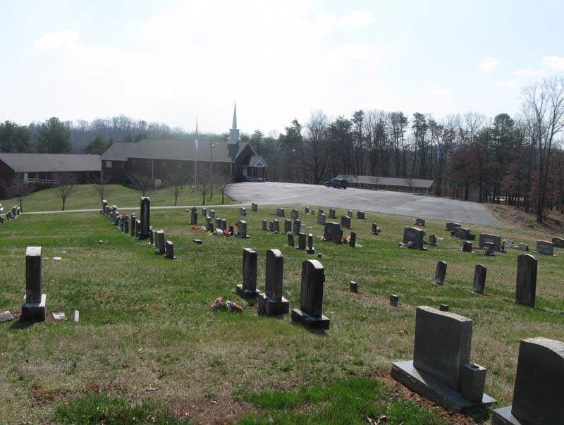
| Memorials | : | 516 |
| Location | : | Bean Station, Grainger County, USA |
| Coordinate | : | 36.3125000, -83.2897034 |
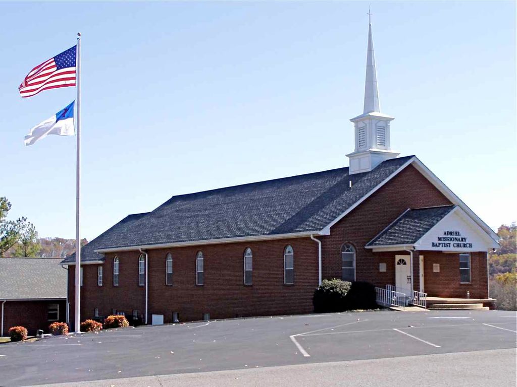
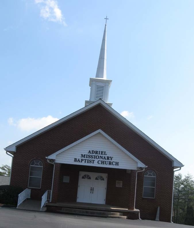
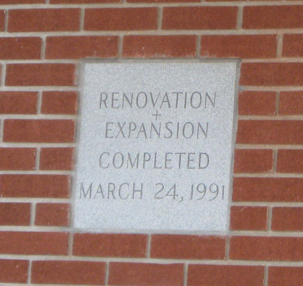
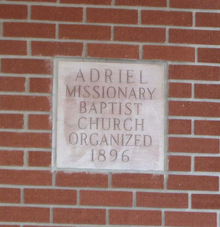
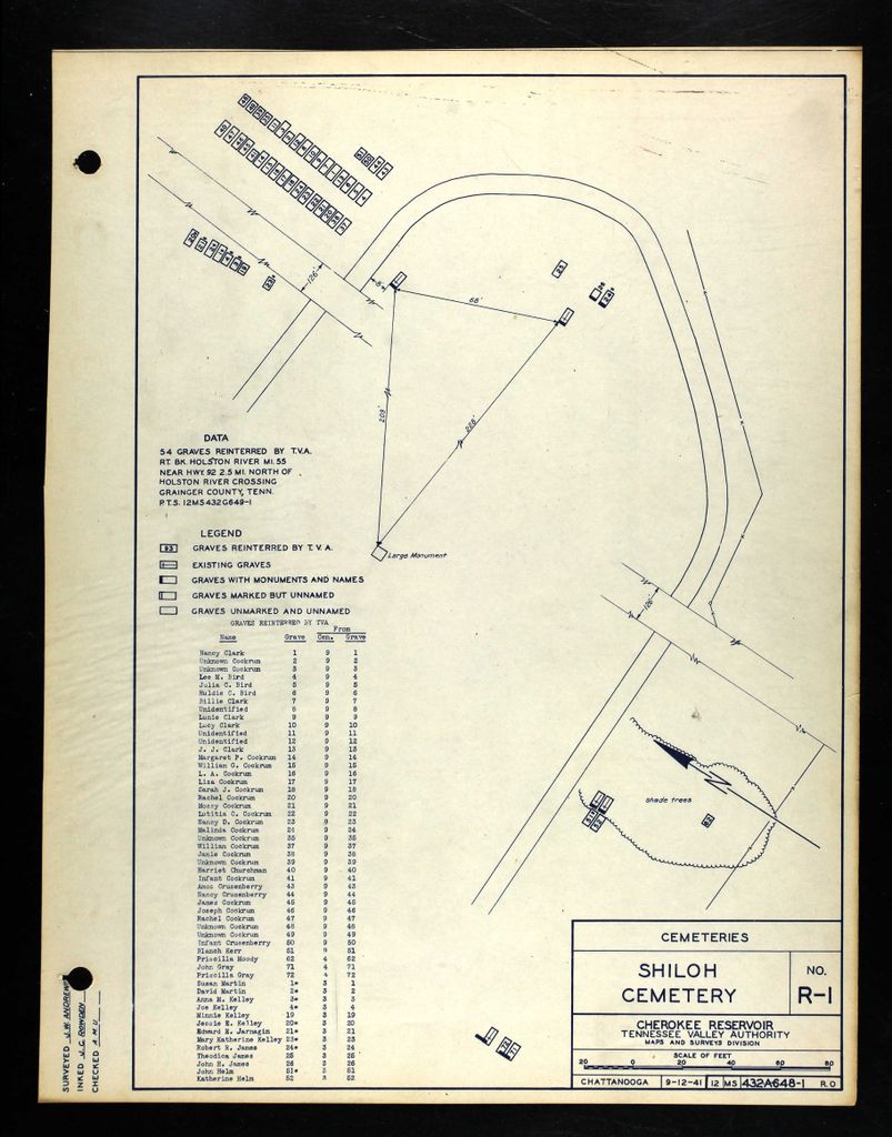
| Description | : | In 1896 some members of the century-old County Line Baptist Church formed a new church, Adriel Missionary Baptist Church, in the Crosby community near the Holston River. Land for the new church and its cemetery was donated by the Crosby family. When TVA built Cherokee Dam on the river, creating Cherokee Lake in 1941, Adriel's church building and cemetery were moved to higher ground at the present location. The church building was completely destroyed by fire in 1967 and replaced with a new structure, which has since had several additions made to it. All the graves in the original Adriel Missionary Baptist... Read More |
frequently asked questions (FAQ):
-
Where is Adriel Baptist Church Cemetery?
Adriel Baptist Church Cemetery is located at Adriel Drive Bean Station, Grainger County ,Tennessee ,USA.
-
Adriel Baptist Church Cemetery cemetery's updated grave count on graveviews.com?
515 memorials
-
Where are the coordinates of the Adriel Baptist Church Cemetery?
Latitude: 36.3125000
Longitude: -83.2897034
Nearby Cemetories:
1. Samsel Cemetery
Bean Station, Grainger County, USA
Coordinate: 36.3114014, -83.2925034
2. First Independent Freewill Baptist Church Cemetery
Bean Station, Grainger County, USA
Coordinate: 36.3158860, -83.2855850
3. Meek Cemetery
Bean Station, Grainger County, USA
Coordinate: 36.3207180, -83.2797150
4. County Line Cemetery
Bean Station, Grainger County, USA
Coordinate: 36.3207700, -83.2789850
5. Dodson Cemetery
Bean Station, Grainger County, USA
Coordinate: 36.2989006, -83.2869034
6. Rocky Summit Cemetery
Bean Station, Grainger County, USA
Coordinate: 36.2984750, -83.2799030
7. Grantham Cemetery
Grainger County, USA
Coordinate: 36.2946860, -83.2794570
8. DeBord Cemetery
Bean Station, Grainger County, USA
Coordinate: 36.3315000, -83.2834000
9. Taylor Family Cemetery
Bean Station, Grainger County, USA
Coordinate: 36.2876670, -83.2907330
10. Ford Cemetery
Grainger County, USA
Coordinate: 36.2902985, -83.3071976
11. Central United Methodist Church Cemetery
Bean Station, Grainger County, USA
Coordinate: 36.3422740, -83.2798470
12. Garrett Cemetery
Grainger County, USA
Coordinate: 36.3414001, -83.3082962
13. Harris Cemetery
Grainger County, USA
Coordinate: 36.3055992, -83.3308029
14. Livingston Cemetery
Bean Station, Grainger County, USA
Coordinate: 36.2785988, -83.2791977
15. Moores Chapel Cemetery
Bean Station, Grainger County, USA
Coordinate: 36.3488998, -83.2897034
16. Samsel Cemetery
Bean Station, Grainger County, USA
Coordinate: 36.3424020, -83.3167060
17. Noeton Baptist Church Cemetery Original
Bean Station, Grainger County, USA
Coordinate: 36.3012600, -83.3342200
18. Samsel Lakeview Cemetery
Bean Station, Grainger County, USA
Coordinate: 36.3475800, -83.3189468
19. N L Henard Cemetery
Morristown, Hamblen County, USA
Coordinate: 36.2708221, -83.2726048
20. Dalton Cemetery
Bean Station, Grainger County, USA
Coordinate: 36.3428001, -83.3296967
21. Meadow Branch Cemetery
Bean Station, Grainger County, USA
Coordinate: 36.3572006, -83.2822037
22. Harrell Cemetery
Bean Station, Grainger County, USA
Coordinate: 36.3074989, -83.3463974
23. Holt Cemetery #2
Bean Station, Grainger County, USA
Coordinate: 36.3630560, -83.2844440
24. Macedonia Missionary Baptist Church Cemetery
Morristown, Hamblen County, USA
Coordinate: 36.2696100, -83.3301400