
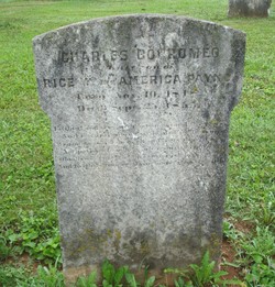
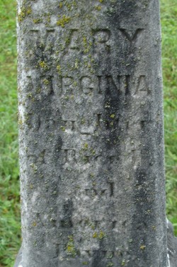
Charles Borromeo Payne
| Birth | : | 10 Nov 1848 |
| Death | : | 25 Sep 1853 |
| Burial | : | Grange Cemetery, Honey Creek, Pottawattamie County, USA |
| Coordinate | : | 41.4446678, -95.8034668 |
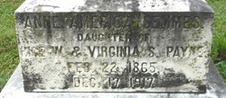
| Description | : | Only son of Rice W. & America Payne |
frequently asked questions (FAQ):
-
Where is Charles Borromeo Payne's memorial?
Charles Borromeo Payne's memorial is located at: Grange Cemetery, Honey Creek, Pottawattamie County, USA.
-
When did Charles Borromeo Payne death?
Charles Borromeo Payne death on 25 Sep 1853 in
-
Where are the coordinates of the Charles Borromeo Payne's memorial?
Latitude: 41.4446678
Longitude: -95.8034668
Family Members:
Parent
Siblings

Flowers:


Nearby Cemetories:
1. Grange Cemetery
Honey Creek, Pottawattamie County, USA
Coordinate: 41.4446678, -95.8034668
2. Saint Bridgets Cemetery
Honey Creek, Pottawattamie County, USA
Coordinate: 41.4664001, -95.8289032
3. Reels Cemetery
Crescent, Pottawattamie County, USA
Coordinate: 41.4234100, -95.8321700
4. Saint Pauls Lutheran Cemetery
Neola, Pottawattamie County, USA
Coordinate: 41.4337000, -95.7607000
5. Allen Cemetery
Pottawattamie County, USA
Coordinate: 41.4427986, -95.8550034
6. William C McIntosh Cemetery
Crescent, Pottawattamie County, USA
Coordinate: 41.4088745, -95.8477097
7. Crook Cemetery
Honey Creek, Pottawattamie County, USA
Coordinate: 41.4581330, -95.8737000
8. Branson Cemetery
Loveland, Pottawattamie County, USA
Coordinate: 41.4846992, -95.8606033
9. Oak Grove Cemetery
Missouri Valley, Harrison County, USA
Coordinate: 41.5167007, -95.8649979
10. Crescent Cemetery
Crescent, Pottawattamie County, USA
Coordinate: 41.3664894, -95.8566208
11. Castor Cemetery
Underwood, Pottawattamie County, USA
Coordinate: 41.4127040, -95.6887490
12. Hazel Dell Cemetery
Council Bluffs, Pottawattamie County, USA
Coordinate: 41.3489723, -95.7939911
13. H G Fisher Cemetery
Underwood, Pottawattamie County, USA
Coordinate: 41.3838997, -95.6889038
14. Saint Columbanus Cemetery
Weston, Pottawattamie County, USA
Coordinate: 41.3429440, -95.7435260
15. Gregg Cemetery
Weston, Pottawattamie County, USA
Coordinate: 41.3330000, -95.7931000
16. Downsville Cemetery
Pottawattamie County, USA
Coordinate: 41.3502998, -95.7039032
17. Linnwood Cemetery
Harrison County, USA
Coordinate: 41.5589200, -95.7502100
18. Evans Cemetery
Crescent, Pottawattamie County, USA
Coordinate: 41.3255997, -95.8368988
19. Hurleys Evergreen Cemetery
Harrison County, USA
Coordinate: 41.5700989, -95.8618698
20. Rose Hill Memorial Gardens
Missouri Valley, Harrison County, USA
Coordinate: 41.5656000, -95.8897000
21. Mount Carmel Cemetery
Missouri Valley, Harrison County, USA
Coordinate: 41.5675011, -95.8897018
22. Saint Patricks Cemetery
Neola, Pottawattamie County, USA
Coordinate: 41.4581300, -95.6183600
23. Neola Township Cemetery
Neola, Pottawattamie County, USA
Coordinate: 41.4591400, -95.6183800
24. Shipley Cemetery
Washington County, USA
Coordinate: 41.3932991, -95.9828033