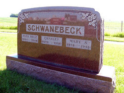
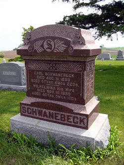
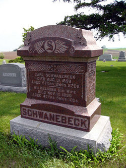
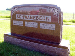
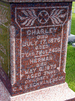
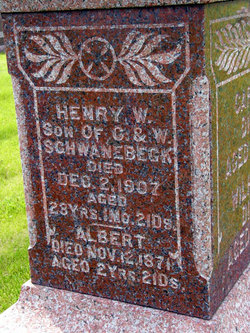
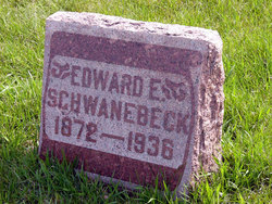
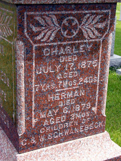
Charles G. “Charley” Schwanebeck
| Birth | : | 23 Sep 1875 Adair County, Iowa, USA |
| Death | : | 19 Dec 1956 Greenfield, Adair County, Iowa, USA |
| Burial | : | Claytonville Cemetery, Horton, Brown County, USA |
| Coordinate | : | 39.7766991, -95.5046997 |
| Plot | : | lot 5 second addition |
| Description | : | The Creston News Advertiser December 20, 1956 Chas. Schwanebeck Dies at Greenfield Charles Schwanebeck, 81, a lifelong resident of Prussia township,, Adair county, died at the Adair county Memorial hospital in Greenfield last night. He was a retired farmer who had lived for many years north of Fontanelle. Funeral services will be held at the Bickford funeral home in Greenfield at 2 p.m. Friday. Rev. Bruce Eshelman of Fontanelle will officiate. Burial will be in the Fontanelle cemetery. His wife preceded him in death in 1948. One brother, Oscar Schwanebeck of Winterset,... Read More |
frequently asked questions (FAQ):
-
Where is Charles G. “Charley” Schwanebeck's memorial?
Charles G. “Charley” Schwanebeck's memorial is located at: Claytonville Cemetery, Horton, Brown County, USA.
-
When did Charles G. “Charley” Schwanebeck death?
Charles G. “Charley” Schwanebeck death on 19 Dec 1956 in Greenfield, Adair County, Iowa, USA
-
Where are the coordinates of the Charles G. “Charley” Schwanebeck's memorial?
Latitude: 39.7766991
Longitude: -95.5046997
Family Members:
Parent
Spouse
Siblings
Flowers:
Nearby Cemetories:
1. Claytonville Cemetery
Horton, Brown County, USA
Coordinate: 39.7766991, -95.5046997
2. Bemis Cemetery
Hiawatha, Brown County, USA
Coordinate: 39.8194900, -95.5668300
3. Madison Cemetery
Robinson, Brown County, USA
Coordinate: 39.7717700, -95.4201700
4. Carr Cemetery
Everest, Brown County, USA
Coordinate: 39.7254600, -95.4521600
5. Zion Lutheran Church Cemetery
Everest, Brown County, USA
Coordinate: 39.7290611, -95.4336777
6. Mount Hope Cemetery
Hiawatha, Brown County, USA
Coordinate: 39.8497009, -95.5156021
7. Rose Hill Cemetery
Robinson, Brown County, USA
Coordinate: 39.8097000, -95.4139023
8. Hiawatha Cemetery
Hiawatha, Brown County, USA
Coordinate: 39.8601799, -95.5265198
9. All Saints Cemetery
Everest, Brown County, USA
Coordinate: 39.7008018, -95.4507980
10. Upper Wolf Lutheran Cemetery
Robinson, Brown County, USA
Coordinate: 39.7690010, -95.3893509
11. Lutheran Cemetery
Mercier, Brown County, USA
Coordinate: 39.7250500, -95.6000710
12. Saint Peters Cemetery
Mercier, Brown County, USA
Coordinate: 39.7247009, -95.6016998
13. Powhattan Cemetery
Powhattan, Brown County, USA
Coordinate: 39.7681007, -95.6288986
14. Kimberlin Cemetery
Everest, Brown County, USA
Coordinate: 39.7111015, -95.3964005
15. Ununda Cemetery
Robinson, Brown County, USA
Coordinate: 39.8582993, -95.4143982
16. Pleasant Ridge Cemetery
Brown County, USA
Coordinate: 39.7928009, -95.3654022
17. Page Cemetery
Brown County, USA
Coordinate: 39.7000600, -95.4015400
18. Saint Leos Catholic Cemetery
Horton, Brown County, USA
Coordinate: 39.6667595, -95.4889603
19. Horton Cemetery
Horton, Brown County, USA
Coordinate: 39.6573982, -95.5126419
20. Kennekuk Cemetery
Horton, Brown County, USA
Coordinate: 39.6533012, -95.4875031
21. Niles Cemetery
Hiawatha, Brown County, USA
Coordinate: 39.8730900, -95.6126300
22. Wolf River Cemetery
Brown County, USA
Coordinate: 39.7476900, -95.3397500
23. Wheatland Cemetery
Atchison County, USA
Coordinate: 39.6453018, -95.5633011
24. Miller Cemetery
Everest, Brown County, USA
Coordinate: 39.6866989, -95.3628006

