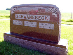
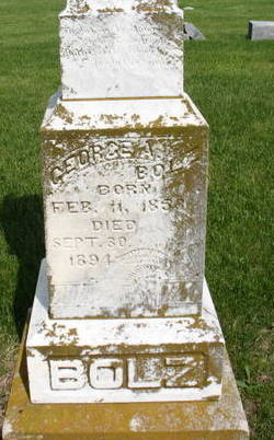
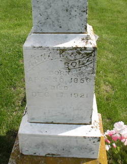
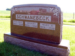
Mary Katherine Bolz Schwanebeck
| Birth | : | 29 Nov 1878 |
| Death | : | 28 Aug 1948 |
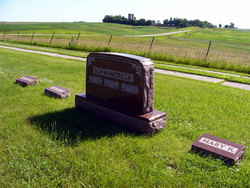
| Burial | : | Claytonville Cemetery, Horton, Brown County, USA |
| Coordinate | : | 39.7766991, -95.5046997 |
| Plot | : | lot 5 second addition |
| Description | : | Obituary that appeared in the Adair County Free Press, Sept. 2, 1948 Mary Katherine Bolz, daughter of Andrew G. and Anna Meyer Bolz, was born in Bureau County, Illinois, November 29, 1878, and quietly passed away early Saturday morning, August 28, 1948, at her home in Prussia Township. When she was six years old, the Bolz family came to Iowa, and settled on a farm in Jackson Township, where she grew to womanhood, and where she became a Christian resting her membership in the Evangelical Church. Services were held in a schoolhouse, she taking part and especially... Read More |
frequently asked questions (FAQ):
-
Where is Mary Katherine Bolz Schwanebeck's memorial?
Mary Katherine Bolz Schwanebeck's memorial is located at: Claytonville Cemetery, Horton, Brown County, USA.
-
When did Mary Katherine Bolz Schwanebeck death?
Mary Katherine Bolz Schwanebeck death on 28 Aug 1948 in
-
Where are the coordinates of the Mary Katherine Bolz Schwanebeck's memorial?
Latitude: 39.7766991
Longitude: -95.5046997
Family Members:
Parent
Spouse
Siblings
Flowers:
Nearby Cemetories:
1. Claytonville Cemetery
Horton, Brown County, USA
Coordinate: 39.7766991, -95.5046997
2. Bemis Cemetery
Hiawatha, Brown County, USA
Coordinate: 39.8194900, -95.5668300
3. Madison Cemetery
Robinson, Brown County, USA
Coordinate: 39.7717700, -95.4201700
4. Carr Cemetery
Everest, Brown County, USA
Coordinate: 39.7254600, -95.4521600
5. Zion Lutheran Church Cemetery
Everest, Brown County, USA
Coordinate: 39.7290611, -95.4336777
6. Mount Hope Cemetery
Hiawatha, Brown County, USA
Coordinate: 39.8497009, -95.5156021
7. Rose Hill Cemetery
Robinson, Brown County, USA
Coordinate: 39.8097000, -95.4139023
8. Hiawatha Cemetery
Hiawatha, Brown County, USA
Coordinate: 39.8601799, -95.5265198
9. All Saints Cemetery
Everest, Brown County, USA
Coordinate: 39.7008018, -95.4507980
10. Upper Wolf Lutheran Cemetery
Robinson, Brown County, USA
Coordinate: 39.7690010, -95.3893509
11. Lutheran Cemetery
Mercier, Brown County, USA
Coordinate: 39.7250500, -95.6000710
12. Saint Peters Cemetery
Mercier, Brown County, USA
Coordinate: 39.7247009, -95.6016998
13. Powhattan Cemetery
Powhattan, Brown County, USA
Coordinate: 39.7681007, -95.6288986
14. Kimberlin Cemetery
Everest, Brown County, USA
Coordinate: 39.7111015, -95.3964005
15. Ununda Cemetery
Robinson, Brown County, USA
Coordinate: 39.8582993, -95.4143982
16. Pleasant Ridge Cemetery
Brown County, USA
Coordinate: 39.7928009, -95.3654022
17. Page Cemetery
Brown County, USA
Coordinate: 39.7000600, -95.4015400
18. Saint Leos Catholic Cemetery
Horton, Brown County, USA
Coordinate: 39.6667595, -95.4889603
19. Horton Cemetery
Horton, Brown County, USA
Coordinate: 39.6573982, -95.5126419
20. Kennekuk Cemetery
Horton, Brown County, USA
Coordinate: 39.6533012, -95.4875031
21. Niles Cemetery
Hiawatha, Brown County, USA
Coordinate: 39.8730900, -95.6126300
22. Wolf River Cemetery
Brown County, USA
Coordinate: 39.7476900, -95.3397500
23. Wheatland Cemetery
Atchison County, USA
Coordinate: 39.6453018, -95.5633011
24. Miller Cemetery
Everest, Brown County, USA
Coordinate: 39.6866989, -95.3628006

