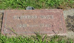
Clifford Wade
| Birth | : | 4 Nov 1881 Kansas, USA |
| Death | : | 13 Mar 1941 Yakima, Yakima County, Washington, USA |
| Burial | : | Dormition of Saint Mary Cemetery, Beyer, Indiana County, USA |
| Coordinate | : | 40.7868780, -79.2149500 |
| Plot | : | Block Section 120 Lot 3.00 Space |
frequently asked questions (FAQ):
-
Where is Clifford Wade's memorial?
Clifford Wade's memorial is located at: Dormition of Saint Mary Cemetery, Beyer, Indiana County, USA.
-
When did Clifford Wade death?
Clifford Wade death on 13 Mar 1941 in Yakima, Yakima County, Washington, USA
-
Where are the coordinates of the Clifford Wade's memorial?
Latitude: 40.7868780
Longitude: -79.2149500
Family Members:
Parent
Spouse
Siblings
Children
Flowers:
Nearby Cemetories:
1. Dormition of Saint Mary Cemetery
Beyer, Indiana County, USA
Coordinate: 40.7868780, -79.2149500
2. Sacred Heart Cemetery
Beyer, Indiana County, USA
Coordinate: 40.7877998, -79.2149963
3. Saint John Lutheran Cemetery
Sagamore, Armstrong County, USA
Coordinate: 40.7858009, -79.2149963
4. Saint Mary's Cemetery
Kittanning, Armstrong County, USA
Coordinate: 40.7896420, -79.2153120
5. Slate Hill Cemetery
Dayton, Armstrong County, USA
Coordinate: 40.7946430, -79.2228310
6. Plumville Cemetery
Plumville, Indiana County, USA
Coordinate: 40.7912000, -79.1799000
7. Bohan Family Farm Burial
Dayton, Armstrong County, USA
Coordinate: 40.7970470, -79.2572490
8. Beracha Presbyterian Church Cemetery
Plumville, Indiana County, USA
Coordinate: 40.7984690, -79.1723190
9. Old Mahoning Baptist Cemetery
South Mahoning Township, Indiana County, USA
Coordinate: 40.8262620, -79.1944240
10. Atwood Cemetery
Atwood, Armstrong County, USA
Coordinate: 40.7527504, -79.2682037
11. Harmony Grove Cemetery
Indiana County, USA
Coordinate: 40.7318993, -79.2200012
12. Smicksburg Cemetery
Smicksburg, Indiana County, USA
Coordinate: 40.8428001, -79.1766968
13. Rural Valley Cemetery
Rural Valley, Armstrong County, USA
Coordinate: 40.8019714, -79.3118515
14. Washington Church Cemetery
Home, Indiana County, USA
Coordinate: 40.7366730, -79.1355620
15. United Presbyterian Cemetery
Dayton, Armstrong County, USA
Coordinate: 40.8652000, -79.2297000
16. Old Washington Church Cemetery
Home, Indiana County, USA
Coordinate: 40.7318993, -79.1346970
17. Dayton Glade Run Cemetery
Dayton, Armstrong County, USA
Coordinate: 40.8710136, -79.2356262
18. Harkleroad Cemetery
Rural Valley, Armstrong County, USA
Coordinate: 40.7718964, -79.3289719
19. Schrecengost Farm Cemetery
Armstrong County, USA
Coordinate: 40.8288070, -79.3177450
20. Crooked Creek Baptist Cemetery
Rayne Township, Indiana County, USA
Coordinate: 40.7116000, -79.1517000
21. Fisher Cemetery
Elderton, Armstrong County, USA
Coordinate: 40.7110610, -79.2780520
22. Saint Michael's Episcopal Cemetery
Rural Valley, Armstrong County, USA
Coordinate: 40.8542328, -79.3036499
23. Georgeville Cemetery
Georgeville, Indiana County, USA
Coordinate: 40.8314000, -79.1027000
24. Speedy Cemetery
Indiana County, USA
Coordinate: 40.6917000, -79.2425003


