
| Memorials | : | 3 |
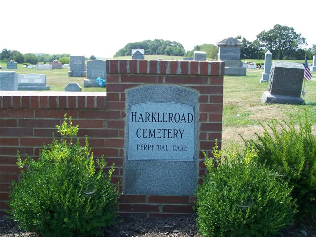
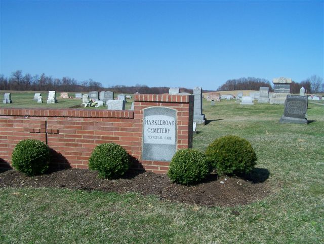
| Location | : | Rural Valley, Armstrong County, USA |
| Coordinate | : | 40.7718964, -79.3289719 |
| Description | : | Directions: From the intersection of State Route 66/28 North and State Route 85, in Kittanning, Pennsylvania, turn onto Route 85 East and drive for 10.13 miles to the town of Rural Valley. At the SST Savings Bank, on the intersection of Route 85 and Water Street, turn right onto South Water St. and drive 2.28 miles to the cemetery on the right. |
frequently asked questions (FAQ):
-
Where is Harkleroad Cemetery?
Harkleroad Cemetery is located at Rural Valley, Armstrong County ,Pennsylvania ,USA.
-
Harkleroad Cemetery cemetery's updated grave count on graveviews.com?
3 memorials
-
Where are the coordinates of the Harkleroad Cemetery?
Latitude: 40.7718964
Longitude: -79.3289719
Nearby Cemetories:
1. Saint Paul's Cemetery
Rural Valley, Armstrong County, USA
Coordinate: 40.7620583, -79.3640823
2. Sowers Cemetery
Rural Valley, Armstrong County, USA
Coordinate: 40.7775993, -79.3703003
3. Rural Valley Cemetery
Rural Valley, Armstrong County, USA
Coordinate: 40.8019714, -79.3118515
4. Elgin-Old Presbyterian Cemetery
Rural Valley, Armstrong County, USA
Coordinate: 40.8046646, -79.3662949
5. Atwood Cemetery
Atwood, Armstrong County, USA
Coordinate: 40.7527504, -79.2682037
6. Salem United Church of Christ Cemetery
Kittanning, Armstrong County, USA
Coordinate: 40.8244130, -79.3559970
7. Schrecengost Farm Cemetery
Armstrong County, USA
Coordinate: 40.8288070, -79.3177450
8. Pleasant Union Cemetery
Cowanshannock Township, Armstrong County, USA
Coordinate: 40.8314018, -79.3350449
9. Bohan Family Farm Burial
Dayton, Armstrong County, USA
Coordinate: 40.7970470, -79.2572490
10. Whitesburg United Methodist Church Cemetery
Whitesburg, Armstrong County, USA
Coordinate: 40.7384000, -79.3964000
11. Whitesburg Presbyterian Cemetery
Armstrong County, USA
Coordinate: 40.7371000, -79.3959000
12. Simpson Church Cemetery
Kittanning, Armstrong County, USA
Coordinate: 40.7899000, -79.4083640
13. Gastown Cemetery
Gastown, Armstrong County, USA
Coordinate: 40.7081000, -79.3180000
14. Pettigrew Cemetery
Elderton, Armstrong County, USA
Coordinate: 40.7330560, -79.3991670
15. Fisher Cemetery
Elderton, Armstrong County, USA
Coordinate: 40.7110610, -79.2780520
16. Elderton Presbyterian Church Cemetery
Elderton, Armstrong County, USA
Coordinate: 40.6972520, -79.3432240
17. Elderton United Methodist Church Cemetery
Elderton, Armstrong County, USA
Coordinate: 40.6941681, -79.3455887
18. Elderton Cemetery
Elderton, Armstrong County, USA
Coordinate: 40.6918000, -79.3436000
19. Kimmel Cemetery
Elderton, Armstrong County, USA
Coordinate: 40.6910190, -79.3346140
20. Slate Hill Cemetery
Dayton, Armstrong County, USA
Coordinate: 40.7946430, -79.2228310
21. Saint Michael's Episcopal Cemetery
Rural Valley, Armstrong County, USA
Coordinate: 40.8542328, -79.3036499
22. Echo Methodist Episcopal Church Cemetery
Armstrong County, USA
Coordinate: 40.8570420, -79.3275330
23. Saint John Lutheran Cemetery
Sagamore, Armstrong County, USA
Coordinate: 40.7858009, -79.2149963
24. Dormition of Saint Mary Cemetery
Beyer, Indiana County, USA
Coordinate: 40.7868780, -79.2149500