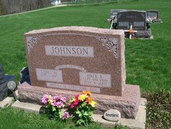
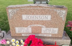
Dale Emanuel Johnson
| Birth | : | 20 Sep 1920 Mediapolis, Des Moines County, Iowa, USA |
| Death | : | 4 Jul 2007 Danville, Des Moines County, Iowa, USA |
| Burial | : | Belgrave Cemetery, Belgrave, Leicester Unitary Authority, England |
| Coordinate | : | 52.6653570, -1.1311220 |
| Description | : | The Burlington Hawkeye Dale Johnson Dale Emanuel Johnson, 86, of Danville died at 4:10 a.m. Wednesday, July 4, 2007, at his home. Born Sept. 20, 1920, in Mediapolis, he was the son of Francis Victor and Gerda Christine Johannson Johnson. On Feb. 27, 1949, he married Ethel M. Swanson in Burlington. Mr. Johnson was a farmer all his life and caretaker of Long Creek Cemetery for the past 12 years. He was a graduate of Burlington High School. He was a member of Danville United Methodist Church, Loyal Order of Moose Lodge 579, Fraternal Order of the Eagles Aries 150, Blackhawk Booster Club... Read More |
frequently asked questions (FAQ):
-
Where is Dale Emanuel Johnson's memorial?
Dale Emanuel Johnson's memorial is located at: Belgrave Cemetery, Belgrave, Leicester Unitary Authority, England.
-
When did Dale Emanuel Johnson death?
Dale Emanuel Johnson death on 4 Jul 2007 in Danville, Des Moines County, Iowa, USA
-
Where are the coordinates of the Dale Emanuel Johnson's memorial?
Latitude: 52.6653570
Longitude: -1.1311220
Family Members:
Parent
Spouse
Siblings
Children
Flowers:
Nearby Cemetories:
1. Belgrave Cemetery
Belgrave, Leicester Unitary Authority, England
Coordinate: 52.6653570, -1.1311220
2. St. Peter's Churchyard
Belgrave, Leicester Unitary Authority, England
Coordinate: 52.6594208, -1.1255690
3. St James the Great Churchyard
Birstall, Charnwood Borough, England
Coordinate: 52.6741150, -1.1189210
4. Greengate Lane Cemetery
Birstall, Charnwood Borough, England
Coordinate: 52.6800110, -1.1346940
5. Leicester Abbey
Leicester, Leicester Unitary Authority, England
Coordinate: 52.6489600, -1.1369470
6. Thurmaston Parish Church Leicestershire
Leicester Unitary Authority, England
Coordinate: 52.6785900, -1.0993062
7. St Michael and All Angels Churchyard
Thurmaston, Charnwood Borough, England
Coordinate: 52.6785630, -1.0989530
8. St Margaret Churchyard
Leicester, Leicester Unitary Authority, England
Coordinate: 52.6403430, -1.1363440
9. Thurmaston Cemetery
Thurmaston, Charnwood Borough, England
Coordinate: 52.6788150, -1.0948670
10. Our Lady and St. Nicholas Churchyard
Wanlip, Charnwood Borough, England
Coordinate: 52.6910000, -1.1150000
11. Great Meeting Unitarian Chapel
Leicester, Leicester Unitary Authority, England
Coordinate: 52.6379400, -1.1360390
12. All Saints Church
Leicester, Leicester Unitary Authority, England
Coordinate: 52.6381940, -1.1403170
13. Gilroes Cemetery and Crematorium
Leicester, Leicester Unitary Authority, England
Coordinate: 52.6514359, -1.1721700
14. St. Nicholas Church
Leicester, Leicester Unitary Authority, England
Coordinate: 52.6351400, -1.1408940
15. Leicester Cathedral
Leicester, Leicester Unitary Authority, England
Coordinate: 52.6347430, -1.1370210
16. St George's Church
Leicester, Leicester Unitary Authority, England
Coordinate: 52.6344300, -1.1267420
17. All Saints Churchyard
Thurcaston, Charnwood Borough, England
Coordinate: 52.6906870, -1.1647320
18. St. Mary de Castro Churchyard
Leicester, Leicester Unitary Authority, England
Coordinate: 52.6322610, -1.1404000
19. Church of the Annunciation of St. Mary
Leicester, Leicester Unitary Authority, England
Coordinate: 52.6308229, -1.1417201
20. St Mary's Church
Anstey, Charnwood Borough, England
Coordinate: 52.6720090, -1.1888250
21. St Peter's Church (Defunct)
Leicester, Leicester Unitary Authority, England
Coordinate: 52.6300260, -1.1164980
22. St. Mary's Churchyard
Humberstone, Leicester Unitary Authority, England
Coordinate: 52.6479200, -1.0760100
23. Anstey Cemetery
Anstey, Charnwood Borough, England
Coordinate: 52.6680480, -1.1955570
24. Chapel of the Knights Templar
Rothley, Charnwood Borough, England
Coordinate: 52.7056000, -1.1478000


