

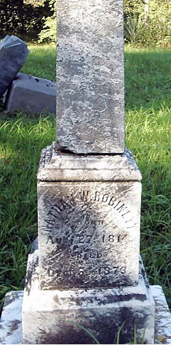
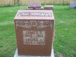
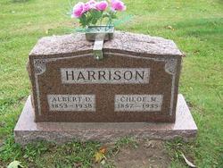
Della Abigail Robinett Smith
| Birth | : | 13 Aug 1867 Whitley County, Indiana, USA |
| Death | : | 15 Feb 1947 Whitley County, Indiana, USA |
| Burial | : | Lone Tree Cemetery, Moundridge, McPherson County, USA |
| Coordinate | : | 38.2846985, -97.5002975 |
frequently asked questions (FAQ):
-
Where is Della Abigail Robinett Smith's memorial?
Della Abigail Robinett Smith's memorial is located at: Lone Tree Cemetery, Moundridge, McPherson County, USA.
-
When did Della Abigail Robinett Smith death?
Della Abigail Robinett Smith death on 15 Feb 1947 in Whitley County, Indiana, USA
-
Where are the coordinates of the Della Abigail Robinett Smith's memorial?
Latitude: 38.2846985
Longitude: -97.5002975
Family Members:
Parent
Spouse
Siblings

Children
Flowers:


Nearby Cemetories:
1. Lone Tree Cemetery
Moundridge, McPherson County, USA
Coordinate: 38.2846985, -97.5002975
2. Emmanuel Bible Church Cemetery
Moundridge, McPherson County, USA
Coordinate: 38.2868200, -97.5264200
3. Immanuel Lutheran Church Cemetery
Canton, McPherson County, USA
Coordinate: 38.2755330, -97.4473030
4. Empire Cemetery
Galva, McPherson County, USA
Coordinate: 38.3403015, -97.5192032
5. German Evangelical Lutheran Cemetery
Meridian Township, McPherson County, USA
Coordinate: 38.2567150, -97.4267420
6. Dunkard Church Cemetery
Galva, McPherson County, USA
Coordinate: 38.3497009, -97.5006027
7. West Zion Cemetery
Moundridge, McPherson County, USA
Coordinate: 38.2028008, -97.5372009
8. Mound Township Cemetery
Moundridge, McPherson County, USA
Coordinate: 38.2028008, -97.5378036
9. Suncrest Mennonite Cemetery
Galva, McPherson County, USA
Coordinate: 38.3685500, -97.5378000
10. Eden Mennonite Church Cemetery
Moundridge, McPherson County, USA
Coordinate: 38.2329890, -97.5940630
11. Freedom Baptist Church Cemetery
McPherson County, USA
Coordinate: 38.2027400, -97.4362500
12. First Mennonite Cemetery
Moundridge, McPherson County, USA
Coordinate: 38.1885090, -97.5094070
13. Heinrich J. Schmidt Family Cemetery
Spring Valley Township, McPherson County, USA
Coordinate: 38.2754900, -97.3763700
14. Spring Valley Mennonite Cemetery
Canton, McPherson County, USA
Coordinate: 38.3338170, -97.3908220
15. Hopefield Church Cemetery
Moundridge, McPherson County, USA
Coordinate: 38.2105180, -97.5858040
16. Schmidt Homestead Cemetery
Meridian Township, McPherson County, USA
Coordinate: 38.2654300, -97.3717700
17. Anna Schmidt Cemetery
Meridian Township, McPherson County, USA
Coordinate: 38.2283911, -97.3893937
18. Blumenfeld Cemetery
Goessel, Marion County, USA
Coordinate: 38.2644900, -97.3697400
19. Goessel Mennonite Church Cemetery
Goessel, Marion County, USA
Coordinate: 38.2544000, -97.3531000
20. Schlender Cemetery
Harvey County, USA
Coordinate: 38.1669006, -97.5374985
21. United Center Church Cemetery
Galva, McPherson County, USA
Coordinate: 38.4069810, -97.4821720
22. Canton Township Cemetery
Canton, McPherson County, USA
Coordinate: 38.3974170, -97.4280350
23. Goessel Mennonite Brethren Cemetery
Goessel, Marion County, USA
Coordinate: 38.2456780, -97.3459880
24. Jones Cemetery
Canton, McPherson County, USA
Coordinate: 38.3833008, -97.3861008