
| Birth | : | 11 Jan 1882 Brown County, Kansas, USA |
| Death | : | 13 Apr 1952 Hiawatha, Brown County, Kansas, USA |
| Burial | : | Mount Hope Cemetery, Hiawatha, Brown County, USA |
| Coordinate | : | 39.8497009, -95.5156021 |
| Description | : | DEATHS Sherrer—Mrs. Della M. Sherrer, 70, wife of Jere L. Sherrer of Hiawatha, died Sunday morning, April 13, 1952, at the Hiawatha Community hospital after an illness of three months. She is survived by her husband of the home at 604 Iowa street, son, Leonard Sherrer of Hamlin, two grandchildren, Judy and Jere Sherrer, sister, Mrs. Anna Pfeiffer of Hamlin, two brothers, Herbert Chaffee of Lincoln, Nebr., Wallace Chaffee of Fairview, Kans. Mrs. Sherrer was a member of the Hiawatha Christian church, the Hiawatha Rebekah lodge and the Hamlin Eastern Star chapter. Funeral services will be held from the Christian... Read More |
frequently asked questions (FAQ):
-
Where is Della May Chaffee Sherrer's memorial?
Della May Chaffee Sherrer's memorial is located at: Mount Hope Cemetery, Hiawatha, Brown County, USA.
-
When did Della May Chaffee Sherrer death?
Della May Chaffee Sherrer death on 13 Apr 1952 in Hiawatha, Brown County, Kansas, USA
-
Where are the coordinates of the Della May Chaffee Sherrer's memorial?
Latitude: 39.8497009
Longitude: -95.5156021
Family Members:
Parent

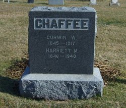
Spouse

Siblings
Children
Flowers:


Nearby Cemetories:
1. Mount Hope Cemetery
Hiawatha, Brown County, USA
Coordinate: 39.8497009, -95.5156021
2. Hiawatha Cemetery
Hiawatha, Brown County, USA
Coordinate: 39.8601799, -95.5265198
3. Bemis Cemetery
Hiawatha, Brown County, USA
Coordinate: 39.8194900, -95.5668300
4. Claytonville Cemetery
Horton, Brown County, USA
Coordinate: 39.7766991, -95.5046997
5. Niles Cemetery
Hiawatha, Brown County, USA
Coordinate: 39.8730900, -95.6126300
6. Ununda Cemetery
Robinson, Brown County, USA
Coordinate: 39.8582993, -95.4143982
7. Oakland Cemetery
Padonia, Brown County, USA
Coordinate: 39.9273900, -95.5610900
8. Rose Hill Cemetery
Robinson, Brown County, USA
Coordinate: 39.8097000, -95.4139023
9. Shelton Cemetery
Hamlin, Brown County, USA
Coordinate: 39.8852997, -95.6393967
10. Hart Cemetery
Reserve, Brown County, USA
Coordinate: 39.9519005, -95.5366974
11. Carson Cemetery
Hamlin, Brown County, USA
Coordinate: 39.8810200, -95.6483100
12. Madison Cemetery
Robinson, Brown County, USA
Coordinate: 39.7717700, -95.4201700
13. Kenyon Cemetery
Robinson, Brown County, USA
Coordinate: 39.9122000, -95.3964600
14. Hamlin Cemetery
Hamlin, Brown County, USA
Coordinate: 39.9206009, -95.6292877
15. Pleasant Hill Cemetery
Irving Township, Brown County, USA
Coordinate: 39.9435997, -95.4328232
16. Powhattan Cemetery
Powhattan, Brown County, USA
Coordinate: 39.7681007, -95.6288986
17. Pleasant Hill Cemetery
Fairview, Brown County, USA
Coordinate: 39.8411800, -95.6716400
18. Saint Paul Lutheran Cemetery
Fairview, Brown County, USA
Coordinate: 39.8559700, -95.6779700
19. Upper Wolf Lutheran Cemetery
Robinson, Brown County, USA
Coordinate: 39.7690010, -95.3893509
20. Cornelison Cemetery
Reserve, Brown County, USA
Coordinate: 39.9754105, -95.5485687
21. Pleasant Ridge Cemetery
Brown County, USA
Coordinate: 39.7928009, -95.3654022
22. Laus Creek Cemetery
Reserve, Brown County, USA
Coordinate: 39.9754105, -95.4699936
23. Immanuel Lutheran Cemetery
Fairview, Brown County, USA
Coordinate: 39.8559700, -95.6858500
24. Carr Cemetery
Everest, Brown County, USA
Coordinate: 39.7254600, -95.4521600