
| Birth | : | Apr 1872 Illinois, USA |
| Death | : | 11 Nov 1955 Hamlin, Brown County, Kansas, USA |
| Burial | : | Mount Hope Cemetery, Hiawatha, Brown County, USA |
| Coordinate | : | 39.8497009, -95.5156021 |
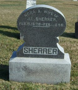
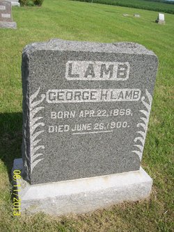
| Description | : | The late Velma (Chaffee) Spangler wrote in a letter, dated 9/9/87, "Uncle Jerry's real name was Lamb. I don't know how or why, but evidently both his parents died. I do know he was adopted by a family named Sherrer and given their name. I think the man (who adopted 'Jerry') was a relative but anymore I am not that sure. At any rate Jerry always considered himself to be a 'real' Sherrer." This is his birth family. June 1, 1870 Census. LAMB household. Morgan County, IL. Joseph, 36, Farmer, b.England. Fanny,... Read More |
frequently asked questions (FAQ):
-
Where is Jerome Leonard “Jerry” Sherrer II's memorial?
Jerome Leonard “Jerry” Sherrer II's memorial is located at: Mount Hope Cemetery, Hiawatha, Brown County, USA.
-
When did Jerome Leonard “Jerry” Sherrer II death?
Jerome Leonard “Jerry” Sherrer II death on 11 Nov 1955 in Hamlin, Brown County, Kansas, USA
-
Where are the coordinates of the Jerome Leonard “Jerry” Sherrer II's memorial?
Latitude: 39.8497009
Longitude: -95.5156021
Family Members:
Parent
Spouse

Siblings
Children
Flowers:


Nearby Cemetories:
1. Mount Hope Cemetery
Hiawatha, Brown County, USA
Coordinate: 39.8497009, -95.5156021
2. Hiawatha Cemetery
Hiawatha, Brown County, USA
Coordinate: 39.8601799, -95.5265198
3. Bemis Cemetery
Hiawatha, Brown County, USA
Coordinate: 39.8194900, -95.5668300
4. Claytonville Cemetery
Horton, Brown County, USA
Coordinate: 39.7766991, -95.5046997
5. Niles Cemetery
Hiawatha, Brown County, USA
Coordinate: 39.8730900, -95.6126300
6. Ununda Cemetery
Robinson, Brown County, USA
Coordinate: 39.8582993, -95.4143982
7. Oakland Cemetery
Padonia, Brown County, USA
Coordinate: 39.9273900, -95.5610900
8. Rose Hill Cemetery
Robinson, Brown County, USA
Coordinate: 39.8097000, -95.4139023
9. Shelton Cemetery
Hamlin, Brown County, USA
Coordinate: 39.8852997, -95.6393967
10. Hart Cemetery
Reserve, Brown County, USA
Coordinate: 39.9519005, -95.5366974
11. Carson Cemetery
Hamlin, Brown County, USA
Coordinate: 39.8810200, -95.6483100
12. Madison Cemetery
Robinson, Brown County, USA
Coordinate: 39.7717700, -95.4201700
13. Kenyon Cemetery
Robinson, Brown County, USA
Coordinate: 39.9122000, -95.3964600
14. Hamlin Cemetery
Hamlin, Brown County, USA
Coordinate: 39.9206009, -95.6292877
15. Pleasant Hill Cemetery
Irving Township, Brown County, USA
Coordinate: 39.9435997, -95.4328232
16. Powhattan Cemetery
Powhattan, Brown County, USA
Coordinate: 39.7681007, -95.6288986
17. Pleasant Hill Cemetery
Fairview, Brown County, USA
Coordinate: 39.8411800, -95.6716400
18. Saint Paul Lutheran Cemetery
Fairview, Brown County, USA
Coordinate: 39.8559700, -95.6779700
19. Upper Wolf Lutheran Cemetery
Robinson, Brown County, USA
Coordinate: 39.7690010, -95.3893509
20. Cornelison Cemetery
Reserve, Brown County, USA
Coordinate: 39.9754105, -95.5485687
21. Pleasant Ridge Cemetery
Brown County, USA
Coordinate: 39.7928009, -95.3654022
22. Laus Creek Cemetery
Reserve, Brown County, USA
Coordinate: 39.9754105, -95.4699936
23. Immanuel Lutheran Cemetery
Fairview, Brown County, USA
Coordinate: 39.8559700, -95.6858500
24. Carr Cemetery
Everest, Brown County, USA
Coordinate: 39.7254600, -95.4521600