
| Birth | : | 3 Mar 1924 Loveland, Pottawattamie County, Iowa, USA |
| Death | : | 15 Oct 2015 Estherville, Emmet County, Iowa, USA |
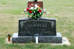
| Burial | : | Branson Cemetery, Loveland, Pottawattamie County, USA |
| Coordinate | : | 41.4846992, -95.8606033 |
| Description | : | DonaFae DeLoris (Hoyt) (Eversole) Dahlberg, the daughter of David Fletcher Hoyt and Sadie Tella (Sims) Hoyt, was born March 3, 1924, in Loveland, Iowa, in Pottawattamie County at home. She passed away Thursday, October 15, 2015, at Rosewood Manor in Estherville, Iowa, at the age of 91. She received her education in Riverview Country School through the 8th grade. Then she was employed as a CNA. On August 6, 1941, Dona was united in marriage to Rex Leonard Eversole in Blair, Nebraska. She lived in several locations including; Berryville, Arkansas, Mitchell, South Dakota, Graettinger, Iowa, Blair, Nebraska, Laurens, Iowa,... Read More |
frequently asked questions (FAQ):
-
Where is DonaFae DeLoris Hoyt Dahlberg's memorial?
DonaFae DeLoris Hoyt Dahlberg's memorial is located at: Branson Cemetery, Loveland, Pottawattamie County, USA.
-
When did DonaFae DeLoris Hoyt Dahlberg death?
DonaFae DeLoris Hoyt Dahlberg death on 15 Oct 2015 in Estherville, Emmet County, Iowa, USA
-
Where are the coordinates of the DonaFae DeLoris Hoyt Dahlberg's memorial?
Latitude: 41.4846992
Longitude: -95.8606033
Family Members:
Parent

Spouse
Siblings
Flowers:


Nearby Cemetories:
1. Branson Cemetery
Loveland, Pottawattamie County, USA
Coordinate: 41.4846992, -95.8606033
2. Crook Cemetery
Honey Creek, Pottawattamie County, USA
Coordinate: 41.4581330, -95.8737000
3. Saint Bridgets Cemetery
Honey Creek, Pottawattamie County, USA
Coordinate: 41.4664001, -95.8289032
4. Oak Grove Cemetery
Missouri Valley, Harrison County, USA
Coordinate: 41.5167007, -95.8649979
5. Allen Cemetery
Pottawattamie County, USA
Coordinate: 41.4427986, -95.8550034
6. Grange Cemetery
Honey Creek, Pottawattamie County, USA
Coordinate: 41.4446678, -95.8034668
7. Reels Cemetery
Crescent, Pottawattamie County, USA
Coordinate: 41.4234100, -95.8321700
8. William C McIntosh Cemetery
Crescent, Pottawattamie County, USA
Coordinate: 41.4088745, -95.8477097
9. Rose Hill Memorial Gardens
Missouri Valley, Harrison County, USA
Coordinate: 41.5656000, -95.8897000
10. Hurleys Evergreen Cemetery
Harrison County, USA
Coordinate: 41.5700989, -95.8618698
11. Mount Carmel Cemetery
Missouri Valley, Harrison County, USA
Coordinate: 41.5675011, -95.8897018
12. Saint Pauls Lutheran Cemetery
Neola, Pottawattamie County, USA
Coordinate: 41.4337000, -95.7607000
13. Champan Frazier Cemetery
Harrison County, USA
Coordinate: 41.5773500, -95.8933500
14. Frazier Cemetery
Missouri Valley, Harrison County, USA
Coordinate: 41.5932999, -95.8375015
15. Linnwood Cemetery
Harrison County, USA
Coordinate: 41.5589200, -95.7502100
16. Crescent Cemetery
Crescent, Pottawattamie County, USA
Coordinate: 41.3664894, -95.8566208
17. Shipley Cemetery
Washington County, USA
Coordinate: 41.3932991, -95.9828033
18. Fort Calhoun Cemetery
Fort Calhoun, Washington County, USA
Coordinate: 41.4581375, -96.0352020
19. Harris Grove Cemetery
Beebeetown, Harrison County, USA
Coordinate: 41.5782928, -95.7262192
20. Hazel Dell Cemetery
Council Bluffs, Pottawattamie County, USA
Coordinate: 41.3489723, -95.7939911
21. Castor Cemetery
Underwood, Pottawattamie County, USA
Coordinate: 41.4127040, -95.6887490
22. Calhoun Cemetery
Calhoun, Harrison County, USA
Coordinate: 41.6391983, -95.8938980
23. Gregg Cemetery
Weston, Pottawattamie County, USA
Coordinate: 41.3330000, -95.7931000
24. Evans Cemetery
Crescent, Pottawattamie County, USA
Coordinate: 41.3255997, -95.8368988