| Birth | : | 4 Aug 1898 Plymouth County, Iowa, USA |
| Death | : | 26 Apr 1987 Ida Grove, Ida County, Iowa, USA |
| Burial | : | St Mary Churchyard, Alverstoke, Gosport Borough, England |
| Coordinate | : | 50.7856760, -1.1480810 |
| Plot | : | Block C., |
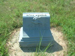
| Description | : | Wife to Truman D. Mrs. Truman Campbell AKRON, Iowa – Mrs. Truman Campbell, 88, of Akron died Sunday in a care center in Ida Grove. Services will be at 1:30 p.m. Wednesday in the First Church of Christ in Akron. The Rev. Elmer Hodge will officiate. Burial will be in Riverside Cemetery. Visitation will be from 2-8 p.m. today with the family present from 7-8 p.m. in Schroeder Funeral Home. Mrs. Campbell, the former Doris Anna Kanago, was born Aug. 4, 1898, in Plymouth County. She married Truman Campbell Nov. 9, 1924, at Akron. He died in September 1977. She taught... Read More |
frequently asked questions (FAQ):
-
Where is Doris A. Kanago Campbell's memorial?
Doris A. Kanago Campbell's memorial is located at: St Mary Churchyard, Alverstoke, Gosport Borough, England.
-
When did Doris A. Kanago Campbell death?
Doris A. Kanago Campbell death on 26 Apr 1987 in Ida Grove, Ida County, Iowa, USA
-
Where are the coordinates of the Doris A. Kanago Campbell's memorial?
Latitude: 50.7856760
Longitude: -1.1480810
Family Members:
Parent
Spouse
Siblings
Children
Flowers:
Nearby Cemetories:
1. St Mary Churchyard
Alverstoke, Gosport Borough, England
Coordinate: 50.7856760, -1.1480810
2. St. Mark's Churchyard
Alverstoke, Gosport Borough, England
Coordinate: 50.7826800, -1.1436100
3. Turkish Naval Cemetery
Gosport, Gosport Borough, England
Coordinate: 50.7840710, -1.1383980
4. Clayhall Naval Cemetery
Gosport, Gosport Borough, England
Coordinate: 50.7833862, -1.1373420
5. Ann's Hill Cemetery
Gosport, Gosport Borough, England
Coordinate: 50.7982670, -1.1549450
6. St John the Evangelist Churchyard
Gosport, Gosport Borough, England
Coordinate: 50.7995600, -1.1397800
7. Holy Trinity Churchyard
Gosport, Gosport Borough, England
Coordinate: 50.7930600, -1.1207620
8. Royal Garrison Churchyard
Portsmouth, Portsmouth Unitary Authority, England
Coordinate: 50.7890180, -1.1040520
9. Portsmouth Cathedral Churchyard
Portsmouth, Portsmouth Unitary Authority, England
Coordinate: 50.7904650, -1.1043720
10. St Thomas the Apostle Churchyard
Gosport, Gosport Borough, England
Coordinate: 50.8137570, -1.1484570
11. Royal Garrison Church Churchyard
Plymouth, Plymouth Unitary Authority, England
Coordinate: 50.7889690, -1.1039650
12. HMS Victory Ship
Portsmouth, Portsmouth Unitary Authority, England
Coordinate: 50.8017290, -1.1095590
13. St Mary the Virgin Churchyard
Gosport, Gosport Borough, England
Coordinate: 50.8112690, -1.1724800
14. Portsmouth Unitarian Church
Portsmouth, Portsmouth Unitary Authority, England
Coordinate: 50.7915640, -1.1011840
15. Portsmouth Naval Memorial
Portsmouth, Portsmouth Unitary Authority, England
Coordinate: 50.7824440, -1.0957720
16. HMS Victoria Monument
Portsmouth, Portsmouth Unitary Authority, England
Coordinate: 50.7997200, -1.0950800
17. Lee-On-Solent Memorial
Lee-on-the-Solent, Gosport Borough, England
Coordinate: 50.8045110, -1.2068440
18. Mile End Cemetery
Portsea, Portsmouth Unitary Authority, England
Coordinate: 50.8108900, -1.0876400
19. Old Jewish Cemetery
Portsmouth, Portsmouth Unitary Authority, England
Coordinate: 50.7887000, -1.0738800
20. St. Mary's Churchyard
Portsea, Portsmouth Unitary Authority, England
Coordinate: 50.8035350, -1.0763490
21. Highland Road Cemetery
Portsmouth, Portsmouth Unitary Authority, England
Coordinate: 50.7860500, -1.0671790
22. Kingston Cemetery
Portsmouth, Portsmouth Unitary Authority, England
Coordinate: 50.8031440, -1.0683260
23. St. Mary's Churchyard
Portchester, Fareham Borough, England
Coordinate: 50.8366280, -1.1134270
24. Roman Grove Cemetery
Portchester, Fareham Borough, England
Coordinate: 50.8384600, -1.1206200

