
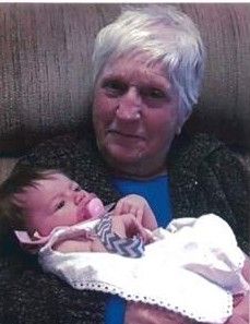


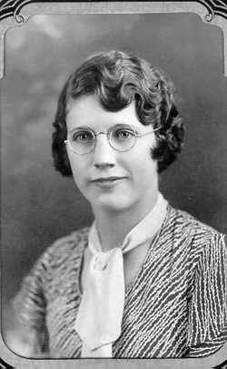
Dorothy Anne “DOT” Packer Duncan
| Birth | : | 12 Apr 1925 Havre, Hill County, Montana, USA |
| Death | : | 4 Sep 2018 Chester, Liberty County, Montana, USA |
| Burial | : | Grace Church Cemetery, Rudyard, Hill County, USA |
| Coordinate | : | 48.8269930, -110.6209890 |
| Description | : | During the early morning hours of September 4, 2018, Dorothy Anne Packer Duncan, slipped these earthly bonds and raced through the "Pearly Gates". She had a good relationship with her Heavenly Father and she was more than ready to go. Dorothy was the youngest of Erwin and Martha (Suckow) Packer's give children: Marie (Lincoln), Doris (Kegel), Bruce Packer and Cora Mae "Brownie" (Theobald). She was born April 12, 1925 in Havre, MT and her father died only eight years later. Her early school years were at School Dist #49, the Packer School and School Dist... Read More |
frequently asked questions (FAQ):
-
Where is Dorothy Anne “DOT” Packer Duncan's memorial?
Dorothy Anne “DOT” Packer Duncan's memorial is located at: Grace Church Cemetery, Rudyard, Hill County, USA.
-
When did Dorothy Anne “DOT” Packer Duncan death?
Dorothy Anne “DOT” Packer Duncan death on 4 Sep 2018 in Chester, Liberty County, Montana, USA
-
Where are the coordinates of the Dorothy Anne “DOT” Packer Duncan's memorial?
Latitude: 48.8269930
Longitude: -110.6209890
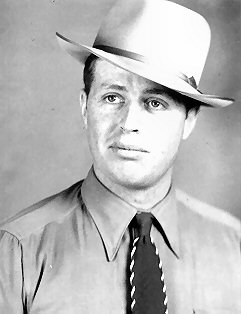
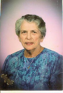
Family Members:
Parent

Spouse
Siblings
Flowers:


Nearby Cemetories:
1. Grace Church Cemetery
Rudyard, Hill County, USA
Coordinate: 48.8269930, -110.6209890
2. Cool Spring Colony Cemetery
Rudyard, Hill County, USA
Coordinate: 48.7704000, -110.5860000
3. Saint Wenceslaus Cemetery
Goldstone, Hill County, USA
Coordinate: 48.9002610, -110.5310160
4. Bethel Cemetery
Hill County, USA
Coordinate: 48.6685982, -110.6406021
5. Sage Creek Colony Cemetery
Sage Creek Colony, Liberty County, USA
Coordinate: 48.9271000, -110.9735000
6. Rudyard Cemetery
Rudyard, Hill County, USA
Coordinate: 48.5659500, -110.5390000
7. Inverness Cemetery
Hill County, USA
Coordinate: 48.5531340, -110.6688450
8. Joplin Cemetery
Joplin, Liberty County, USA
Coordinate: 48.5576720, -110.7622930
9. Spring Coulee Cemetery
Hill County, USA
Coordinate: 48.9138985, -110.2035980
10. Hingham Union Cemetery
Hingham, Hill County, USA
Coordinate: 48.5601570, -110.4178980
11. Milk River Valley Church Graveyard
Hill County, USA
Coordinate: 48.6787180, -110.2261080
12. Comrey Cemetery
Manyberries, Medicine Hat Census Division, Canada
Coordinate: 49.1204000, -110.7179700
13. Gildford Hill County Cemetery
Gildford, Hill County, USA
Coordinate: 48.5778008, -110.2957993
14. Chester Cemetery
Chester, Liberty County, USA
Coordinate: 48.5219002, -110.9807968
15. Eagle Creek Colony Cemetery
Chester, Liberty County, USA
Coordinate: 48.6976000, -111.2011000
16. Trinity Church Cemetery
Lothair, Liberty County, USA
Coordinate: 48.7263000, -111.2296000
17. Old Indian Cemetery
Liberty County, USA
Coordinate: 48.8680992, -111.2585983
18. Pendant d'Oreille Cemetery
Manyberries, Medicine Hat Census Division, Canada
Coordinate: 49.2202530, -110.8806230
19. Whitlash Cemetery
Liberty County, USA
Coordinate: 48.9085999, -111.2699966
20. Saint Johns Catholic Cemetery
Havre, Hill County, USA
Coordinate: 48.7625008, -109.9638977
21. Pleasant View Cemetery
Manyberries, Medicine Hat Census Division, Canada
Coordinate: 49.2610400, -110.7579200
22. Cottonwood Lutheran Church Cemetery
Havre, Hill County, USA
Coordinate: 48.4545000, -110.1748000
23. Grandview Cemetery
Toole County, USA
Coordinate: 48.7265000, -111.3615000
24. Sunnyside Cemetery
Aden, Medicine Hat Census Division, Canada
Coordinate: 49.0286300, -111.3240800