
Dr John Knox McKelvy
| Birth | : | 14 Aug 1857 Utica, Licking County, Ohio, USA |
| Death | : | 18 Sep 1939 Chatham, Licking County, Ohio, USA |
| Burial | : | St Mary's Churchyard, Burford, Shropshire Unitary Authority, England |
| Coordinate | : | 52.3087670, -2.6126000 |
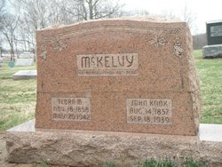
| Description | : | McKelvy, Dr. John 14 Aug. 1857 – 18 Sept. 1939 Dr. John McKelvy, 82, retired physician of Chatham, died today at 9:15 a.m. in his home there following a stroke of paralysis suffered six weeks ago. Mr. McKelvy practiced medicine in Chatham and vicinity for 35 years, but had been retired more than 20 years. He was the son of J.N. and Mary McKelvy and was born in Utica, Aug. 14, 1857. He was graduated from Utica Normal School and finished his medical education in Baltimore MD. He opened offices in Utica and a year later located in Chatham, where... Read More |
frequently asked questions (FAQ):
-
Where is Dr John Knox McKelvy's memorial?
Dr John Knox McKelvy's memorial is located at: St Mary's Churchyard, Burford, Shropshire Unitary Authority, England.
-
When did Dr John Knox McKelvy death?
Dr John Knox McKelvy death on 18 Sep 1939 in Chatham, Licking County, Ohio, USA
-
Where are the coordinates of the Dr John Knox McKelvy's memorial?
Latitude: 52.3087670
Longitude: -2.6126000
Family Members:
Spouse

Flowers:


Nearby Cemetories:
1. St Mary's Churchyard
Burford, Shropshire Unitary Authority, England
Coordinate: 52.3087670, -2.6126000
2. St. Mary's Churchyard
Tenbury Wells, Malvern Hills District, England
Coordinate: 52.3120500, -2.5962400
3. St Michael's Churchyard Extension
Tenbury Wells, Malvern Hills District, England
Coordinate: 52.2941032, -2.6183906
4. St Michael and All Angels Churchyard
Tenbury Wells, Malvern Hills District, England
Coordinate: 52.2882600, -2.6137900
5. St. Mary Magdalene Churchyard
Little Hereford, Herefordshire Unitary Authority, England
Coordinate: 52.3112129, -2.6572039
6. St Michael and All Angels Churchyard
Rochford, Malvern Hills District, England
Coordinate: 52.3134240, -2.5454090
7. St Michael & All Angels Churchyard
Knighton-on-Teme, Malvern Hills District, England
Coordinate: 52.3260900, -2.5393500
8. St. Mary's Churchyard
Caynham, Shropshire Unitary Authority, England
Coordinate: 52.3558260, -2.6564540
9. St Marys Churchyard
Kyre, Malvern Hills District, England
Coordinate: 52.2685140, -2.5488360
10. St. Peter's Churchyard
Coreley, Shropshire Unitary Authority, England
Coordinate: 52.3627780, -2.5694950
11. St. Andrew, Ashford Bowdler.
Ashford Bowdler, Shropshire Unitary Authority, England
Coordinate: 52.3308770, -2.7065930
12. Knowbury, St Paul
Caynham, Shropshire Unitary Authority, England
Coordinate: 52.3734750, -2.6300130
13. St Peter & St Paul Churchyard
Eastham, Malvern Hills District, England
Coordinate: 52.3156100, -2.5046000
14. St. Peter's Churchyard
Stoke Bliss, Malvern Hills District, England
Coordinate: 52.2627200, -2.5121300
15. St. James the Less Churchyard
Kimbolton, Herefordshire Unitary Authority, England
Coordinate: 52.2507757, -2.6957349
16. St. John the Baptist Churchyard
Doddington, Cheshire East Unitary Authority, England
Coordinate: 52.3822068, -2.5651644
17. St Lawrence Churchyard
Lindridge, Malvern Hills District, England
Coordinate: 52.3180700, -2.4779300
18. St. Mary's Churchyard
Bitterley, Shropshire Unitary Authority, England
Coordinate: 52.3922280, -2.6319790
19. Hopton Bank Methodist Church Burial Ground
Hopton Wafers, Shropshire Unitary Authority, England
Coordinate: 52.3872950, -2.5584430
20. St. Peter and St. Paul
Leominster, Herefordshire Unitary Authority, England
Coordinate: 52.2704100, -2.7398260
21. St. Michael & All Angels Churchyard
Hopton Wafers, Shropshire Unitary Authority, England
Coordinate: 52.3857100, -2.5343700
22. St John the Baptist Churchyard
Mamble, Malvern Hills District, England
Coordinate: 52.3416520, -2.4586520
23. St Mary the Virgin
Cleobury Mortimer, Shropshire Unitary Authority, England
Coordinate: 52.3792280, -2.4803610
24. St Bartholomews Churchyard
Bayton, Malvern Hills District, England
Coordinate: 52.3562100, -2.4548200