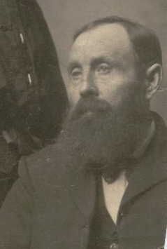
Earl Barnhill
| Birth | : | 31 Jul 1887 Meade County, Kansas, USA |
| Death | : | 3 May 1967 Wenatchee, Chelan County, Washington, USA |
| Burial | : | St Marys Churchyard, Headley, Mole Valley District, England |
| Coordinate | : | 51.2799700, -0.2736100 |
| Description | : | Social Security Death Index about Earl Barnhill Name: Earl Barnhill Last Residence: 98801 Wenatchee, Chelan, Washington, United States of America Born: 31 Jul 1887 Died: May 1967 State (Year) SSN issued: Washington (Before 1951) U.S. World War II Draft Registration Cards, 1942 about Earl Barnhill Name: Earl Barnhill Birth Date: 31 Jul 1887 Birth Place: Meade County, Kansas Residence: Wenatchee, Washington Race: White 1900 United States Federal Census about Earl F Barnhill Name: Earl F Barnhill [Earl T Barnhill] Home in 1900: Plymouth, Marshall, Indiana Age: 12 Birth Date: Jul 1887 Birthplace: Kansas Race: White Gender: Male Relationship to head-of-house: Son Father's Name: Hugh Barnhill Father's Birthplace: Indiana Mother's Name: Rebeca Barnhill Mother's Birthplace: Ohio Marital Status: Single Occupation: View on Image Neighbors: View others on... Read More |
frequently asked questions (FAQ):
-
Where is Earl Barnhill's memorial?
Earl Barnhill's memorial is located at: St Marys Churchyard, Headley, Mole Valley District, England.
-
When did Earl Barnhill death?
Earl Barnhill death on 3 May 1967 in Wenatchee, Chelan County, Washington, USA
-
Where are the coordinates of the Earl Barnhill's memorial?
Latitude: 51.2799700
Longitude: -0.2736100
Family Members:
Parent
Spouse
Siblings
Children
Flowers:
Nearby Cemetories:
1. St Marys Churchyard
Headley, Mole Valley District, England
Coordinate: 51.2799700, -0.2736100
2. Saint Peter's Church
Walton-on-the-Hill, Reigate and Banstead Borough, England
Coordinate: 51.2817810, -0.2467230
3. St Giles Churchyard
Ashtead, Mole Valley District, England
Coordinate: 51.3086540, -0.2900093
4. St Michael Churchyard
Mickleham, Mole Valley District, England
Coordinate: 51.2675150, -0.3233720
5. St Mary and St Nicholas Churchyard
Leatherhead, Mole Valley District, England
Coordinate: 51.2925810, -0.3269850
6. St. Mary the Virgin Churchyard
Buckland, Mole Valley District, England
Coordinate: 51.2435590, -0.2511510
7. Epsom Cemetery
Epsom, Epsom and Ewell Borough, England
Coordinate: 51.3198040, -0.2594180
8. Betchworth Parish Council Burial Ground
Betchworth, Mole Valley District, England
Coordinate: 51.2349245, -0.2695398
9. St. Michael's Churchyard
Betchworth, Mole Valley District, England
Coordinate: 51.2336480, -0.2673300
10. St Mary Churchyard
Fetcham, Mole Valley District, England
Coordinate: 51.2881290, -0.3525500
11. St. Martin of Tours Churchyard
Epsom, Epsom and Ewell Borough, England
Coordinate: 51.3306847, -0.2593640
12. Randalls Park Cemetery and Crematorium
Leatherhead, Mole Valley District, England
Coordinate: 51.3035290, -0.3469730
13. Dorking Cemetery
Dorking, Mole Valley District, England
Coordinate: 51.2365646, -0.3189580
14. St Ann's Memorial Garden
Banstead, Reigate and Banstead Borough, England
Coordinate: 51.3215180, -0.2120434
15. Deepdene Mausoleum
Dorking, Mole Valley District, England
Coordinate: 51.2307590, -0.3206630
16. St Martin Churchyard
Dorking, Mole Valley District, England
Coordinate: 51.2326360, -0.3320140
17. All Saints Churchyard
Banstead, Reigate and Banstead Borough, England
Coordinate: 51.3220583, -0.2008833
18. St Nicolas Parish Churchyard
Great Bookham, Mole Valley District, England
Coordinate: 51.2798220, -0.3739870
19. St Mary Magdalene Churchyard
Reigate, Reigate and Banstead Borough, England
Coordinate: 51.2368540, -0.1972560
20. Polesden Lacey Estate Pet Cemetery
Great Bookham, Mole Valley District, England
Coordinate: 51.2592260, -0.3718640
21. Polesden Lacey Estate
Great Bookham, Mole Valley District, England
Coordinate: 51.2591310, -0.3718630
22. Reigate Cemetery
Reigate, Reigate and Banstead Borough, England
Coordinate: 51.2353550, -0.1977820
23. Quakers Burial Ground
Reigate, Reigate and Banstead Borough, England
Coordinate: 51.2372600, -0.1936700
24. St. Barnabas Churchyard
Ranmore Common, Mole Valley District, England
Coordinate: 51.2419730, -0.3602730


