
Electa Louisa “Lecty” Newberry Mansur
| Birth | : | 4 Apr 1827 Brownhelm, Lorain County, Ohio, USA |
| Death | : | 13 Feb 1888 San Francisco, San Francisco County, California, USA |
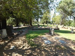
| Burial | : | Newcastle Cemetery, Newcastle, Placer County, USA |
| Coordinate | : | 38.8708880, -121.1444060 |
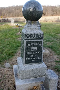
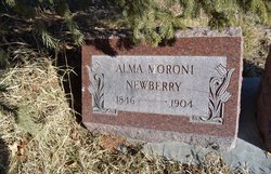
| Description | : | Electa was the eighth of ten children born to James A. Newberry and Mary (Smith) Newberry. Her siblings were Jane (1812-1907, m. Jacob Crandall), John Smith (1814-1870, m. Lucinda Williams), Abraham Benjamin (1818-1898, m. Eliza Ann Duty), James Washington (1819-1895, m. Edith Benedict), Sarah "Sally" (1821-1907, m. Calvin C. Pendleton), Hannah Maria (1823-1893, m. George Morris), Esther (1829-1891, m. Edward Beebee) and Martha "Patty (1832-1917, m. George Hyatt). Electa married George John Wixon (who went by "John") on the trail to Utah in 1847. She had an earlier marriage to Robert A. Lee and was shown as "Electra Louisa Newberry... Read More |
frequently asked questions (FAQ):
-
Where is Electa Louisa “Lecty” Newberry Mansur's memorial?
Electa Louisa “Lecty” Newberry Mansur's memorial is located at: Newcastle Cemetery, Newcastle, Placer County, USA.
-
When did Electa Louisa “Lecty” Newberry Mansur death?
Electa Louisa “Lecty” Newberry Mansur death on 13 Feb 1888 in San Francisco, San Francisco County, California, USA
-
Where are the coordinates of the Electa Louisa “Lecty” Newberry Mansur's memorial?
Latitude: 38.8708880
Longitude: -121.1444060
Family Members:
Parent
Spouse
Siblings

Children
Flowers:


Nearby Cemetories:
1. Newcastle Cemetery
Newcastle, Placer County, USA
Coordinate: 38.8708880, -121.1444060
2. Ophir Cemetery
Placer County, USA
Coordinate: 38.8928870, -121.1273790
3. Stewarts Flat Cemetery
Penryn, Placer County, USA
Coordinate: 38.8447360, -121.1507950
4. Gold Hill Cemetery
Gold Hill, Placer County, USA
Coordinate: 38.9025000, -121.1802200
5. Maidu Indian Burial Grounds
Auburn, Placer County, USA
Coordinate: 38.8744350, -121.0777290
6. New Auburn Cemetery
Auburn, Placer County, USA
Coordinate: 38.9026900, -121.0870800
7. Clark Ashton Smith Gravesite
Auburn, Placer County, USA
Coordinate: 38.8952100, -121.0770500
8. Old Auburn Cemetery
Auburn, Placer County, USA
Coordinate: 38.9023720, -121.0812230
9. Bethlehem Lutheran Church Columbarium
Auburn, Placer County, USA
Coordinate: 38.8932350, -121.0749690
10. Mansur Family Cemetery
Loomis, Placer County, USA
Coordinate: 38.8139600, -121.1214000
11. Prosser Family Cemetery
Loomis, Placer County, USA
Coordinate: 38.8071900, -121.1285600
12. Placer County Hospital Cemetery
Auburn, Placer County, USA
Coordinate: 38.9045120, -121.0721320
13. Chinese Cemetery
Auburn, Placer County, USA
Coordinate: 38.9183502, -121.0802383
14. Rattlesnake Bar Graveyard
Auburn, Placer County, USA
Coordinate: 38.8163050, -121.0895100
15. First Congregational Church Memorial Garden
Auburn, Placer County, USA
Coordinate: 38.9118660, -121.0711770
16. Shepherd of the Sierra Memorial Garden
Loomis, Placer County, USA
Coordinate: 38.7890800, -121.1944200
17. Whitney Family Mausoleum
Rocklin, Placer County, USA
Coordinate: 38.8256500, -121.2477000
18. Wells Cemetery
Auburn, Placer County, USA
Coordinate: 38.9667000, -121.1054900
19. Bayley Family Cemetery
Pilot Hill, El Dorado County, USA
Coordinate: 38.8438800, -121.0148900
20. Lone Star Cemetery
Placer County, USA
Coordinate: 38.9757996, -121.1380997
21. Rocklin Cemetery
Rocklin, Placer County, USA
Coordinate: 38.7827670, -121.2337980
22. Pilot Hill Cemetery
Pilot Hill, El Dorado County, USA
Coordinate: 38.8301010, -121.0093307
23. Lincoln Cemetery
Lincoln, Placer County, USA
Coordinate: 38.8864310, -121.3020500
24. Clipper Gap Cemetery
Clipper Gap, Placer County, USA
Coordinate: 38.9784880, -121.0256590