
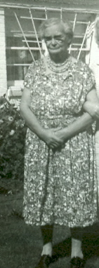

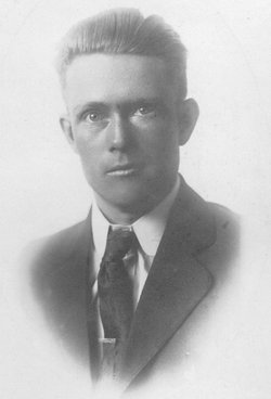
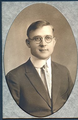
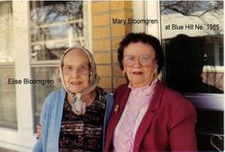
Ellen Caroline Bloomgren Stark
| Birth | : | 15 May 1892 |
| Death | : | 5 Sep 1979 |
| Burial | : | Saint Margaret of Antioch, City of Oxford, England |
| Coordinate | : | 51.7690340, -1.2975900 |
| Plot | : | SW section Lot 188 |
frequently asked questions (FAQ):
-
Where is Ellen Caroline Bloomgren Stark's memorial?
Ellen Caroline Bloomgren Stark's memorial is located at: Saint Margaret of Antioch, City of Oxford, England.
-
When did Ellen Caroline Bloomgren Stark death?
Ellen Caroline Bloomgren Stark death on 5 Sep 1979 in
-
Where are the coordinates of the Ellen Caroline Bloomgren Stark's memorial?
Latitude: 51.7690340
Longitude: -1.2975900
Family Members:
Parent
Spouse
Siblings
Children
Flowers:


Nearby Cemetories:
1. Saint Margaret of Antioch
City of Oxford, England
Coordinate: 51.7690340, -1.2975900
2. Godstow Abbey Ruins
Oxford, City of Oxford, England
Coordinate: 51.7784060, -1.2998170
3. Wytham Churchyard
Wytham, Vale of White Horse District, England
Coordinate: 51.7736230, -1.3131610
4. Botley Cemetery
Botley, Vale of White Horse District, England
Coordinate: 51.7518050, -1.2930000
5. St. Peter Churchyard
Wolvercote, City of Oxford, England
Coordinate: 51.7848300, -1.2811100
6. St. Sepulchres Cemetery
Oxford, City of Oxford, England
Coordinate: 51.7611110, -1.2694440
7. Saint Barnabas Church
Oxford, City of Oxford, England
Coordinate: 51.7579620, -1.2697600
8. St Frideswide Churchyard
Oxford, City of Oxford, England
Coordinate: 51.7521560, -1.2748350
9. St Paul's Oxford Cemetery
Oxford, City of Oxford, England
Coordinate: 51.7594590, -1.2648470
10. St Michael and All Angels Summertown
Oxford, City of Oxford, England
Coordinate: 51.7796280, -1.2643940
11. Rewley Abbey
Oxford, City of Oxford, England
Coordinate: 51.7543810, -1.2675170
12. St. Lawrence's Churchyard
North Hinksey, Vale of White Horse District, England
Coordinate: 51.7457590, -1.2848020
13. St Giles Churchyard
Oxford, City of Oxford, England
Coordinate: 51.7591660, -1.2605170
14. St Thomas the Martyr
Oxford, City of Oxford, England
Coordinate: 51.7518100, -1.2683430
15. Osney Cemetery
Oxford, City of Oxford, England
Coordinate: 51.7505310, -1.2703040
16. Saint Thomas the Martyr Churchyard
Oxford, City of Oxford, England
Coordinate: 51.7512222, -1.2679445
17. Osney Cathedral
Oxford, City of Oxford, England
Coordinate: 51.7497220, -1.2700000
18. Blackfriars
Oxford, City of Oxford, England
Coordinate: 51.7561210, -1.2602060
19. St Johns College
Oxford, City of Oxford, England
Coordinate: 51.7560820, -1.2589910
20. Oxford Castle and Prison Cemetery
Oxford, City of Oxford, England
Coordinate: 51.7521453, -1.2631165
21. Wolvercote Cemetery
Oxford, City of Oxford, England
Coordinate: 51.7913666, -1.2721500
22. Martyrs' Memorial
Oxford, City of Oxford, England
Coordinate: 51.7550900, -1.2590100
23. St. Mary Magdalene's Churchyard
Oxford, City of Oxford, England
Coordinate: 51.7546250, -1.2588340
24. Trinity College Chapel
Oxford, City of Oxford, England
Coordinate: 51.7552360, -1.2569620