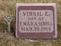
Elmer William “Pat” Scholl
| Birth | : | 9 Jul 1893 Cass County, Iowa, USA |
| Death | : | 13 Oct 1981 Greenfield, Adair County, Iowa, USA |
| Burial | : | Chapel of the Chimes Columbarium and Mausoleum, Oakland, Alameda County, USA |
| Coordinate | : | 37.8318863, -122.2456894 |
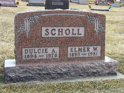
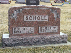
| Inscription | : | Scholl Dulcie A. 1894 - 1978 Elmer W. 1893 - 1981 |
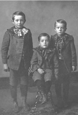
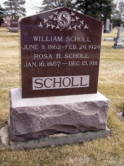
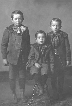
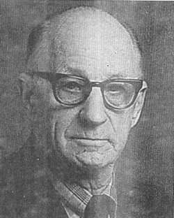
| Description | : | 'Pat' Scholl Dies William Elmer 'Pat' Scholl, 88, longtime Anita resident, died October 13 at the Greenfield manor in Greenfield, Iowa. Mr. Scholl was born July 9, 1893 in Cass County, the son of William and Rosa Brockman Scholl and was reared south of Anita and attended maple Grove School. He was married to Dulcie Bills in Atlantic March 31, 1915, and lived on the family farm for 5 years and later farmed 5 miles south of Anita until moving into town in 1948. He was a member of the Congregational Church and also the Knights of Pythias Lodge. Surviving are a daughter, Mrs. Wilbur... Read More |
frequently asked questions (FAQ):
-
Where is Elmer William “Pat” Scholl's memorial?
Elmer William “Pat” Scholl's memorial is located at: Chapel of the Chimes Columbarium and Mausoleum, Oakland, Alameda County, USA.
-
When did Elmer William “Pat” Scholl death?
Elmer William “Pat” Scholl death on 13 Oct 1981 in Greenfield, Adair County, Iowa, USA
-
Where are the coordinates of the Elmer William “Pat” Scholl's memorial?
Latitude: 37.8318863
Longitude: -122.2456894
Family Members:
Parent
Spouse
Siblings
Children
Flowers:
Nearby Cemetories:
1. Chapel of the Chimes Columbarium and Mausoleum
Oakland, Alameda County, USA
Coordinate: 37.8318863, -122.2456894
2. Home of Eternity Cemetery
Oakland, Alameda County, USA
Coordinate: 37.8322970, -122.2448270
3. Chapel of Memories Columbarium
Oakland, Alameda County, USA
Coordinate: 37.8310471, -122.2480927
4. Saint Mary's Cemetery
Oakland, Alameda County, USA
Coordinate: 37.8349991, -122.2418976
5. Mountain View Cemetery
Oakland, Alameda County, USA
Coordinate: 37.8327600, -122.2395200
6. Cathedral of Christ the Light Mausoleum
Oakland, Alameda County, USA
Coordinate: 37.8105316, -122.2633896
7. Saint Paul Lutheran Church
Oakland, Alameda County, USA
Coordinate: 37.8020820, -122.2222780
8. Home of Peace Cemetery
Oakland, Alameda County, USA
Coordinate: 37.7790604, -122.2036285
9. Northbrae Community Church Columbarium
Berkeley, Alameda County, USA
Coordinate: 37.8905500, -122.2763200
10. Sunnyside Cemetery
Oakland, Alameda County, USA
Coordinate: 37.7806260, -122.1822410
11. Golden Gate Fields
Albany, Alameda County, USA
Coordinate: 37.8854000, -122.3117000
12. Evergreen Cemetery
Oakland, Alameda County, USA
Coordinate: 37.7719002, -122.1782990
13. Golden Gate Mausoleum and Columbaria
El Cerrito, Contra Costa County, USA
Coordinate: 37.9073150, -122.2857220
14. Sunset View Cemetery
El Cerrito, Contra Costa County, USA
Coordinate: 37.9077721, -122.2871017
15. Lafayette-Orinda Presbyterian Church Garden
Contra Costa County, USA
Coordinate: 37.8866040, -122.1606950
16. Saint Stephens Episcopal Church Memorial Garden
Orinda, Contra Costa County, USA
Coordinate: 37.8982650, -122.1729170
17. Yerba Buena Island Cemetery (Defunct)
San Francisco, San Francisco County, USA
Coordinate: 37.8127420, -122.3707880
18. Gan Shalom Cemetery
Contra Costa County, USA
Coordinate: 37.9528122, -122.1975098
19. Saint Anselms Episcopal Church Columbarium
Lafayette, Contra Costa County, USA
Coordinate: 37.8737230, -122.0933820
20. First Street Cemetery (Defunct)
San Francisco, San Francisco County, USA
Coordinate: 37.7906170, -122.3991770
21. Bush Street Cemetery (Defunct)
San Francisco, San Francisco County, USA
Coordinate: 37.7907950, -122.4011960
22. Old Saint Marys Cathedral Crypt
San Francisco, San Francisco County, USA
Coordinate: 37.7929010, -122.4058220
23. Lafayette Cemetery
Lafayette, Contra Costa County, USA
Coordinate: 37.8964005, -122.0986023
24. Grace Cathedral Columbarium
San Francisco, San Francisco County, USA
Coordinate: 37.7921110, -122.4133220

