
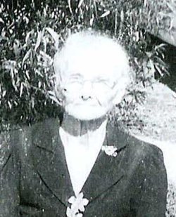
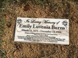
Emily Luvenia Kelley Burns
| Birth | : | 13 Mar 1875 Decatur County, Tennessee, USA |
| Death | : | 14 Dec 1956 Hayti, Pemiscot County, Missouri, USA |
| Burial | : | Corinth Church Cemetery, Decatur County, USA |
| Coordinate | : | 35.4126020, -88.2056180 |
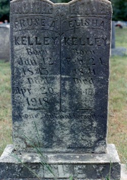
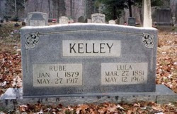
| Description | : | For many years, her burial location was forgotten and unknown. Thanks to a rediscovered photo taken shortly after her burial, Emily's unmarked grave was located in the most obvious place: right next to her parents, Elisha and Fruse Ann Kelley. If not for the persistence of Emily's grandchildren, her grave might have gone unmarked forever. Now she has the grave marker she deserves, so that future generations can easily find her. |
frequently asked questions (FAQ):
-
Where is Emily Luvenia Kelley Burns's memorial?
Emily Luvenia Kelley Burns's memorial is located at: Corinth Church Cemetery, Decatur County, USA.
-
When did Emily Luvenia Kelley Burns death?
Emily Luvenia Kelley Burns death on 14 Dec 1956 in Hayti, Pemiscot County, Missouri, USA
-
Where are the coordinates of the Emily Luvenia Kelley Burns's memorial?
Latitude: 35.4126020
Longitude: -88.2056180
Family Members:
Parent

Spouse
Siblings

Children
Flowers:


Nearby Cemetories:
1. Corinth Church Cemetery
Decatur County, USA
Coordinate: 35.4126020, -88.2056180
2. Patterson Cemetery
Lick Skillet, Decatur County, USA
Coordinate: 35.4383800, -88.1979020
3. Shannon Cemetery
Decatur County, USA
Coordinate: 35.3916230, -88.1832190
4. Liberty Church Cemetery
Scotts Hill, Decatur County, USA
Coordinate: 35.4466050, -88.2146570
5. Kelley Cemetery
Bath Springs, Decatur County, USA
Coordinate: 35.4037640, -88.1532630
6. Gardner - Wylie Cemetery
Bath Springs, Decatur County, USA
Coordinate: 35.4370190, -88.1558690
7. Carter Cemetery
Hardin County, USA
Coordinate: 35.3731003, -88.2407990
8. Lowery-Doe Creek Cemetery
Decatur County, USA
Coordinate: 35.4483120, -88.2468900
9. Red Walnut Church Cemetery
Lick Skillet, Decatur County, USA
Coordinate: 35.4700840, -88.1787990
10. Altom Cemetery
Decatur County, USA
Coordinate: 35.4169006, -88.1280975
11. Doe Creek Cemetery
Scotts Hill, Henderson County, USA
Coordinate: 35.4692990, -88.2474350
12. Sardis Cemetery
Sardis, Henderson County, USA
Coordinate: 35.4366020, -88.2833100
13. Murphy Cemetery
Lick Skillet, Decatur County, USA
Coordinate: 35.4806930, -88.1983720
14. Prospect Church Cemetery
Sardis, Henderson County, USA
Coordinate: 35.4584950, -88.2683120
15. Union Cemetery
Decatur County, USA
Coordinate: 35.4150009, -88.1213989
16. Butler Cemetery
Bath Springs, Decatur County, USA
Coordinate: 35.4525690, -88.1296430
17. Cawthon Cemetery
Hookers Bend, Hardin County, USA
Coordinate: 35.3403550, -88.2329100
18. Lafferty Cemetery
Bath Springs, Decatur County, USA
Coordinate: 35.4673620, -88.1414970
19. Brasher Cemetery
Bath Springs, Decatur County, USA
Coordinate: 35.4432640, -88.1192950
20. Hanna Cemetery
Hinkle, Hardin County, USA
Coordinate: 35.3991600, -88.3006680
21. Connelly Cemetery
Grandview, Hardin County, USA
Coordinate: 35.3733560, -88.1203440
22. Oakland Cemetery
Hookers Bend, Hardin County, USA
Coordinate: 35.3298870, -88.2166980
23. Pleasant Hill Church Cemetery
Bath Springs, Decatur County, USA
Coordinate: 35.4839610, -88.1511390
24. McCall Cemetery
Hardin County, USA
Coordinate: 35.3838997, -88.1085968