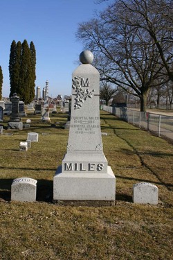
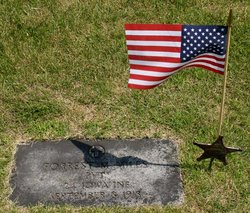
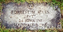
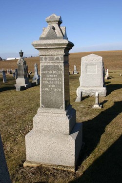
Forrest M. Miles
| Birth | : | 14 Apr 1840 Wayne County, Ohio, USA |
| Death | : | 8 Sep 1918 Miles, Jackson County, Iowa, USA |
| Burial | : | Free Will Baptist Church Cemetery, Holmesville, Carleton County, Canada |
| Coordinate | : | 46.5748720, -67.6033510 |
| Plot | : | Lot 1 - 12 |
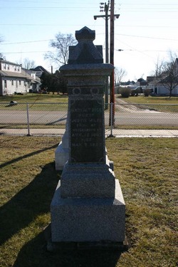
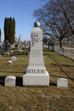
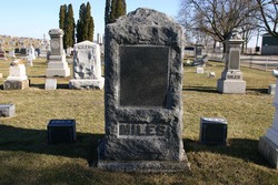
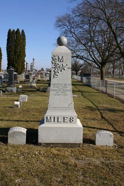
| Description | : | Husband of: Henrietta Graham Miles. Parents of: Willard S. Miles. ENLISTED 11 AUGUST 1862 PVT. CO. A INFANTRY 24 th. INFANTRY IOWA VOL. CIVIL WAR DISCHARGED FOR WOUNDS 14 APRIL 1865 Family stone, Civil War Record and pension, and GAR record give first name as Forest. |
frequently asked questions (FAQ):
-
Where is Forrest M. Miles's memorial?
Forrest M. Miles's memorial is located at: Free Will Baptist Church Cemetery, Holmesville, Carleton County, Canada.
-
When did Forrest M. Miles death?
Forrest M. Miles death on 8 Sep 1918 in Miles, Jackson County, Iowa, USA
-
Where are the coordinates of the Forrest M. Miles's memorial?
Latitude: 46.5748720
Longitude: -67.6033510
Family Members:
Parent
Spouse
Siblings
Children
Flowers:
Nearby Cemetories:
1. Free Will Baptist Church Cemetery
Holmesville, Carleton County, Canada
Coordinate: 46.5748720, -67.6033510
2. Buckley Cemetery
Holmesville, Carleton County, Canada
Coordinate: 46.5781683, -67.6194186
3. Mineral Cemetery
Kent, Carleton County, Canada
Coordinate: 46.5918753, -67.5843827
4. Taylor Cemetery
Piercemont, Carleton County, Canada
Coordinate: 46.5548580, -67.6317020
5. Johnville Cemetery
Johnville, Carleton County, Canada
Coordinate: 46.5870263, -67.5493302
6. Moose Mountain Pioneer Cemetery
Moose Mountain, Carleton County, Canada
Coordinate: 46.6007340, -67.6610030
7. Currie Cemetery
Bath, Carleton County, Canada
Coordinate: 46.5293370, -67.6286000
8. Beechwood United Baptist Cemetery
Beechwood, Carleton County, Canada
Coordinate: 46.5433300, -67.6625000
9. Gee Flat Cemetery
Bath, Carleton County, Canada
Coordinate: 46.5213340, -67.6162040
10. Pine Tree Cemetery
Bath, Carleton County, Canada
Coordinate: 46.5164370, -67.6046100
11. Pomphrey Cemetery
Wicklow, Carleton County, Canada
Coordinate: 46.5437840, -67.6802360
12. Barker Cemetery
Bath, Carleton County, Canada
Coordinate: 46.5102780, -67.5961110
13. Wharton Cemetery
Upper Kent, Carleton County, Canada
Coordinate: 46.5583300, -67.7011100
14. Melville Cemetery
Kincardine, Victoria County, Canada
Coordinate: 46.6366790, -67.6660930
15. Pomphrey Island Cemetery
Clearview, Carleton County, Canada
Coordinate: 46.5637693, -67.7153083
16. Hawthorne Cemetery
Upper Kent, Carleton County, Canada
Coordinate: 46.5833177, -67.7179017
17. St Bartholomew Catholic Cemetery
Clearview, Carleton County, Canada
Coordinate: 46.5730900, -67.7196300
18. Lower Wicklow Cemetery
Wicklow, Carleton County, Canada
Coordinate: 46.4916000, -67.5862200
19. Summerfield Cemetery
Wicklow, Carleton County, Canada
Coordinate: 46.5249990, -67.7083540
20. Bairdsville Anglican Cemetery
Bairdsville, Victoria County, Canada
Coordinate: 46.6269606, -67.7164698
21. Kilburn Community Cemetery
Kilburn, Victoria County, Canada
Coordinate: 46.6406400, -67.7061800
22. Greenfield Anglican Cemetery
Greenfield, Carleton County, Canada
Coordinate: 46.4900710, -67.6862390
23. River de Chute Cemetery
Carleton County, Canada
Coordinate: 46.5935500, -67.7500700
24. Bristol United Church Cemetery
Florenceville-Bristol, Carleton County, Canada
Coordinate: 46.4722370, -67.5787790

