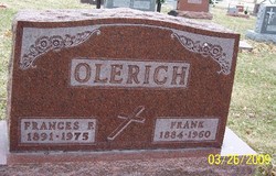
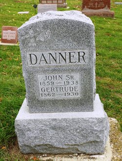
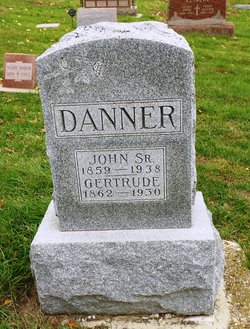
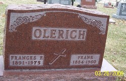
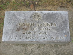
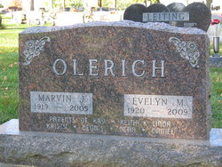
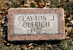
Frances Fanny Danner Olerich
| Birth | : | 3 Mar 1891 Mount Carmel, Carroll County, Iowa, USA |
| Death | : | 26 Dec 1975 Wall Lake, Sac County, Iowa, USA |
| Burial | : | Mount Hope Cemetery, Independence, Montgomery County, USA |
| Coordinate | : | 37.2413300, -95.7060050 |
| Description | : | Dec 29, 1975 - Carroll Daily Times - Wall Lake — Mrs. Frances Fannie Olerich, 84, of Wall Lake, formerly of Carroll, died at 6:30 p.m. Friday, Dec. 26, at Twilight Acres nursing home in Wall Lake, where she had resided for several years. She was the widow of Frank Olerich. Mass of the resurrection was offered at 1:30 p.m. Monday in St. Lawrence Church, Carroll, of which she was a member. The Rev. Dale Reiff officiated. Interment was in Mt. Olivet Cemetery, Carroll, under direction of the Twit Funeral Home of Carroll. Mrs. Olerich, daughter of... Read More |
frequently asked questions (FAQ):
-
Where is Frances Fanny Danner Olerich's memorial?
Frances Fanny Danner Olerich's memorial is located at: Mount Hope Cemetery, Independence, Montgomery County, USA.
-
When did Frances Fanny Danner Olerich death?
Frances Fanny Danner Olerich death on 26 Dec 1975 in Wall Lake, Sac County, Iowa, USA
-
Where are the coordinates of the Frances Fanny Danner Olerich's memorial?
Latitude: 37.2413300
Longitude: -95.7060050
Family Members:
Parent
Spouse
Siblings
Children
Flowers:
Nearby Cemetories:
1. Mount Hope Cemetery
Independence, Montgomery County, USA
Coordinate: 37.2413300, -95.7060050
2. Calvary Cemetery
Independence, Montgomery County, USA
Coordinate: 37.2486000, -95.7043991
3. Saint Andrews Cemetery
Independence, Montgomery County, USA
Coordinate: 37.2566986, -95.6658020
4. Pratt Cemetery
Montgomery County, USA
Coordinate: 37.2324982, -95.6557999
5. Le Hunt Cemetery
Montgomery County, USA
Coordinate: 37.2744300, -95.7586200
6. Radical Cemetery
Montgomery County, USA
Coordinate: 37.2882996, -95.7416992
7. Bethel Cemetery
Independence, Montgomery County, USA
Coordinate: 37.2761002, -95.6457977
8. Montgomery County Poor Farm Cemetery
Liberty, Montgomery County, USA
Coordinate: 37.1888590, -95.6493690
9. Choteau Cemetery
Independence, Montgomery County, USA
Coordinate: 37.3194700, -95.6746700
10. Harmony Cemetery
Cherryvale, Montgomery County, USA
Coordinate: 37.2324982, -95.5950012
11. Quaker Cemetery
Elk City, Montgomery County, USA
Coordinate: 37.2395900, -95.8243400
12. Thompson Homestead Cemetery
Liberty, Montgomery County, USA
Coordinate: 37.1767000, -95.6183100
13. Krone Cemetery
Montgomery County, USA
Coordinate: 37.3302400, -95.7494600
14. Highland Cemetery
Montgomery County, USA
Coordinate: 37.2092018, -95.8283005
15. Saint Francis Xavier Cemetery
Cherryvale, Montgomery County, USA
Coordinate: 37.2633018, -95.5753021
16. Liberty Cemetery
Liberty, Montgomery County, USA
Coordinate: 37.1581890, -95.6001580
17. Pleasant Dale Cemetery
Cherryvale, Montgomery County, USA
Coordinate: 37.3139700, -95.5860700
18. Parker Cemetery
Montgomery County, USA
Coordinate: 37.2630997, -95.8572006
19. Spring Hill Cemetery
Montgomery County, USA
Coordinate: 37.1235600, -95.6595500
20. Simpson Cemetery
Elk City, Montgomery County, USA
Coordinate: 37.3269005, -95.8186035
21. Centennial Cemetery
Cherryvale, Montgomery County, USA
Coordinate: 37.2296982, -95.5466995
22. Hinton Cemetery
Liberty, Montgomery County, USA
Coordinate: 37.1384900, -95.6101000
23. Spindletop Cemetery
Cherryvale, Montgomery County, USA
Coordinate: 37.2958400, -95.5570700
24. All Saints Cemetery
Liberty, Montgomery County, USA
Coordinate: 37.1542015, -95.5757980

