
| Birth | : | 16 Jul 1920 Council Bluffs, Pottawattamie County, Iowa, USA |
| Death | : | 16 Feb 2012 Council Bluffs, Pottawattamie County, Iowa, USA |
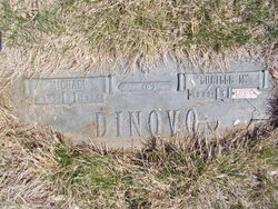
| Burial | : | Saint Joseph Cemetery, Council Bluffs, Pottawattamie County, USA |
| Coordinate | : | 41.2722015, -95.8208008 |
| Description | : | Frank J. Dinovo, Sr., age 91, of Council Bluffs, Iowa, passed away February 16, 2012, at Bethany Lutheran Home. Frank was born July 16, 1920, in Council Bluffs, Iowa, to the late Mariano and Pearl (Tedesco) Dinovo. He graduated from Abraham Lincoln High School in 1940 and served his country in the U.S. Navy during World War II. Frank married Mary Garafalo on August 8, 1944. They were blessed with three children, Frank, Jr., Mary Jo and Patty. He worked for Northwestern Bell/Qwest from 1945-1989, retiring as toll terminal man. He was a member of St. Patrick Catholic Church; American Legion... Read More |
frequently asked questions (FAQ):
-
Where is Frank J. Dinovo Sr.'s memorial?
Frank J. Dinovo Sr.'s memorial is located at: Saint Joseph Cemetery, Council Bluffs, Pottawattamie County, USA.
-
When did Frank J. Dinovo Sr. death?
Frank J. Dinovo Sr. death on 16 Feb 2012 in Council Bluffs, Pottawattamie County, Iowa, USA
-
Where are the coordinates of the Frank J. Dinovo Sr.'s memorial?
Latitude: 41.2722015
Longitude: -95.8208008
Family Members:
Parent

Spouse
Siblings
Flowers:


Nearby Cemetories:
1. Saint Joseph Cemetery
Council Bluffs, Pottawattamie County, USA
Coordinate: 41.2722015, -95.8208008
2. Bikhor Cholim Cemetery
Council Bluffs, Pottawattamie County, USA
Coordinate: 41.2703670, -95.8229350
3. Oak Hill Cemetery
Council Bluffs, Pottawattamie County, USA
Coordinate: 41.2700900, -95.8226400
4. Green Valley Cemetery
Council Bluffs, Pottawattamie County, USA
Coordinate: 41.2743988, -95.8225021
5. Cedar Lawn Cemetery
Council Bluffs, Pottawattamie County, USA
Coordinate: 41.2694016, -95.8182983
6. Walnut Hill Cemetery
Council Bluffs, Pottawattamie County, USA
Coordinate: 41.2719002, -95.8255997
7. Ridgewood Cemetery
Council Bluffs, Pottawattamie County, USA
Coordinate: 41.2694016, -95.8272018
8. Memorial Park Cemetery
Council Bluffs, Pottawattamie County, USA
Coordinate: 41.2644005, -95.8261032
9. Clark Cemetery
Pottawattamie County, USA
Coordinate: 41.2551610, -95.8223390
10. Fairview Cemetery
Council Bluffs, Pottawattamie County, USA
Coordinate: 41.2703018, -95.8480988
11. Garner Cemetery
Council Bluffs, Pottawattamie County, USA
Coordinate: 41.2956161, -95.8001709
12. Stoker-Graybill Cemetery
Council Bluffs, Pottawattamie County, USA
Coordinate: 41.2532620, -95.7751770
13. Maple Grove Cemetery
Council Bluffs, Pottawattamie County, USA
Coordinate: 41.2265560, -95.8187100
14. Evans Cemetery
Crescent, Pottawattamie County, USA
Coordinate: 41.3255997, -95.8368988
15. Lewis Township Cemetery
Council Bluffs, Pottawattamie County, USA
Coordinate: 41.2117004, -95.7938995
16. Gregg Cemetery
Weston, Pottawattamie County, USA
Coordinate: 41.3330000, -95.7931000
17. Council Point Cemetery
Council Bluffs, Pottawattamie County, USA
Coordinate: 41.2110830, -95.8788610
18. Hazel Dell Cemetery
Council Bluffs, Pottawattamie County, USA
Coordinate: 41.3489723, -95.7939911
19. Trinity Cathedral Columbarium
Omaha, Douglas County, USA
Coordinate: 41.2603900, -95.9393660
20. Saint Columbanus Cemetery
Weston, Pottawattamie County, USA
Coordinate: 41.3429440, -95.7435260
21. Crescent Cemetery
Crescent, Pottawattamie County, USA
Coordinate: 41.3664894, -95.8566208
22. Prospect Hill Cemetery
Omaha, Douglas County, USA
Coordinate: 41.2780991, -95.9593964
23. First Central Congregational Columbarium
Omaha, Douglas County, USA
Coordinate: 41.2563456, -95.9658365
24. Saint Pauls Evangelical Country Church Cemetery
Dumfries, Pottawattamie County, USA
Coordinate: 41.1748352, -95.7492371