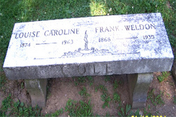
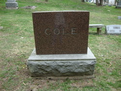
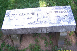
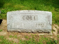
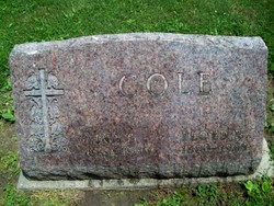
Frank Weldon Cole
| Birth | : | 10 Sep 1868 Indiana, USA |
| Death | : | May 1935 Indiana, USA |
| Burial | : | Opdycke Cemetery, Hunterdon County, USA |
| Coordinate | : | 40.4375000, -74.9250000 |
| Plot | : | C-4 |
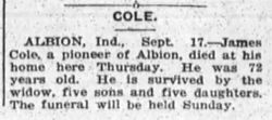
| Description | : | Cole Frank W, 66, was born Sept. 10, 1868 in Jefferson Twp, the son of James R. and Martha Cole, and died at his home here Friday after a four day's illness from pneumonia and heart complications. He spent his entire life in this community and during the past 25 years had owned and operated the Cole's Variety Store. When about seven years old, his eyes became afflicted and a year later he became totally blind. He attended the school for the blind at Indianapolis where he learned the Braille system and received his education. Despite the fact he was... Read More |
frequently asked questions (FAQ):
-
Where is Frank Weldon Cole's memorial?
Frank Weldon Cole's memorial is located at: Opdycke Cemetery, Hunterdon County, USA.
-
When did Frank Weldon Cole death?
Frank Weldon Cole death on May 1935 in Indiana, USA
-
Where are the coordinates of the Frank Weldon Cole's memorial?
Latitude: 40.4375000
Longitude: -74.9250000
Family Members:
Parent
Spouse
Siblings
Children
Flowers:
Nearby Cemetories:
1. Opdycke Cemetery
Hunterdon County, USA
Coordinate: 40.4375000, -74.9250000
2. Lower Amwell Cemetery - New Yard
Sergeantsville, Hunterdon County, USA
Coordinate: 40.4475098, -74.9133453
3. Lower Amwell Cemetery - Old Yard
Sergeantsville, Hunterdon County, USA
Coordinate: 40.4479866, -74.9134750
4. Barber Burying Ground
Sandy Ridge, Hunterdon County, USA
Coordinate: 40.4190292, -74.9282608
5. Moore Family Burying Ground
Sergeantsville, Hunterdon County, USA
Coordinate: 40.4414400, -74.9008720
6. Rake Family Burying Ground
Sand Brook, Hunterdon County, USA
Coordinate: 40.4598999, -74.9170914
7. Sergeantville Methodist Episcopal Church Cemetery
Sergeantsville, Hunterdon County, USA
Coordinate: 40.4458333, -74.9538880
8. Sandy Ridge Cemetery
Sandy Ridge, Hunterdon County, USA
Coordinate: 40.4232178, -74.9541168
9. Sand Brook German Baptist Church Cemetery
Sand Brook, Hunterdon County, USA
Coordinate: 40.4687500, -74.9162216
10. Pine Hill Cemetery
Sergeantsville, Hunterdon County, USA
Coordinate: 40.4580498, -74.9622192
11. Sutton Farm Cemetery
Hunterdon County, USA
Coordinate: 40.4737206, -74.9048309
12. Saint Andrews Episcopal Churchyard
Ringoes, Hunterdon County, USA
Coordinate: 40.4406586, -74.8734360
13. Servis-Quick Family Cemetery
Ringoes, Hunterdon County, USA
Coordinate: 40.4375000, -74.8722220
14. Union Cemetery
Ringoes, Hunterdon County, USA
Coordinate: 40.4261017, -74.8732986
15. Second English Presbyterian Church Cemetery
Amwell, Hunterdon County, USA
Coordinate: 40.3984718, -74.9072189
16. Williamson Farm Family Cemetery
Stockton, Hunterdon County, USA
Coordinate: 40.4457220, -74.9818690
17. Kitchen Cemetery
Sand Brook, Hunterdon County, USA
Coordinate: 40.4803810, -74.9092480
18. Trout Family Burying Ground
Sand Brook, Hunterdon County, USA
Coordinate: 40.4777778, -74.8972222
19. Rosemont Cemetery
Rosemont, Hunterdon County, USA
Coordinate: 40.4290009, -74.9902802
20. Prallsville Cemetery
Hunterdon County, USA
Coordinate: 40.4090300, -74.9827760
21. Amwell Ridge Cemetery
Ringoes, Hunterdon County, USA
Coordinate: 40.4415970, -74.8554840
22. Geary Gravesite
Amwell, Hunterdon County, USA
Coordinate: 40.4561386, -74.8564301
23. Locktown Christian Cemetery
Locktown, Hunterdon County, USA
Coordinate: 40.4820137, -74.9694443
24. Holcombe Riverview Cemetery
Lambertville, Hunterdon County, USA
Coordinate: 40.3828011, -74.9535980

