
| Birth | : | 27 Dec 1908 Linwood, Butler County, Nebraska, USA |
| Death | : | 8 Mar 2010 Omaha, Douglas County, Nebraska, USA |
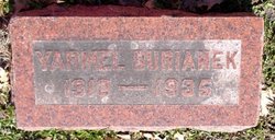
| Burial | : | Sackett Cemetery, Danbury, Ottawa County, USA |
| Coordinate | : | 41.5303001, -82.7872009 |
| Description | : | Preceded in death by husband, Yarmel; parents, Frank and Anna Roh; sister, Rose Roh; brothers, Joseph, Albin, Edward, Frank and Emil Roh. Survived by son and daughter-in-law, L.F. "Bud" and Arlene Burianek of Ralston; grandchildren, Lisa Burianek (John Cropley) Jeffrey Burianek (Jill Reel, M.D.), Laura (Mark) Gilliland, Becky (Bryan) Canaday, Bret Burianek (Melissa McFadden); eight great-grandchildren; brother, Dr. Roman C. (Martha) Roh; dear friend, Bernita Majerus; many nieces and nephews. |
frequently asked questions (FAQ):
-
Where is Gladys A Roh Burianek's memorial?
Gladys A Roh Burianek's memorial is located at: Sackett Cemetery, Danbury, Ottawa County, USA.
-
When did Gladys A Roh Burianek death?
Gladys A Roh Burianek death on 8 Mar 2010 in Omaha, Douglas County, Nebraska, USA
-
Where are the coordinates of the Gladys A Roh Burianek's memorial?
Latitude: 41.5303001
Longitude: -82.7872009
Family Members:
Parent

Spouse
Siblings
Flowers:


Nearby Cemetories:
1. Sackett Cemetery
Danbury, Ottawa County, USA
Coordinate: 41.5303001, -82.7872009
2. Kelly Cemetery
Danbury, Ottawa County, USA
Coordinate: 41.5245720, -82.7705950
3. Saint Pauls Lutheran Church Cemetery
Lakeside, Ottawa County, USA
Coordinate: 41.5242200, -82.8049100
4. Lockwood Cemetery
Lakeside, Ottawa County, USA
Coordinate: 41.5435140, -82.8161560
5. Hartshorn Cemetery
Danbury, Ottawa County, USA
Coordinate: 41.5144440, -82.7499530
6. Jamison Cemetery
Danbury, Ottawa County, USA
Coordinate: 41.5050060, -82.8180740
7. Chautauqua Park Memorial Garden
Lakeside, Ottawa County, USA
Coordinate: 41.5412410, -82.7418240
8. War of 1812 Battle Site
Mineyahta-on-the Bay, Ottawa County, USA
Coordinate: 41.5140350, -82.7438530
9. Holy Assumption Orthodox Cemetery
Marblehead, Ottawa County, USA
Coordinate: 41.5361530, -82.7389380
10. Saint Joseph's Catholic Cemetery
Marblehead, Ottawa County, USA
Coordinate: 41.5344009, -82.7382965
11. Wolcott Cemetery
Marblehead, Ottawa County, USA
Coordinate: 41.5177994, -82.7403030
12. Russian Cemetery
Marblehead, Ottawa County, USA
Coordinate: 41.5335999, -82.7371979
13. Catawba Island Cemetery
Catawba Island, Ottawa County, USA
Coordinate: 41.5569000, -82.8403015
14. Saint Mary's Byzantine Catholic Cemetery
Marblehead, Ottawa County, USA
Coordinate: 41.5409012, -82.7223969
15. Clemons Cemetery
Marblehead, Ottawa County, USA
Coordinate: 41.5409012, -82.7213974
16. Johnson's Island Confederate Cemetery
Marblehead, Ottawa County, USA
Coordinate: 41.5003014, -82.7300034
17. K'Burg Family Cemetery
Catawba Island Township, Ottawa County, USA
Coordinate: 41.5589400, -82.8463000
18. Dwelle Cemetery
Port Clinton, Ottawa County, USA
Coordinate: 41.5069008, -82.8563995
19. Shook Cemetery
Portage Township, Ottawa County, USA
Coordinate: 41.5214005, -82.8758011
20. Christy Chapel Cemetery
Gypsum, Ottawa County, USA
Coordinate: 41.5085983, -82.8861008
21. Tynan Burial Plot
Portage Township, Ottawa County, USA
Coordinate: 41.4909000, -82.8835000
22. Venice Cemetery
Margaretta Township, Erie County, USA
Coordinate: 41.4413690, -82.7829920
23. First Cemetery (Defunct)
Sandusky, Erie County, USA
Coordinate: 41.4543770, -82.7216040
24. Cholera Cemetery
Sandusky, Erie County, USA
Coordinate: 41.4496660, -82.7252970