
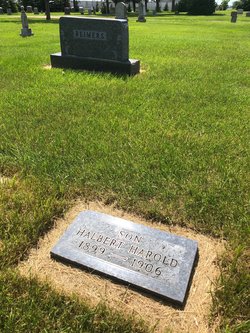

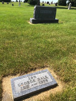
Halbert Harold Reimers
| Birth | : | 9 Dec 1899 Moingona, Boone County, Iowa, USA |
| Death | : | 12 Apr 1906 Carrington, Foster County, North Dakota, USA |
| Burial | : | Keynsham Cemetery, Keynsham, Bath and North East Somerset Unitary Authority, England |
| Coordinate | : | 51.4212975, -2.5116095 |
| Inscription | : | Son |
| Description | : | He fell while ice skating and hit his head. He died two weeks later. |
frequently asked questions (FAQ):
-
Where is Halbert Harold Reimers's memorial?
Halbert Harold Reimers's memorial is located at: Keynsham Cemetery, Keynsham, Bath and North East Somerset Unitary Authority, England.
-
When did Halbert Harold Reimers death?
Halbert Harold Reimers death on 12 Apr 1906 in Carrington, Foster County, North Dakota, USA
-
Where are the coordinates of the Halbert Harold Reimers's memorial?
Latitude: 51.4212975
Longitude: -2.5116095
Family Members:
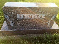
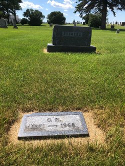
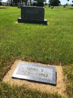
Parent
Siblings
Flowers:


Nearby Cemetories:
1. Keynsham Cemetery
Keynsham, Bath and North East Somerset Unitary Authority, England
Coordinate: 51.4212975, -2.5116095
2. St. John the Baptist Churchyard
Keynsham, Bath and North East Somerset Unitary Authority, England
Coordinate: 51.4174570, -2.4987140
3. Ebenezer Baptist Church
Keynsham, Bath and North East Somerset Unitary Authority, England
Coordinate: 51.4160710, -2.4983170
4. Keynsham Abbey
Keynsham, Bath and North East Somerset Unitary Authority, England
Coordinate: 51.4172000, -2.4961000
5. Queen Charlton St. Margaret Churchyard
Compton Dando, Bath and North East Somerset Unitary Authority, England
Coordinate: 51.4009300, -2.5271800
6. Saint Margaret Churchyard
Compton Dando, Bath and North East Somerset Unitary Authority, England
Coordinate: 51.4009330, -2.5272136
7. Brislington Cemetery
Brislington, Bristol Unitary Authority, England
Coordinate: 51.4355480, -2.5438020
8. Hanham Baptist Church Cemetery
Hanham, South Gloucestershire Unitary Authority, England
Coordinate: 51.4474802, -2.5107480
9. St Anne Churchyard
Oldland, South Gloucestershire Unitary Authority, England
Coordinate: 51.4381800, -2.4780900
10. Christ Church Churchyard
Hanham, South Gloucestershire Unitary Authority, England
Coordinate: 51.4484992, -2.5222650
11. Hanham United Reform Church Cemetery
Hanham, South Gloucestershire Unitary Authority, England
Coordinate: 51.4509706, -2.5189809
12. Christ Church Churchyard
Bristol, Bristol Unitary Authority, England
Coordinate: 51.4213270, -2.5632460
13. St. Mary Churchyard
Bitton, South Gloucestershire Unitary Authority, England
Coordinate: 51.4223600, -2.4599100
14. Whitchurch Cemetery
Bristol Unitary Authority, England
Coordinate: 51.3990278, -2.5506809
15. Ebenezer Methodist Chapel
Warmley, South Gloucestershire Unitary Authority, England
Coordinate: 51.4514960, -2.4779637
16. Holy Souls Catholic Cemetery
Arnos Vale, Bristol Unitary Authority, England
Coordinate: 51.4422800, -2.5639300
17. Saint Michael Churchyard
Keynsham, Bath and North East Somerset Unitary Authority, England
Coordinate: 51.3865690, -2.4830350
18. Arnos Vale Cemetery and Crematorium
Arnos Vale, Bristol Unitary Authority, England
Coordinate: 51.4423740, -2.5648680
19. St. Mary Redcliffe Cemetery
Arnos Vale, Bristol Unitary Authority, England
Coordinate: 51.4428370, -2.5646220
20. Blessed Virgin Mary Churchyard
Saltford, Bath and North East Somerset Unitary Authority, England
Coordinate: 51.4056845, -2.4528274
21. Holy Trinity Churchyard
Kingswood, South Gloucestershire Unitary Authority, England
Coordinate: 51.4619990, -2.5040620
22. St Michael the Archangel Churchyard
Bristol Unitary Authority, England
Coordinate: 51.4619199, -2.5211279
23. Blessed Virgin Mary Churchyard
Compton Dando, Bath and North East Somerset Unitary Authority, England
Coordinate: 51.3796870, -2.5100920
24. Master's Church Cemetery
Kingswood, South Gloucestershire Unitary Authority, England
Coordinate: 51.4630871, -2.5068932