| Birth | : | 28 Apr 1872 Virginia City, Madison County, Montana, USA |
| Death | : | 29 Apr 1957 Alameda, Alameda County, California, USA |
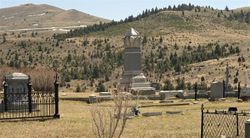
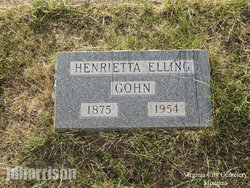
| Burial | : | Mountain View Cemetery, Oakland, Alameda County, USA |
| Coordinate | : | 37.8327600, -122.2395200 |
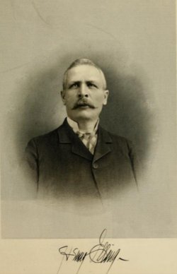
| Description | : | The Montana Standard Virginia City Native Dies in California VIRGINIA CITY - Helena K. (Lena) Bowman, 83, eldest daughter of the late Henry and Mary B. Elling, died recently in Alameda, Calif. Her father was a pioneer of Virginia City and was prominent in local affairs, being the owner of the Elling State Bank and also the owner of considerable property in Madison County. She was born in Virginia City April 28, 1874, and grew to womanhood here. Later she moved to California and was active in the Christian Science Church. She is survived by a sister, Mrs. Mable E. Hull; a brother, Harrison... Read More |
frequently asked questions (FAQ):
-
Where is Helena Kathryn Elling Bowman's memorial?
Helena Kathryn Elling Bowman's memorial is located at: Mountain View Cemetery, Oakland, Alameda County, USA.
-
When did Helena Kathryn Elling Bowman death?
Helena Kathryn Elling Bowman death on 29 Apr 1957 in Alameda, Alameda County, California, USA
-
Where are the coordinates of the Helena Kathryn Elling Bowman's memorial?
Latitude: 37.8327600
Longitude: -122.2395200
Family Members:
Parent
Siblings
Flowers:
Nearby Cemetories:
1. Mountain View Cemetery
Oakland, Alameda County, USA
Coordinate: 37.8327600, -122.2395200
2. Saint Mary's Cemetery
Oakland, Alameda County, USA
Coordinate: 37.8349991, -122.2418976
3. Home of Eternity Cemetery
Oakland, Alameda County, USA
Coordinate: 37.8322970, -122.2448270
4. Chapel of the Chimes Columbarium and Mausoleum
Oakland, Alameda County, USA
Coordinate: 37.8318863, -122.2456894
5. Chapel of Memories Columbarium
Oakland, Alameda County, USA
Coordinate: 37.8310471, -122.2480927
6. Cathedral of Christ the Light Mausoleum
Oakland, Alameda County, USA
Coordinate: 37.8105316, -122.2633896
7. Saint Paul Lutheran Church
Oakland, Alameda County, USA
Coordinate: 37.8020820, -122.2222780
8. Home of Peace Cemetery
Oakland, Alameda County, USA
Coordinate: 37.7790604, -122.2036285
9. Northbrae Community Church Columbarium
Berkeley, Alameda County, USA
Coordinate: 37.8905500, -122.2763200
10. Sunnyside Cemetery
Oakland, Alameda County, USA
Coordinate: 37.7806260, -122.1822410
11. Golden Gate Fields
Albany, Alameda County, USA
Coordinate: 37.8854000, -122.3117000
12. Evergreen Cemetery
Oakland, Alameda County, USA
Coordinate: 37.7719002, -122.1782990
13. Lafayette-Orinda Presbyterian Church Garden
Contra Costa County, USA
Coordinate: 37.8866040, -122.1606950
14. Golden Gate Mausoleum and Columbaria
El Cerrito, Contra Costa County, USA
Coordinate: 37.9073150, -122.2857220
15. Sunset View Cemetery
El Cerrito, Contra Costa County, USA
Coordinate: 37.9077721, -122.2871017
16. Saint Stephens Episcopal Church Memorial Garden
Orinda, Contra Costa County, USA
Coordinate: 37.8982650, -122.1729170
17. Yerba Buena Island Cemetery (Defunct)
San Francisco, San Francisco County, USA
Coordinate: 37.8127420, -122.3707880
18. Saint Anselms Episcopal Church Columbarium
Lafayette, Contra Costa County, USA
Coordinate: 37.8737230, -122.0933820
19. Gan Shalom Cemetery
Contra Costa County, USA
Coordinate: 37.9528122, -122.1975098
20. Lafayette Cemetery
Lafayette, Contra Costa County, USA
Coordinate: 37.8964005, -122.0986023
21. First Street Cemetery (Defunct)
San Francisco, San Francisco County, USA
Coordinate: 37.7906170, -122.3991770
22. Bush Street Cemetery (Defunct)
San Francisco, San Francisco County, USA
Coordinate: 37.7907950, -122.4011960
23. Old Saint Marys Cathedral Crypt
San Francisco, San Francisco County, USA
Coordinate: 37.7929010, -122.4058220
24. Hulls Walnut Creek Chapel Columbarium
Walnut Creek, Contra Costa County, USA
Coordinate: 37.8955350, -122.0782110

