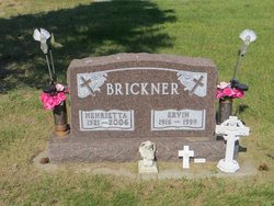
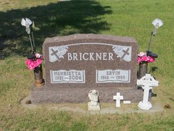
Henrietta A Schlene Brickner
| Birth | : | 24 Nov 1921 Westville, La Porte County, Indiana, USA |
| Death | : | 3 Jun 2006 Garrison, McLean County, North Dakota, USA |
| Burial | : | St Wilfrid Churchyard, Ribchester, Ribble Valley Borough, England |
| Coordinate | : | 53.8102780, -2.5332650 |
| Description | : | Henrietta A. Brickner, 84, of Garrison, N.D. died Saturday, June 3, 2006, at the Garrison Memorial Hospital. She was born Nov. 24, 1921, in Westville, the daughter of Frank and Louisa (Malcow) Schlene. She is survived by daughter and son-in-law, Joetta and Alvin Magandy of Douglas, N.D.; one brother and sister-in-law, Carl and Mildred Schlene Sr. of Westville, Ind., one grandson, Chris Magandy of Underwood, N.D. one granddaughter, Jessica Magandy of Bismarck, N.D. and three grand dogs, Shilo, Shyla and Cocoa. She was preceded in death by her husband Ervin Brickner, and her parents, Frank and Louise Schlene. She was raised in... Read More |
frequently asked questions (FAQ):
-
Where is Henrietta A Schlene Brickner's memorial?
Henrietta A Schlene Brickner's memorial is located at: St Wilfrid Churchyard, Ribchester, Ribble Valley Borough, England.
-
When did Henrietta A Schlene Brickner death?
Henrietta A Schlene Brickner death on 3 Jun 2006 in Garrison, McLean County, North Dakota, USA
-
Where are the coordinates of the Henrietta A Schlene Brickner's memorial?
Latitude: 53.8102780
Longitude: -2.5332650
Family Members:
Flowers:
Nearby Cemetories:
1. St Wilfrid Churchyard
Ribchester, Ribble Valley Borough, England
Coordinate: 53.8102780, -2.5332650
2. The Church of St. Saviour The Holy House of Stydd
Ribchester, Ribble Valley Borough, England
Coordinate: 53.8188690, -2.5272770
3. St Mary's R.C. Church Cemetery
Osbaldeston, Ribble Valley Borough, England
Coordinate: 53.7816970, -2.5350240
4. St Leonard Churchyard
Balderstone, Ribble Valley Borough, England
Coordinate: 53.7860070, -2.5609380
5. Knowle Green Congregational Graveyard
Knowle Green, Ribble Valley Borough, England
Coordinate: 53.8380170, -2.5507210
6. St Peter Churchyard
Salesbury, Ribble Valley Borough, England
Coordinate: 53.7915000, -2.4859100
7. Mellor Methodist Churchyard
Blackburn, Blackburn with Darwen Unitary Authority, England
Coordinate: 53.7742950, -2.5255060
8. St. Mary's Churchyard
Mellor, Ribble Valley Borough, England
Coordinate: 53.7728600, -2.5312400
9. St John the Evangelist Churchyard
Hurst Green, Ribble Valley Borough, England
Coordinate: 53.8358000, -2.4852530
10. Stonyhurst College Burial Ground
Hurst Green, Ribble Valley Borough, England
Coordinate: 53.8403420, -2.4840310
11. St Lawrence Churchyard
Longridge, Ribble Valley Borough, England
Coordinate: 53.8252470, -2.6015030
12. St. Joseph Roman Catholic Churchyard
Hurst Green, Ribble Valley Borough, England
Coordinate: 53.8409900, -2.4820600
13. Brockhall Hospital Cemetery
Brockhall Village, Ribble Valley Borough, England
Coordinate: 53.8186850, -2.4560220
14. St. Leonard Old Churchyard
Langho, Ribble Valley Borough, England
Coordinate: 53.8178590, -2.4552870
15. Our Lady and St. Michael Roman Catholic Churchyard
Longridge, Ribble Valley Borough, England
Coordinate: 53.8088040, -2.6133470
16. St Wilfred Roman Catholic Churchyard Cemetery
Longridge, Ribble Valley Borough, England
Coordinate: 53.8317380, -2.6086060
17. St William of York Churchyard
Thornley with Wheatley, Ribble Valley Borough, England
Coordinate: 53.8559540, -2.5866660
18. Blackburn Cemetery
Blackburn, Blackburn with Darwen Unitary Authority, England
Coordinate: 53.7662430, -2.4726050
19. St. Michael's Churchyard
Grimsargh, City of Preston, England
Coordinate: 53.7990710, -2.6352530
20. Preston Crematorium
Preston, City of Preston, England
Coordinate: 53.7863750, -2.6340170
21. St. Mary's and St. John RC Churchyard, Southworth
Samlesbury, South Ribble Borough, England
Coordinate: 53.7676690, -2.6183400
22. St Paul's
Blackburn, Blackburn with Darwen Unitary Authority, England
Coordinate: 53.7491222, -2.4891266
23. St Alban's Churchyard
Blackburn, Blackburn with Darwen Unitary Authority, England
Coordinate: 53.7530090, -2.4748540
24. St. Leonard the Less Churchyard
Samlesbury, South Ribble Borough, England
Coordinate: 53.7680000, -2.6237000


