
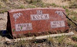
Ida Bell Fellows Koch
| Birth | : | 11 Jan 1868 Fort Smith, Sebastian County, Arkansas, USA |
| Death | : | 26 Jan 1958 Canon City, Fremont County, Colorado, USA |
| Burial | : | Lake Of The Woods Cemetery, Kenora, Kenora District, Canada |
| Coordinate | : | 49.7764700, -94.4798500 |
| Description | : | Unknown newspaper Mrs. Ida Koch Dies In Hospital Mrs. Ida B. Koch, 90, a resident of Hillside [Custer County] until recently died at a local hospital Sunday morning [Jan. 26, 1958] following an illness of about two and a half years. Mrs. Koch had been hospitalized for nine months and prior to that time lived in Hillside. She was a resident of the state for 85 years, coming here from [Fort Smith] Arkansas where she was born on Jan. 11, 1868. On August 29, 1886, she was married to Fred Koch in Canon City. He preceded her in death in... Read More |
frequently asked questions (FAQ):
-
Where is Ida Bell Fellows Koch's memorial?
Ida Bell Fellows Koch's memorial is located at: Lake Of The Woods Cemetery, Kenora, Kenora District, Canada.
-
When did Ida Bell Fellows Koch death?
Ida Bell Fellows Koch death on 26 Jan 1958 in Canon City, Fremont County, Colorado, USA
-
Where are the coordinates of the Ida Bell Fellows Koch's memorial?
Latitude: 49.7764700
Longitude: -94.4798500
Family Members:
Spouse

Children
Flowers:


Nearby Cemetories:
1. Lake Of The Woods Cemetery
Kenora, Kenora District, Canada
Coordinate: 49.7764700, -94.4798500
2. Pineridge Cemetery
Sioux Narrows, Kenora District, Canada
Coordinate: 49.3975171, -94.0623584
3. South East Whiteshell Cemetery
Falcon Lake, Eastern Manitoba Census Division, Canada
Coordinate: 49.7142730, -95.2546700
4. Fort Saint Charles Cemetery
Fort Saint Charles, Lake of the Woods County, USA
Coordinate: 49.3628400, -94.9807120
5. Good Shepherd Cemetery
Angle Inlet, Lake of the Woods County, USA
Coordinate: 49.3511110, -95.0822500
6. McIntosh First Nation Residential School Cemetery
McIntosh, Kenora District, Canada
Coordinate: 49.9794440, -93.6108330
7. McIntosh Cemetery
McIntosh, Kenora District, Canada
Coordinate: 49.9813175, -93.5870514
8. Vermilion Bay Catholic Cemetery
Vermilion Bay, Kenora District, Canada
Coordinate: 49.8782390, -93.4265730
9. Quibell Cemetery
Quibell, Kenora District, Canada
Coordinate: 49.9594491, -93.4252027
10. Norman Cottam Memorial Gardens
Nestor Falls, Kenora District, Canada
Coordinate: 49.1343810, -93.9210630
11. East Braintree Cemetery
East Braintree, Eastern Manitoba Census Division, Canada
Coordinate: 49.5985150, -95.6123610
12. Eagle River Cemetery
Eagle River, Kenora District, Canada
Coordinate: 49.7920670, -93.2036170
13. Saint Marys Riverside Cemetery
Prawda, Eastern Manitoba Census Division, Canada
Coordinate: 49.6903670, -95.7950330
14. Birch River Community Cemetery
Prawda, Eastern Manitoba Census Division, Canada
Coordinate: 49.7493580, -95.8491470
15. Minnitaki Cemetery
Minnitaki, Kenora District, Canada
Coordinate: 49.8157393, -93.0846587
16. Twin Rivers Mennonite Church Cemetery
Elma, Eastern Manitoba Census Division, Canada
Coordinate: 49.7973690, -95.8932610
17. Holy Cross Ukrainian Catholic Cemetery
Elma, Eastern Manitoba Census Division, Canada
Coordinate: 49.8742620, -95.9009350
18. Ukrainian Catholic Cemetery Ascension of Our Lord
Hadashville, Eastern Manitoba Census Division, Canada
Coordinate: 49.6945830, -95.9064670
19. St. Anthony of Padua Roman Catholic Cemetery
Elma, Eastern Manitoba Census Division, Canada
Coordinate: 49.8731000, -95.9073670
20. Saint John the Baptist Roman Catholic Cemetery
Hadashville, Eastern Manitoba Census Division, Canada
Coordinate: 49.6753170, -95.9071500
21. Prosper Township Cemetery
Birch Beach, Lake of the Woods County, USA
Coordinate: 48.8863450, -94.9375190
22. Hillside Cemetery
Lake of the Woods County, USA
Coordinate: 48.8436012, -94.8822021
23. Middlebro Community Cemetery
Middlebro, Eastern Manitoba Census Division, Canada
Coordinate: 49.0312000, -95.4318000
24. Stony Hill Cemetery
Stony Hill, Eastern Manitoba Census Division, Canada
Coordinate: 49.8688830, -95.9753670