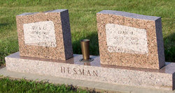
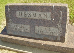
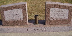
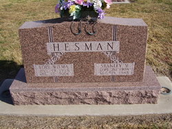
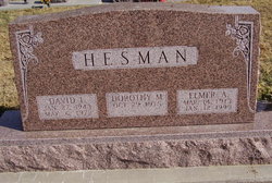
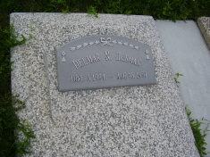
Ivan John Hesman
| Birth | : | 11 Jun 1918 Pauline, Adams County, Nebraska, USA |
| Death | : | 13 Aug 1994 Blue Hill, Webster County, Nebraska, USA |
| Burial | : | St. Mary's Churchyard, Westow, Ryedale District, England |
| Coordinate | : | 54.0846190, -0.8406850 |
| Plot | : | SW section Lot 177 |
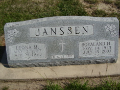
| Description | : | Ivan John Hesman, son of John and Pauline (Stichka) Hesman, was born June 11, 1918, at Pauline, Nebraska, and passed away Saturday, August 13, 1994, at Community Care of Blue Hill, Nebraska. July 29, 1941, in Hastings, Nebraska, he was married to Lois Zenalda Van Metre. They farmed near Pauline, Nebraska, then moved to Blue Hill after retiring. Preceding him in death were two brothers, Stanley and George; and one sister, Leona Janssen. Survivors include his wife, Lola of the Community Care of Blue Hill, Nebraska; three daughters, Norma Krueger and her husband, Harold (Wally) of Elkhorn, Nebraska, Donna... Read More |
frequently asked questions (FAQ):
-
Where is Ivan John Hesman's memorial?
Ivan John Hesman's memorial is located at: St. Mary's Churchyard, Westow, Ryedale District, England.
-
When did Ivan John Hesman death?
Ivan John Hesman death on 13 Aug 1994 in Blue Hill, Webster County, Nebraska, USA
-
Where are the coordinates of the Ivan John Hesman's memorial?
Latitude: 54.0846190
Longitude: -0.8406850
Family Members:
Parent
Spouse
Siblings
Children
Flowers:
Nearby Cemetories:
1. St. Mary's Churchyard
Westow, Ryedale District, England
Coordinate: 54.0846190, -0.8406850
2. Kirkham Priory
Kirkham, Ryedale District, England
Coordinate: 54.0826180, -0.8768470
3. St. Margaret's Churchyard
Huttons Ambo, Ryedale District, England
Coordinate: 54.1066490, -0.8490640
4. St Michael Churchyard
Crambe, Ryedale District, England
Coordinate: 54.0744550, -0.8809390
5. Burythorpe Churchyard
Burythorpe, Ryedale District, England
Coordinate: 54.0752951, -0.7955984
6. St Andrew Churchyard
Langton, Ryedale District, England
Coordinate: 54.0934510, -0.7834680
7. Howsham Churchyard
Howsham, Ryedale District, England
Coordinate: 54.0565520, -0.8755670
8. St John the Evangelist Churchyard
Welburn (Malton), Ryedale District, England
Coordinate: 54.1008850, -0.8985440
9. Castle Howard Mausoleum
Castle Howard, Ryedale District, England
Coordinate: 54.1173870, -0.8886900
10. St John the Baptist
Acklam, Ryedale District, England
Coordinate: 54.0451010, -0.8006330
11. St Mary Churchyard
Birdsall, Ryedale District, England
Coordinate: 54.0780000, -0.7508000
12. St Peter Churchyard
Norton, Ryedale District, England
Coordinate: 54.1289040, -0.7861910
13. All Saints Churchyard
Foston, Ryedale District, England
Coordinate: 54.0775719, -0.9331510
14. St Martin Churchyard
Bulmer, Ryedale District, England
Coordinate: 54.0997510, -0.9317700
15. St Peter and St Paul Churchyard
Scrayingham, Ryedale District, England
Coordinate: 54.0342510, -0.8826130
16. Norton Cemetery
Norton, Ryedale District, England
Coordinate: 54.1306400, -0.7834200
17. St. Leonard with St. Mary Churchyard
Malton, Ryedale District, England
Coordinate: 54.1348110, -0.7946110
18. Coneysthorpe Cemetery
Coneysthorpe, Ryedale District, England
Coordinate: 54.1308750, -0.9042820
19. Malton Cemetery
Malton, Ryedale District, England
Coordinate: 54.1392670, -0.7980300
20. St Botolph Churchyard
Bossall, Ryedale District, England
Coordinate: 54.0375570, -0.9047540
21. St Helen Churchyard
Amotherby, Ryedale District, England
Coordinate: 54.1512000, -0.8521000
22. St Mary the Virgin Priory Churchyard
Malton, Ryedale District, England
Coordinate: 54.1427520, -0.7786450
23. Old Malton Cemetery
Malton, Ryedale District, England
Coordinate: 54.1443200, -0.7808900
24. All Saints Churchyard
Appleton-le-Street, Ryedale District, England
Coordinate: 54.1529500, -0.8766300

