
| Birth | : | 26 Feb 1933 Council Bluffs, Pottawattamie County, Iowa, USA |
| Death | : | 3 May 2012 Council Bluffs, Pottawattamie County, Iowa, USA |
| Burial | : | Lewis Township Cemetery, Council Bluffs, Pottawattamie County, USA |
| Coordinate | : | 41.2117004, -95.7938995 |
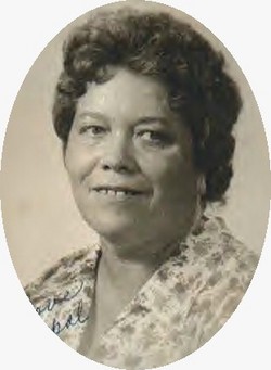
| Description | : | Jacqueline J. Marsh of Council Bluffs passed away May 3, 2012 at her home. She was born February 26, 1933 in Council Bluffs to the late Earl & Myrtle (Orr) Jeffers. In addition to her parents she was preceded in death by her husband, John Marsh; daughter, Edith Marsh; step-daughters, Carolyn and Alice; step-son, Rodney; 4 brothers; 6 sisters. Jacqueline is surviced by her children, Sue Meneley (John), Debbie McKain (Bill), Mary Marsh, Marian Hannon (Randy), Kenneth Marsh (Traci), Robert Marsh (Eleanor); step-daughter, Bonnie Mason (Chuck); step-son, John Marsh (Bobbi); sisters, Marian Peer and Barbie Hunter (Harry); brother, Kenny Jeffers (Lupe); 33... Read More |
frequently asked questions (FAQ):
-
Where is Jacqueline Jean Jeffers Marsh's memorial?
Jacqueline Jean Jeffers Marsh's memorial is located at: Lewis Township Cemetery, Council Bluffs, Pottawattamie County, USA.
-
When did Jacqueline Jean Jeffers Marsh death?
Jacqueline Jean Jeffers Marsh death on 3 May 2012 in Council Bluffs, Pottawattamie County, Iowa, USA
-
Where are the coordinates of the Jacqueline Jean Jeffers Marsh's memorial?
Latitude: 41.2117004
Longitude: -95.7938995
Family Members:
Parent
Spouse

Siblings
Children
Flowers:


Nearby Cemetories:
1. Lewis Township Cemetery
Council Bluffs, Pottawattamie County, USA
Coordinate: 41.2117004, -95.7938995
2. Maple Grove Cemetery
Council Bluffs, Pottawattamie County, USA
Coordinate: 41.2265560, -95.8187100
3. Stoker-Graybill Cemetery
Council Bluffs, Pottawattamie County, USA
Coordinate: 41.2532620, -95.7751770
4. Clark Cemetery
Pottawattamie County, USA
Coordinate: 41.2551610, -95.8223390
5. Saint Pauls Evangelical Country Church Cemetery
Dumfries, Pottawattamie County, USA
Coordinate: 41.1748352, -95.7492371
6. Memorial Park Cemetery
Council Bluffs, Pottawattamie County, USA
Coordinate: 41.2644005, -95.8261032
7. Cedar Lawn Cemetery
Council Bluffs, Pottawattamie County, USA
Coordinate: 41.2694016, -95.8182983
8. Zion Cemetery
Pottawattamie County, USA
Coordinate: 41.1778000, -95.7272000
9. Salem Lutheran Church Cemetery
Glenwood, Mills County, USA
Coordinate: 41.1556015, -95.7617035
10. Oak Hill Cemetery
Council Bluffs, Pottawattamie County, USA
Coordinate: 41.2700900, -95.8226400
11. Bikhor Cholim Cemetery
Council Bluffs, Pottawattamie County, USA
Coordinate: 41.2703670, -95.8229350
12. Ridgewood Cemetery
Council Bluffs, Pottawattamie County, USA
Coordinate: 41.2694016, -95.8272018
13. Saint Joseph Cemetery
Council Bluffs, Pottawattamie County, USA
Coordinate: 41.2722015, -95.8208008
14. Council Point Cemetery
Council Bluffs, Pottawattamie County, USA
Coordinate: 41.2110830, -95.8788610
15. Walnut Hill Cemetery
Council Bluffs, Pottawattamie County, USA
Coordinate: 41.2719002, -95.8255997
16. Green Valley Cemetery
Council Bluffs, Pottawattamie County, USA
Coordinate: 41.2743988, -95.8225021
17. Fairview Cemetery
Council Bluffs, Pottawattamie County, USA
Coordinate: 41.2703018, -95.8480988
18. Saint Marys Cemetery
Mills County, USA
Coordinate: 41.1517580, -95.8514000
19. Saint Boniface Catholic Cemetery
Mills County, USA
Coordinate: 41.1419000, -95.7467100
20. Keg Creek Township Cemetery
Treynor, Pottawattamie County, USA
Coordinate: 41.1913986, -95.6893997
21. Garner Cemetery
Council Bluffs, Pottawattamie County, USA
Coordinate: 41.2956161, -95.8001709
22. Fontenelle Forest Cemetery
Bellevue, Sarpy County, USA
Coordinate: 41.1636430, -95.8887200
23. Saar's Field Cemetery
Mills County, USA
Coordinate: 41.1255500, -95.7725000
24. Wall Cemetery
Mineola, Mills County, USA
Coordinate: 41.1157990, -95.8153000