
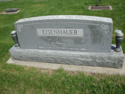
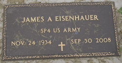
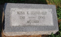
James A Eisenhauer
| Birth | : | 24 Nov 1934 Unadilla, Otoe County, Nebraska, USA |
| Death | : | 30 Sep 2008 Syracuse, Otoe County, Nebraska, USA |
| Burial | : | Saint John Cemetery, Fort Mitchell, Kenton County, USA |
| Coordinate | : | 39.0619011, -84.5550003 |
| Inscription | : | SP4 US ARMY |
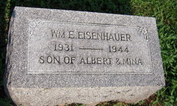
| Description | : | Nebraska City News-Press (NE) - Tuesday, October 7, 2008 James (Jim) "Chester" A. Eisenhauer, 73, Syracuse, formerly Unadilla, died Tuesday, Sept. 30, 2008, at his home. He was born Nov. 24, 1934, at Unadilla, son of Albert and Mina (Goering) Eisenhauer. He married Geraldine (Gerri) Walters June 14, 1963, at Luther Memorial Church, Syracuse. A farmer, Eisenhauer was member of Mid-County Veterans of Foreign Wars (VFW) Post No. 5547 and Massie-Richards American Legion Post No. 100, both Syracuse; Hope Lutheran Church, Burr and the church council; raised many Holstein cattle; served a term on the Unadilla School Board and was a... Read More |
frequently asked questions (FAQ):
-
Where is James A Eisenhauer's memorial?
James A Eisenhauer's memorial is located at: Saint John Cemetery, Fort Mitchell, Kenton County, USA.
-
When did James A Eisenhauer death?
James A Eisenhauer death on 30 Sep 2008 in Syracuse, Otoe County, Nebraska, USA
-
Where are the coordinates of the James A Eisenhauer's memorial?
Latitude: 39.0619011
Longitude: -84.5550003
Family Members:
Parent
Siblings
Flowers:


Nearby Cemetories:
1. Saint John Cemetery
Fort Mitchell, Kenton County, USA
Coordinate: 39.0619011, -84.5550003
2. LaBare Cemetery
Crescent Springs, Kenton County, USA
Coordinate: 39.0631570, -84.5596300
3. Saldridge Cemetery
Crescent Springs, Kenton County, USA
Coordinate: 39.0620860, -84.5690090
4. Flournoy Family Cemetery
Crescent Springs, Kenton County, USA
Coordinate: 39.0672830, -84.5706660
5. Reinhart Family Cemetery
Crescent Springs, Kenton County, USA
Coordinate: 39.0672510, -84.5707150
6. Highland Cemetery
Fort Mitchell, Kenton County, USA
Coordinate: 39.0475006, -84.5457993
7. Saint Mary's Cemetery
Fort Mitchell, Kenton County, USA
Coordinate: 39.0438995, -84.5500031
8. Wilson Cemetery
Covington, Kenton County, USA
Coordinate: 39.0786110, -84.5438900
9. Gardner-Harris Cemetery
Bromley, Kenton County, USA
Coordinate: 39.0807991, -84.5586014
10. Sisters of Notre Dame Cemetery
Park Hills, Kenton County, USA
Coordinate: 39.0637530, -84.5303120
11. Cleveland-McKay Family Cemetery
Villa Hills, Kenton County, USA
Coordinate: 39.0736230, -84.5802230
12. Montague Cemetery
Covington, Kenton County, USA
Coordinate: 39.0805560, -84.5380550
13. Northern Kentucky Police K-9 Memorial
Fort Mitchell, Kenton County, USA
Coordinate: 39.0387149, -84.5476438
14. Highland Pet Cemetery
Fort Mitchell, Kenton County, USA
Coordinate: 39.0384507, -84.5483047
15. Perry Family Burying Ground
Lakeside Park, Kenton County, USA
Coordinate: 39.0333600, -84.5724130
16. Mother Of God Cemetery
Kenton Vale, Kenton County, USA
Coordinate: 39.0480995, -84.5171967
17. Linden Grove Cemetery
Covington, Kenton County, USA
Coordinate: 39.0738983, -84.5152969
18. Beechwood Farm Cemetery
Crestview Hills, Kenton County, USA
Coordinate: 39.0304020, -84.5756360
19. Saint Walburg Cemetery
Villa Hills, Kenton County, USA
Coordinate: 39.0671860, -84.6001990
20. Holy Guardian Angels Cemetery
Edgewood, Kenton County, USA
Coordinate: 39.0269444, -84.5358330
21. Craig Street Burying Ground
Covington, Kenton County, USA
Coordinate: 39.0840890, -84.5151330
22. Mother of God Church
Covington, Kenton County, USA
Coordinate: 39.0839600, -84.5125700
23. Buena Vista Cemetery
Covington, Kenton County, USA
Coordinate: 39.0595200, -84.5040000
24. Cathedral Basilica of the Assumption
Covington, Kenton County, USA
Coordinate: 39.0781120, -84.5081700