
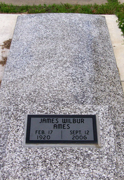
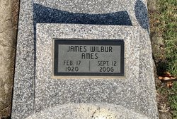
James Wilbur Ames Jr.
| Birth | : | 17 Feb 1920 Chanute, Neosho County, Kansas, USA |
| Death | : | 12 Sep 2006 Wichita, Sedgwick County, Kansas, USA |
| Burial | : | Welford Road Cemetery, Leicester, Leicester Unitary Authority, England |
| Coordinate | : | 52.6200104, -1.1295080 |
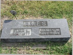
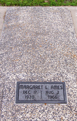
| Description | : | *********************** Chanute Tribune ~ Chanute, KS ~ September 15, 2006 James Wilbur Ames, Jr., 86, Chanute, KS, died Tuesday, Sept. 12, 2006, in Wichita, Kansas. He was born in Chanute, Kansas on Feb. 17, 1920, the son of James W. and Elma Taylor-Ames. He was united in marriage to Margaret Shorter in 1941. She preceded him in death August 12, 1966. In February of 1967 he was united in marriage to Ann Vandiver. She preceded him in death on March 26, 1979. He was united in marriage to Amy June Sherbenou June 14, 1980. She survives, of the home. He served his country during World... Read More |
frequently asked questions (FAQ):
-
Where is James Wilbur Ames Jr.'s memorial?
James Wilbur Ames Jr.'s memorial is located at: Welford Road Cemetery, Leicester, Leicester Unitary Authority, England.
-
When did James Wilbur Ames Jr. death?
James Wilbur Ames Jr. death on 12 Sep 2006 in Wichita, Sedgwick County, Kansas, USA
-
Where are the coordinates of the James Wilbur Ames Jr.'s memorial?
Latitude: 52.6200104
Longitude: -1.1295080
Family Members:
Parent

Spouse
Siblings
Children
Flowers:


Nearby Cemetories:
1. Welford Road Cemetery
Leicester, Leicester Unitary Authority, England
Coordinate: 52.6200104, -1.1295080
2. St. john the Baptist
Leicester, Leicester Unitary Authority, England
Coordinate: 52.6181730, -1.1118790
3. St Peter's Church (Defunct)
Leicester, Leicester Unitary Authority, England
Coordinate: 52.6300260, -1.1164980
4. Church of the Annunciation of St. Mary
Leicester, Leicester Unitary Authority, England
Coordinate: 52.6308229, -1.1417201
5. St. Mary de Castro Churchyard
Leicester, Leicester Unitary Authority, England
Coordinate: 52.6322610, -1.1404000
6. St George's Church
Leicester, Leicester Unitary Authority, England
Coordinate: 52.6344300, -1.1267420
7. Leicester Cathedral
Leicester, Leicester Unitary Authority, England
Coordinate: 52.6347430, -1.1370210
8. Saint Mary Magdalene Churchyard
Knighton, Leicester Unitary Authority, England
Coordinate: 52.6054170, -1.1163730
9. St. Nicholas Church
Leicester, Leicester Unitary Authority, England
Coordinate: 52.6351400, -1.1408940
10. Great Meeting Unitarian Chapel
Leicester, Leicester Unitary Authority, England
Coordinate: 52.6379400, -1.1360390
11. All Saints Church
Leicester, Leicester Unitary Authority, England
Coordinate: 52.6381940, -1.1403170
12. St Margaret Churchyard
Leicester, Leicester Unitary Authority, England
Coordinate: 52.6403430, -1.1363440
13. St Andrew Churchyard
Aylestone, Leicester Unitary Authority, England
Coordinate: 52.6038420, -1.1568900
14. Saffron Hill Cemetery
Leicester, Leicester Unitary Authority, England
Coordinate: 52.5934120, -1.1310010
15. Leicester Abbey
Leicester, Leicester Unitary Authority, England
Coordinate: 52.6489600, -1.1369470
16. St Peter's Churchyard
Braunstone, Blaby District, England
Coordinate: 52.6208940, -1.1812900
17. St. Denys' Churchyard
Evington, Leicester Unitary Authority, England
Coordinate: 52.6193210, -1.0743860
18. Oadby Cemetery
Oadby, Oadby and Wigston Borough, England
Coordinate: 52.5961580, -1.0826170
19. St Wistan's Churchyard
Wigston, Oadby and Wigston Borough, England
Coordinate: 52.5866580, -1.1024700
20. St. Peter Churchyard
Oadby, Oadby and Wigston Borough, England
Coordinate: 52.5973900, -1.0805100
21. Wigston United Reformed Church
Wigston, Oadby and Wigston Borough, England
Coordinate: 52.5840900, -1.1071200
22. St. Peter's Churchyard
Belgrave, Leicester Unitary Authority, England
Coordinate: 52.6594208, -1.1255690
23. All Saints Churchyard
Wigston, Oadby and Wigston Borough, England
Coordinate: 52.5823880, -1.1096900
24. Gilroes Cemetery and Crematorium
Leicester, Leicester Unitary Authority, England
Coordinate: 52.6514359, -1.1721700