Jessie I. Elswick Sylvester
| Birth | : | 16 Feb 1916 Albia, Monroe County, Iowa, USA |
| Death | : | 2 Jan 2006 Centerville, Appanoose County, Iowa, USA |
| Burial | : | Saint Remigius Churchyard, Hethersett, South Norfolk District, England |
| Coordinate | : | 52.5992830, 1.1889340 |
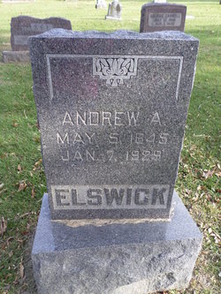
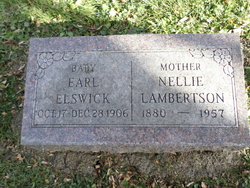
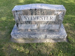
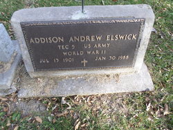
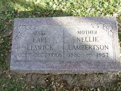
| Description | : | Jessie I. Sylvester, age 89, of Centerville, Iowa, died Monday, January 2, 2006, at Mercy Medical Center in Centerville. She was born the daughter of Andrew and Nellie(Hynd)Elswick on February 16, 1916 in Albia, Iowa. She received her education in a Rural Monroe County School. On September 25, 1937, Jessie was united in marriage to Clarence "Larry" Sylvester in Albia, Iowa. She worked for over 17 years at the Trophy Glove Factory in Albia as a Seamstress. Jessie was a member of First Christian Church and CWF both in Albia. She was preceded in death by: her parents;... Read More |
frequently asked questions (FAQ):
-
Where is Jessie I. Elswick Sylvester's memorial?
Jessie I. Elswick Sylvester's memorial is located at: Saint Remigius Churchyard, Hethersett, South Norfolk District, England.
-
When did Jessie I. Elswick Sylvester death?
Jessie I. Elswick Sylvester death on 2 Jan 2006 in Centerville, Appanoose County, Iowa, USA
-
Where are the coordinates of the Jessie I. Elswick Sylvester's memorial?
Latitude: 52.5992830
Longitude: 1.1889340
Family Members:
Parent
Spouse
Siblings
Children
Flowers:
Nearby Cemetories:
1. St Mary's and All Saints Churchyard
Little Melton, South Norfolk District, England
Coordinate: 52.6173083, 1.1798046
2. All Saints & St Mary Churchyard
Great Melton, South Norfolk District, England
Coordinate: 52.6108700, 1.1602200
3. St. Peter's Churchyard
Ketteringham, South Norfolk District, England
Coordinate: 52.5778000, 1.1921000
4. Colney Woodland Burial Park
Colney, South Norfolk District, England
Coordinate: 52.6254580, 1.1991560
5. St Mary Churchyard
East Carleton, South Norfolk District, England
Coordinate: 52.5726700, 1.2153470
6. St. Andrew Churchyard
Colney, South Norfolk District, England
Coordinate: 52.6253800, 1.2206100
7. Keswick Churchyard
Keswick, South Norfolk District, England
Coordinate: 52.5909460, 1.2419310
8. All Saints Church, Intwood
Cringleford, South Norfolk District, England
Coordinate: 52.5910430, 1.2419930
9. St. Mary and St. Walstan Churchyard
Bawburgh, South Norfolk District, England
Coordinate: 52.6327480, 1.1796530
10. St. Peter's Churchyard
Cringleford, South Norfolk District, England
Coordinate: 52.6057990, 1.2453370
11. St. Andrew's Old Churchyard
Eaton, City of Norwich, England
Coordinate: 52.6068200, 1.2514300
12. St. Mary's Churchyard
Earlham, City of Norwich, England
Coordinate: 52.6280416, 1.2353034
13. St Michael's Church
Bowthorpe, City of Norwich, England
Coordinate: 52.6359300, 1.2163600
14. Eaton Parish Burial Ground
Eaton, City of Norwich, England
Coordinate: 52.6053900, 1.2556800
15. All Saints Churchyard
Hethel, South Norfolk District, England
Coordinate: 52.5578530, 1.2014560
16. St. Mary's Churchyard
Marlingford, South Norfolk District, England
Coordinate: 52.6310660, 1.1416800
17. St. Mary Magdalen Churchyard
Mulbarton, South Norfolk District, England
Coordinate: 52.5638930, 1.2360530
18. St Nicholas Churchyard
Bracon Ash, South Norfolk District, England
Coordinate: 52.5559000, 1.2137000
19. All Saints Churchyard
Keswick, South Norfolk District, England
Coordinate: 52.5951470, 1.2675790
20. Costessey Parish Cemetery
Costessey, South Norfolk District, England
Coordinate: 52.6495927, 1.2040157
21. St Botolphs
Barford, South Norfolk District, England
Coordinate: 52.6287000, 1.1118000
22. Earlham Road Cemetery
Norwich, City of Norwich, England
Coordinate: 52.6305900, 1.2677400
23. St. Peter's Churchyard
Easton, South Norfolk District, England
Coordinate: 52.6543660, 1.1478070
24. Our Lady & St. Walstan Churchyard
Costessey, South Norfolk District, England
Coordinate: 52.6583200, 1.2119300

