
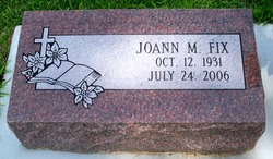
JoAnn M. Lassek Fix
| Birth | : | 12 Oct 1931 Litchfield, Sherman County, Nebraska, USA |
| Death | : | 24 Jul 2006 Lincoln, Lancaster County, Nebraska, USA |
| Burial | : | St. Edmund Churchyard, Sutton St Edmund, South Holland District, England |
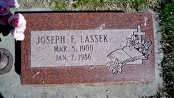
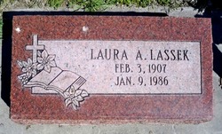
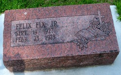
| Description | : | Daughter of Joseph & Laura (Kusek) Lassek. She grew up on a farm near Litchfield and rural Columbus, moving to Columbus at about age 14. JoAnn graduated from Kramer High School in 1949. She married Felix Fix, Jr. on November 23, 1950 at St. Anthony Church in Columbus. JoAnn began working at Loup Power District as a steno-clerk in 1950 and resigned in 1954 to raise her family. She worked part-time as a typist for Schweser's in Columbus and in the insurance claims department for Becher-Curry before returning to Loup Public Power District in 1963. JoAnn worked at Loup as an... Read More |
frequently asked questions (FAQ):
-
Where is JoAnn M. Lassek Fix's memorial?
JoAnn M. Lassek Fix's memorial is located at: St. Edmund Churchyard, Sutton St Edmund, South Holland District, England.
-
When did JoAnn M. Lassek Fix death?
JoAnn M. Lassek Fix death on 24 Jul 2006 in Lincoln, Lancaster County, Nebraska, USA
Family Members:
Parent
Spouse
Flowers:


Nearby Cemetories:
1. Crowland Abbey
Crowland, South Holland District, England
Coordinate: 52.8080873, -0.2216285
2. Gedney Hill Churchyard Extension
Gedney Hill, South Holland District, England
Coordinate: 52.8135340, -0.1589220
3. Holy Trinity Churchyard
Gedney Hill, South Holland District, England
4. Lutton Cemetery
Lutton, South Holland District, England
Coordinate: 52.7974840, -0.0385520
5. St Nicholas Churchyard
Lutton, South Holland District, England
Coordinate: 52.8016190, -0.0281347
6. St. Matthew's Churchyard
Sutton Bridge, South Holland District, England
Coordinate: 52.9071410, -0.2059100
7. St. John the Baptist Churchyard
Whaplode Drove, South Holland District, England
Coordinate: 52.9091670, -0.2055560
8. Christs Church Churchyard
Dawsmere, South Holland District, England
Coordinate: 52.9072790, -0.2050080
9. All Saints Churchyard
Holbeach, South Holland District, England
Coordinate: 52.8518081, -0.2166268
10. Holbeach Cemetery
Holbeach, South Holland District, England
Coordinate: 52.8903400, -0.1819700
11. St. John's Churchyard
Holbeach, South Holland District, England
12. Pinchbeck Cherry Holt Cemetery
Pinchbeck, South Holland District, England
13. St Bartholomew's Church West Pinchbeck
Pinchbeck, South Holland District, England
Coordinate: 52.8080873, -0.2216285
14. St. Mary's Churchyard
Pinchbeck, South Holland District, England
Coordinate: 52.8135340, -0.1589220
15. St. Edmund Churchyard
Sutton St Edmund, South Holland District, England
16. St. Mary's Churchyard
Whaplode, South Holland District, England
Coordinate: 52.7974840, -0.0385520
17. Whaplode Cemetery
Whaplode, South Holland District, England
Coordinate: 52.8016190, -0.0281347
18. Donington New Cemetery
Donington, South Holland District, England
Coordinate: 52.9071410, -0.2059100
19. Donington Old Cemetery
Donington, South Holland District, England
Coordinate: 52.9091670, -0.2055560
20. St. Mary and the Holy Rood Churchyard
Donington, South Holland District, England
Coordinate: 52.9072790, -0.2050080
21. St Gilbert and St Hugh Churchyard
Gosberton Clough, South Holland District, England
Coordinate: 52.8518081, -0.2166268
22. St. Margaret's Churchyard
Quadring, South Holland District, England
Coordinate: 52.8903400, -0.1819700
23. Baptist Church
Sutton St James, South Holland District, England
24. St. James Churchyard
Sutton St James, South Holland District, England