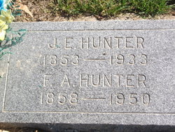
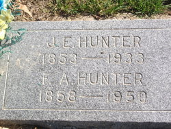
Joel Ellis Hunter
| Birth | : | 6 May 1853 Clinton County, Kentucky, USA |
| Death | : | 28 Sep 1933 Bloomfield, Davis County, Iowa, USA |
| Burial | : | Pleasant Hill Cemetery, Mount Gilead, Henderson County, USA |
| Coordinate | : | 35.7599983, -88.5408020 |
| Description | : | Son of William H. Hunter, and wife, Martha Jane Ellis. Married Francis Almeda Henderson, December 19, 1873. |
frequently asked questions (FAQ):
-
Where is Joel Ellis Hunter's memorial?
Joel Ellis Hunter's memorial is located at: Pleasant Hill Cemetery, Mount Gilead, Henderson County, USA.
-
When did Joel Ellis Hunter death?
Joel Ellis Hunter death on 28 Sep 1933 in Bloomfield, Davis County, Iowa, USA
-
Where are the coordinates of the Joel Ellis Hunter's memorial?
Latitude: 35.7599983
Longitude: -88.5408020
Family Members:
Flowers:
Nearby Cemetories:
1. Pleasant Hill Cemetery
Mount Gilead, Henderson County, USA
Coordinate: 35.7599983, -88.5408020
2. Stewart Cemetery
Henderson County, USA
Coordinate: 35.7694170, -88.5537500
3. Waller-Douglas Cemetery
Henderson County, USA
Coordinate: 35.7301970, -88.5179270
4. Cool Springs Cemetery
Independence, Henderson County, USA
Coordinate: 35.7494490, -88.5923100
5. James Cemetery
Cedar Grove, Henderson County, USA
Coordinate: 35.8034590, -88.5310720
6. Independence Cemetery
Poplar Springs, Henderson County, USA
Coordinate: 35.7280998, -88.5860977
7. Bargerton Church of Christ Cemetery
Henderson County, USA
Coordinate: 35.7314000, -88.4917570
8. Spain Cemetery
Henderson County, USA
Coordinate: 35.8069000, -88.5663986
9. Hall Cemetery
Lexington, Henderson County, USA
Coordinate: 35.7330850, -88.4841940
10. Old Shady Grove Methodist Church Cemetery
Lexington, Henderson County, USA
Coordinate: 35.7056400, -88.5319300
11. Douglass Cemetery
Union Cross, Henderson County, USA
Coordinate: 35.7579550, -88.4705780
12. Oakley Cemetery
Jackson, Madison County, USA
Coordinate: 35.7467730, -88.6094490
13. Douglass Cemetery
Bargerton, Henderson County, USA
Coordinate: 35.7734720, -88.4710370
14. Anderson Cemetery
Henderson County, USA
Coordinate: 35.7016983, -88.5342026
15. George Anderson Cemetery
Lexington, Henderson County, USA
Coordinate: 35.7014470, -88.5324140
16. Oak Grove Cemetery
Madison County, USA
Coordinate: 35.7581000, -88.6139000
17. Rue Hammer Cemetery
Parkers Crossroads, Henderson County, USA
Coordinate: 35.8093400, -88.4994800
18. Bible Hill Cemetery
Henderson County, USA
Coordinate: 35.8097000, -88.4985200
19. Mount Pleasant Church Cemetery
Wildersville, Henderson County, USA
Coordinate: 35.8095680, -88.4974310
20. Seats Chapel Holiness Church Cemetery
Cedar Grove, Henderson County, USA
Coordinate: 35.8118860, -88.4964260
21. Manley Cemetery
Blue Goose, Henderson County, USA
Coordinate: 35.7069600, -88.5837520
22. Cogdell Cemetery
Blue Goose, Henderson County, USA
Coordinate: 35.7015520, -88.5732290
23. Lucas Cemetery
Henderson County, USA
Coordinate: 35.7983589, -88.4765930
24. Church of Christ Cemetery
Huron, Henderson County, USA
Coordinate: 35.6919921, -88.5300273


