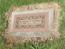
| Birth | : | 2 Aug 1860 Pennsylvania, USA |
| Death | : | 24 Dec 1927 Placer County, California, USA |
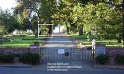
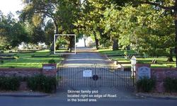
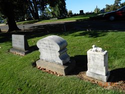
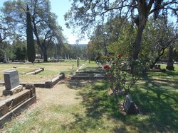
| Burial | : | Old Auburn Cemetery, Auburn, Placer County, USA |
| Coordinate | : | 38.9023720, -121.0812230 |
| Description | : | "Skinner-Monaghan Wedding--On Wednesday evening last, Miss Mary Monaghan, oldest daughter of James Monaghan, a pioneer resident of Rock Creek, was married to Mr. Harry Skinner of Mt. Pleasant. The ceremony was performed by Father Tormey at the residence of the bride's parents. The bride, who is one of Placer's fairest native daughters and a favorite with all the Rock Creek people, old and young, looked charming in a gown of golden brown satin and plush trimmed with gimp ornaments. The groom is well known as one of Placer's rising young farmers and has a host of friends who wish him... Read More |
frequently asked questions (FAQ):
-
Where is John Harry Skinner's memorial?
John Harry Skinner's memorial is located at: Old Auburn Cemetery, Auburn, Placer County, USA.
-
When did John Harry Skinner death?
John Harry Skinner death on 24 Dec 1927 in Placer County, California, USA
-
Where are the coordinates of the John Harry Skinner's memorial?
Latitude: 38.9023720
Longitude: -121.0812230
Family Members:
Parent
Spouse
Siblings
Children
Flowers:
Nearby Cemetories:
1. Old Auburn Cemetery
Auburn, Placer County, USA
Coordinate: 38.9023720, -121.0812230
2. New Auburn Cemetery
Auburn, Placer County, USA
Coordinate: 38.9026900, -121.0870800
3. Placer County Hospital Cemetery
Auburn, Placer County, USA
Coordinate: 38.9045120, -121.0721320
4. Clark Ashton Smith Gravesite
Auburn, Placer County, USA
Coordinate: 38.8952100, -121.0770500
5. Bethlehem Lutheran Church Columbarium
Auburn, Placer County, USA
Coordinate: 38.8932350, -121.0749690
6. First Congregational Church Memorial Garden
Auburn, Placer County, USA
Coordinate: 38.9118660, -121.0711770
7. Chinese Cemetery
Auburn, Placer County, USA
Coordinate: 38.9183502, -121.0802383
8. Maidu Indian Burial Grounds
Auburn, Placer County, USA
Coordinate: 38.8744350, -121.0777290
9. Ophir Cemetery
Placer County, USA
Coordinate: 38.8928870, -121.1273790
10. Newcastle Cemetery
Newcastle, Placer County, USA
Coordinate: 38.8708880, -121.1444060
11. Wells Cemetery
Auburn, Placer County, USA
Coordinate: 38.9667000, -121.1054900
12. Gold Hill Cemetery
Gold Hill, Placer County, USA
Coordinate: 38.9025000, -121.1802200
13. Bayley Family Cemetery
Pilot Hill, El Dorado County, USA
Coordinate: 38.8438800, -121.0148900
14. Stewarts Flat Cemetery
Penryn, Placer County, USA
Coordinate: 38.8447360, -121.1507950
15. Lone Star Cemetery
Placer County, USA
Coordinate: 38.9757996, -121.1380997
16. Rattlesnake Bar Graveyard
Auburn, Placer County, USA
Coordinate: 38.8163050, -121.0895100
17. Clipper Gap Cemetery
Clipper Gap, Placer County, USA
Coordinate: 38.9784880, -121.0256590
18. Pilot Hill Cemetery
Pilot Hill, El Dorado County, USA
Coordinate: 38.8301010, -121.0093307
19. Mansur Family Cemetery
Loomis, Placer County, USA
Coordinate: 38.8139600, -121.1214000
20. Prosser Family Cemetery
Loomis, Placer County, USA
Coordinate: 38.8071900, -121.1285600
21. Esoteric Fraternity Cemetery
Applegate, Placer County, USA
Coordinate: 38.9946190, -120.9687490
22. Georgetown-Renke Cemetery Annex
Georgetown, El Dorado County, USA
Coordinate: 38.8964610, -120.9116240
23. Greenwood Pioneer Cemetery
Greenwood, El Dorado County, USA
Coordinate: 38.8985786, -120.9099274
24. Spanish Dry Diggings Cemetery
Greenwood, El Dorado County, USA
Coordinate: 38.9431600, -120.9158000

