
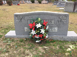
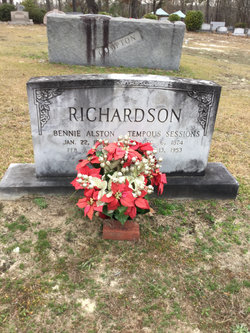
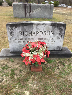
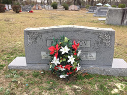
John L. Richardson
| Birth | : | 13 Aug 1904 |
| Death | : | 22 Apr 1934 |
| Burial | : | Oak Grove Cemetery, Missouri Valley, Harrison County, USA |
| Coordinate | : | 41.5167007, -95.8649979 |
| Description | : | Horry Herald May 3, 1934 In Memoriam John L. Richardson John L. Richardson, a young man of about thirty years of age was shot and killed at the home of Harry Benson about 2:30 am April 22, 1934. He was taken to the Conway Hospital but nothing could be done to save him. His many friends extend to his parents, his wife, and to his children their deepest and most heartfelt sympathy. And may we all just look unto the Lord in times of trials and distress, remembering that all things, though sad as they may seem, work for the good of... Read More |
frequently asked questions (FAQ):
-
Where is John L. Richardson's memorial?
John L. Richardson's memorial is located at: Oak Grove Cemetery, Missouri Valley, Harrison County, USA.
-
When did John L. Richardson death?
John L. Richardson death on 22 Apr 1934 in
-
Where are the coordinates of the John L. Richardson's memorial?
Latitude: 41.5167007
Longitude: -95.8649979
Family Members:
Parent
Spouse
Children


Nearby Cemetories:
1. Oak Grove Cemetery
Missouri Valley, Harrison County, USA
Coordinate: 41.5167007, -95.8649979
2. Branson Cemetery
Loveland, Pottawattamie County, USA
Coordinate: 41.4846992, -95.8606033
3. Rose Hill Memorial Gardens
Missouri Valley, Harrison County, USA
Coordinate: 41.5656000, -95.8897000
4. Hurleys Evergreen Cemetery
Harrison County, USA
Coordinate: 41.5700989, -95.8618698
5. Mount Carmel Cemetery
Missouri Valley, Harrison County, USA
Coordinate: 41.5675011, -95.8897018
6. Saint Bridgets Cemetery
Honey Creek, Pottawattamie County, USA
Coordinate: 41.4664001, -95.8289032
7. Crook Cemetery
Honey Creek, Pottawattamie County, USA
Coordinate: 41.4581330, -95.8737000
8. Champan Frazier Cemetery
Harrison County, USA
Coordinate: 41.5773500, -95.8933500
9. Allen Cemetery
Pottawattamie County, USA
Coordinate: 41.4427986, -95.8550034
10. Frazier Cemetery
Missouri Valley, Harrison County, USA
Coordinate: 41.5932999, -95.8375015
11. Grange Cemetery
Honey Creek, Pottawattamie County, USA
Coordinate: 41.4446678, -95.8034668
12. Linnwood Cemetery
Harrison County, USA
Coordinate: 41.5589200, -95.7502100
13. Reels Cemetery
Crescent, Pottawattamie County, USA
Coordinate: 41.4234100, -95.8321700
14. William C McIntosh Cemetery
Crescent, Pottawattamie County, USA
Coordinate: 41.4088745, -95.8477097
15. Saint Pauls Lutheran Cemetery
Neola, Pottawattamie County, USA
Coordinate: 41.4337000, -95.7607000
16. Harris Grove Cemetery
Beebeetown, Harrison County, USA
Coordinate: 41.5782928, -95.7262192
17. Calhoun Cemetery
Calhoun, Harrison County, USA
Coordinate: 41.6391983, -95.8938980
18. Fort Calhoun Cemetery
Fort Calhoun, Washington County, USA
Coordinate: 41.4581375, -96.0352020
19. Logan Cemetery
Logan, Harrison County, USA
Coordinate: 41.6487579, -95.7843170
20. Crescent Cemetery
Crescent, Pottawattamie County, USA
Coordinate: 41.3664894, -95.8566208
21. Shipley Cemetery
Washington County, USA
Coordinate: 41.3932991, -95.9828033
22. Bethel Cemetery
Logan, Harrison County, USA
Coordinate: 41.6239014, -95.6999969
23. Castor Cemetery
Underwood, Pottawattamie County, USA
Coordinate: 41.4127040, -95.6887490
24. Cox Cemetery
Persia, Harrison County, USA
Coordinate: 41.5391998, -95.6418991