
| Birth | : | 5 May 1933 Council Bluffs, Pottawattamie County, Iowa, USA |
| Death | : | 19 Jan 2015 Nevada, Vernon County, Missouri, USA |
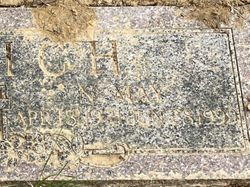
| Burial | : | Garner Cemetery, Council Bluffs, Pottawattamie County, USA |
| Coordinate | : | 41.2956161, -95.8001709 |
| Plot | : | Blk 1, Lot 6, Space 1 |
| Description | : | Johnnie LeRoy Foote, 81, of Nevada, Mo., passed away Jan. 19, 2015. He was born May 5, 1933, in Council Bluffs, Iowa, to the late Basil and Blanche (Buffin) Foote. In addition to his parents he was preceded in death by his wife, Jean Foote; brothers, Walt Foote and Basil Foote Jr.; sister, May Pavich; and stepfather, Seymour Hathaway. John is survived by his children, Gavleen Smoot and husband, Ray, Jay Shatto, and Robin Hager and husband, Jody; stepchildren, Rusty Nelson and wife, Doreen, Jeff Nelson, and David Nelson and wife, Jeri; sisters, Betty Million and Wanda Rodriquez;... Read More |
frequently asked questions (FAQ):
-
Where is John LeRoy “Johnnie” Foote's memorial?
John LeRoy “Johnnie” Foote's memorial is located at: Garner Cemetery, Council Bluffs, Pottawattamie County, USA.
-
When did John LeRoy “Johnnie” Foote death?
John LeRoy “Johnnie” Foote death on 19 Jan 2015 in Nevada, Vernon County, Missouri, USA
-
Where are the coordinates of the John LeRoy “Johnnie” Foote's memorial?
Latitude: 41.2956161
Longitude: -95.8001709
Family Members:
Parent

Spouse
Siblings
Flowers:


Nearby Cemetories:
1. Garner Cemetery
Council Bluffs, Pottawattamie County, USA
Coordinate: 41.2956161, -95.8001709
2. Green Valley Cemetery
Council Bluffs, Pottawattamie County, USA
Coordinate: 41.2743988, -95.8225021
3. Saint Joseph Cemetery
Council Bluffs, Pottawattamie County, USA
Coordinate: 41.2722015, -95.8208008
4. Cedar Lawn Cemetery
Council Bluffs, Pottawattamie County, USA
Coordinate: 41.2694016, -95.8182983
5. Walnut Hill Cemetery
Council Bluffs, Pottawattamie County, USA
Coordinate: 41.2719002, -95.8255997
6. Bikhor Cholim Cemetery
Council Bluffs, Pottawattamie County, USA
Coordinate: 41.2703670, -95.8229350
7. Oak Hill Cemetery
Council Bluffs, Pottawattamie County, USA
Coordinate: 41.2700900, -95.8226400
8. Ridgewood Cemetery
Council Bluffs, Pottawattamie County, USA
Coordinate: 41.2694016, -95.8272018
9. Memorial Park Cemetery
Council Bluffs, Pottawattamie County, USA
Coordinate: 41.2644005, -95.8261032
10. Gregg Cemetery
Weston, Pottawattamie County, USA
Coordinate: 41.3330000, -95.7931000
11. Evans Cemetery
Crescent, Pottawattamie County, USA
Coordinate: 41.3255997, -95.8368988
12. Clark Cemetery
Pottawattamie County, USA
Coordinate: 41.2551610, -95.8223390
13. Fairview Cemetery
Council Bluffs, Pottawattamie County, USA
Coordinate: 41.2703018, -95.8480988
14. Stoker-Graybill Cemetery
Council Bluffs, Pottawattamie County, USA
Coordinate: 41.2532620, -95.7751770
15. Hazel Dell Cemetery
Council Bluffs, Pottawattamie County, USA
Coordinate: 41.3489723, -95.7939911
16. Saint Columbanus Cemetery
Weston, Pottawattamie County, USA
Coordinate: 41.3429440, -95.7435260
17. Maple Grove Cemetery
Council Bluffs, Pottawattamie County, USA
Coordinate: 41.2265560, -95.8187100
18. Crescent Cemetery
Crescent, Pottawattamie County, USA
Coordinate: 41.3664894, -95.8566208
19. Lewis Township Cemetery
Council Bluffs, Pottawattamie County, USA
Coordinate: 41.2117004, -95.7938995
20. Downsville Cemetery
Pottawattamie County, USA
Coordinate: 41.3502998, -95.7039032
21. Council Point Cemetery
Council Bluffs, Pottawattamie County, USA
Coordinate: 41.2110830, -95.8788610
22. Pottawattamie County Home Cemetery
McClelland, Pottawattamie County, USA
Coordinate: 41.3269400, -95.6691738
23. Trinity Cathedral Columbarium
Omaha, Douglas County, USA
Coordinate: 41.2603900, -95.9393660
24. Hardin Township Cemetery
McClelland, Pottawattamie County, USA
Coordinate: 41.2949982, -95.6513977