
| Birth | : | 22 Dec 1900 Ellsworth, Ellsworth County, Kansas, USA |
| Death | : | 28 Oct 1983 Council Bluffs, Pottawattamie County, Iowa, USA |
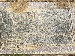
| Burial | : | Branson Cemetery, Loveland, Pottawattamie County, USA |
| Coordinate | : | 41.4846992, -95.8606033 |
| Description | : | Iowa, U.S., Birth Records, 1856-1944 Name: Blanche Baker Gender: Female Race: White Birth Date: 22 Dec 1900 Birth Place: Council Bluffs, Pottawattamie, Iowa, USA Father: Alonso Clarance Baker Mother: Anna Harriet Buffon Certificate Number: 286283 1910 United States Federal Census Name: Blanche Baker Age in 1910: 9 Birth Date: 1901 Birthplace: Kansas Home in 1910: Marena, Hodgeman, Kansas, USA Race: White Gender: Female Relation to Head of House: Daughter Marital Status: Single Father's Name: Alonzo C Baker Father's Birthplace: Nebraska Mother's Name: Harriett A Baker Mother's Birthplace: Iowa Attended School: Yes Household Members Age Relationship Alonzo C Baker 37... Read More |
frequently asked questions (FAQ):
-
Where is Blanche Belle Baker Foote-Hathaway's memorial?
Blanche Belle Baker Foote-Hathaway's memorial is located at: Branson Cemetery, Loveland, Pottawattamie County, USA.
-
When did Blanche Belle Baker Foote-Hathaway death?
Blanche Belle Baker Foote-Hathaway death on 28 Oct 1983 in Council Bluffs, Pottawattamie County, Iowa, USA
-
Where are the coordinates of the Blanche Belle Baker Foote-Hathaway's memorial?
Latitude: 41.4846992
Longitude: -95.8606033
Family Members:
Parent
Spouse

Siblings
Children
Flowers:


Nearby Cemetories:
1. Branson Cemetery
Loveland, Pottawattamie County, USA
Coordinate: 41.4846992, -95.8606033
2. Crook Cemetery
Honey Creek, Pottawattamie County, USA
Coordinate: 41.4581330, -95.8737000
3. Saint Bridgets Cemetery
Honey Creek, Pottawattamie County, USA
Coordinate: 41.4664001, -95.8289032
4. Oak Grove Cemetery
Missouri Valley, Harrison County, USA
Coordinate: 41.5167007, -95.8649979
5. Allen Cemetery
Pottawattamie County, USA
Coordinate: 41.4427986, -95.8550034
6. Grange Cemetery
Honey Creek, Pottawattamie County, USA
Coordinate: 41.4446678, -95.8034668
7. Reels Cemetery
Crescent, Pottawattamie County, USA
Coordinate: 41.4234100, -95.8321700
8. William C McIntosh Cemetery
Crescent, Pottawattamie County, USA
Coordinate: 41.4088745, -95.8477097
9. Rose Hill Memorial Gardens
Missouri Valley, Harrison County, USA
Coordinate: 41.5656000, -95.8897000
10. Hurleys Evergreen Cemetery
Harrison County, USA
Coordinate: 41.5700989, -95.8618698
11. Mount Carmel Cemetery
Missouri Valley, Harrison County, USA
Coordinate: 41.5675011, -95.8897018
12. Saint Pauls Lutheran Cemetery
Neola, Pottawattamie County, USA
Coordinate: 41.4337000, -95.7607000
13. Champan Frazier Cemetery
Harrison County, USA
Coordinate: 41.5773500, -95.8933500
14. Frazier Cemetery
Missouri Valley, Harrison County, USA
Coordinate: 41.5932999, -95.8375015
15. Linnwood Cemetery
Harrison County, USA
Coordinate: 41.5589200, -95.7502100
16. Crescent Cemetery
Crescent, Pottawattamie County, USA
Coordinate: 41.3664894, -95.8566208
17. Shipley Cemetery
Washington County, USA
Coordinate: 41.3932991, -95.9828033
18. Fort Calhoun Cemetery
Fort Calhoun, Washington County, USA
Coordinate: 41.4581375, -96.0352020
19. Harris Grove Cemetery
Beebeetown, Harrison County, USA
Coordinate: 41.5782928, -95.7262192
20. Hazel Dell Cemetery
Council Bluffs, Pottawattamie County, USA
Coordinate: 41.3489723, -95.7939911
21. Castor Cemetery
Underwood, Pottawattamie County, USA
Coordinate: 41.4127040, -95.6887490
22. Calhoun Cemetery
Calhoun, Harrison County, USA
Coordinate: 41.6391983, -95.8938980
23. Gregg Cemetery
Weston, Pottawattamie County, USA
Coordinate: 41.3330000, -95.7931000
24. Evans Cemetery
Crescent, Pottawattamie County, USA
Coordinate: 41.3255997, -95.8368988