
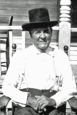

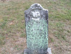
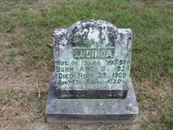
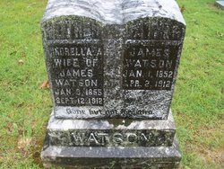
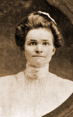
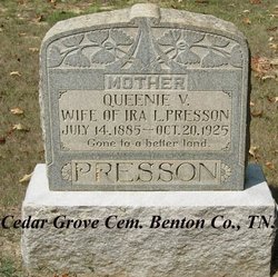
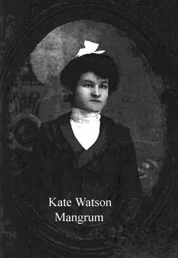
John Watson
| Birth | : | 22 May 1847 Camden, Benton County, Tennessee, USA |
| Death | : | 26 Jun 1932 Camden, Benton County, Tennessee, USA |
| Burial | : | Holy Trinity Churchyard, Wensley, Richmondshire District, England |
| Coordinate | : | 54.3014000, -1.8600000 |
frequently asked questions (FAQ):
-
Where is John Watson's memorial?
John Watson's memorial is located at: Holy Trinity Churchyard, Wensley, Richmondshire District, England.
-
When did John Watson death?
John Watson death on 26 Jun 1932 in Camden, Benton County, Tennessee, USA
-
Where are the coordinates of the John Watson's memorial?
Latitude: 54.3014000
Longitude: -1.8600000
Family Members:
Parent
Spouse
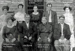
Siblings
Children
Flowers:


Nearby Cemetories:
1. Holy Trinity Churchyard
Wensley, Richmondshire District, England
Coordinate: 54.3014000, -1.8600000
2. Wensley Cemetery
Wensley, Richmondshire District, England
Coordinate: 54.3013320, -1.8568169
3. Leyburn Cemetery
Leyburn, Richmondshire District, England
Coordinate: 54.3093030, -1.8348630
4. Preston Under Scar Cemetery
Preston-under-Scar, Richmondshire District, England
Coordinate: 54.3133800, -1.8964000
5. St Bartholomew Churchyard
West Witton, Richmondshire District, England
Coordinate: 54.2920100, -1.9073200
6. Holy Trinity Churchyard
Coverham, Richmondshire District, England
Coordinate: 54.2727230, -1.8429440
7. Coverham Abbey
Coverham, Richmondshire District, England
Coordinate: 54.2728510, -1.8392460
8. St. Mary and St. Alkelda Churchyard
Middleham, Richmondshire District, England
Coordinate: 54.2864000, -1.8074000
9. Spennithorne & Harmby Cemetery
Harmby, Richmondshire District, England
Coordinate: 54.3002500, -1.7989900
10. St John the Evangelist Churchyard
Bellerby, Richmondshire District, England
Coordinate: 54.3303200, -1.8239000
11. St Mary Churchyard
Redmire, Richmondshire District, England
Coordinate: 54.3126200, -1.9227400
12. St Michael and All Angels Churchyard Spennithorne
Spennithorne, Richmondshire District, England
Coordinate: 54.2960200, -1.7910200
13. St Simon and St Jude Roman Catholic Churchyard
Ulshaw Bridge, Richmondshire District, England
Coordinate: 54.2809800, -1.7771600
14. St John the Evangelist Churchyard
East Witton, Richmondshire District, England
Coordinate: 54.2696020, -1.7760850
15. St. Andrew Churchyard
Aysgarth, Richmondshire District, England
Coordinate: 54.2922340, -1.9833760
16. St. Oswald's Churchyard
Thornton Steward, Richmondshire District, England
Coordinate: 54.2776700, -1.7398000
17. Friends Meeting House Burial Ground
Carperby, Richmondshire District, England
Coordinate: 54.3031720, -1.9925670
18. Marrick Priory Churchyard
Marrick, Richmondshire District, England
Coordinate: 54.3758830, -1.8977990
19. Jervaulx Abbey
East Witton, Richmondshire District, England
Coordinate: 54.2670280, -1.7379870
20. St Michael and All Angels Churchyard
Downholme, Richmondshire District, England
Coordinate: 54.3799700, -1.8313400
21. St Oswald Churchyard
Hauxwell, Richmondshire District, England
Coordinate: 54.3333300, -1.7333300
22. St Botolph Churchyard
Horsehouse, Richmondshire District, England
Coordinate: 54.2269100, -1.9292300
23. Reeth and Grinton Cemetery
Grinton, Richmondshire District, England
Coordinate: 54.3800400, -1.9246700
24. St. Andrew's Churchyard
Finghall, Richmondshire District, England
Coordinate: 54.3068300, -1.7085500