
| Memorials | : | 7 |
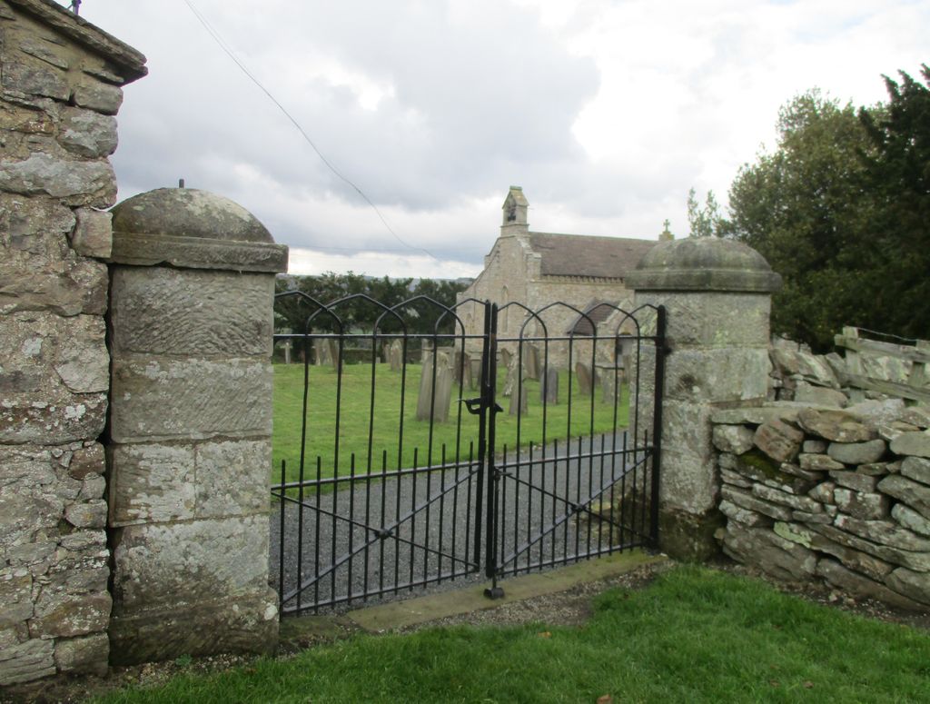
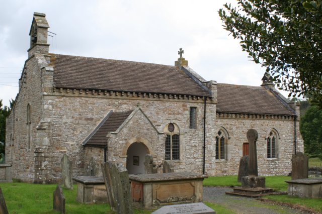
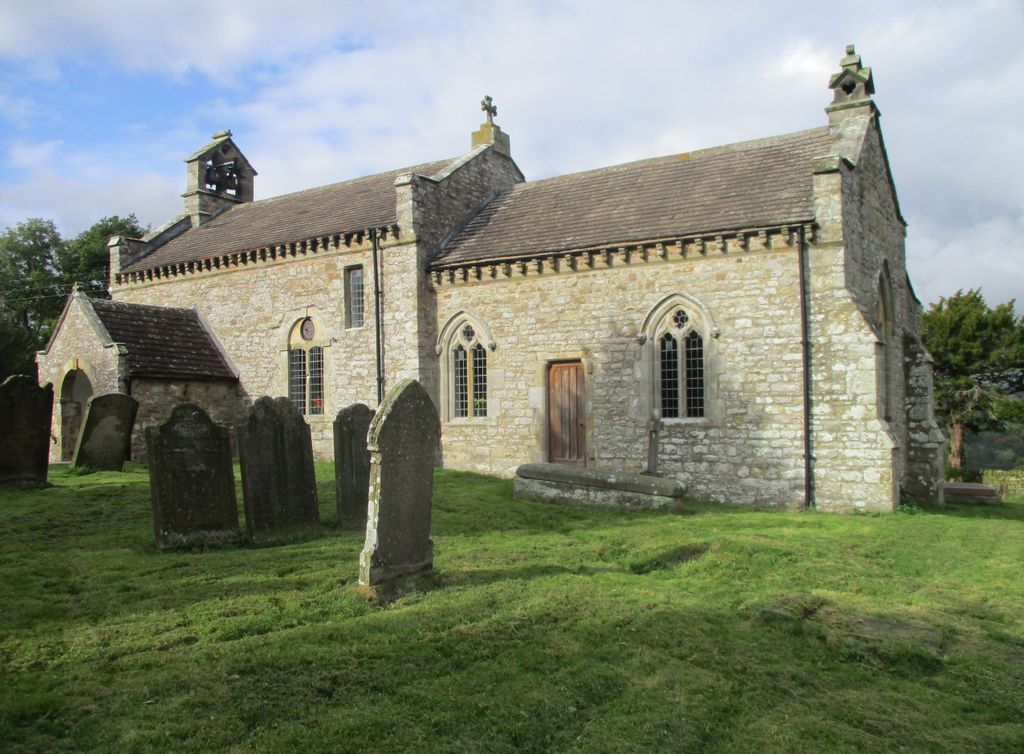
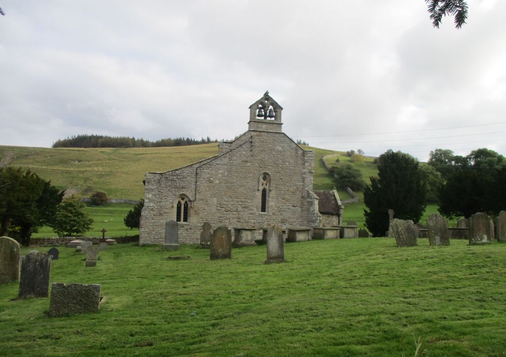
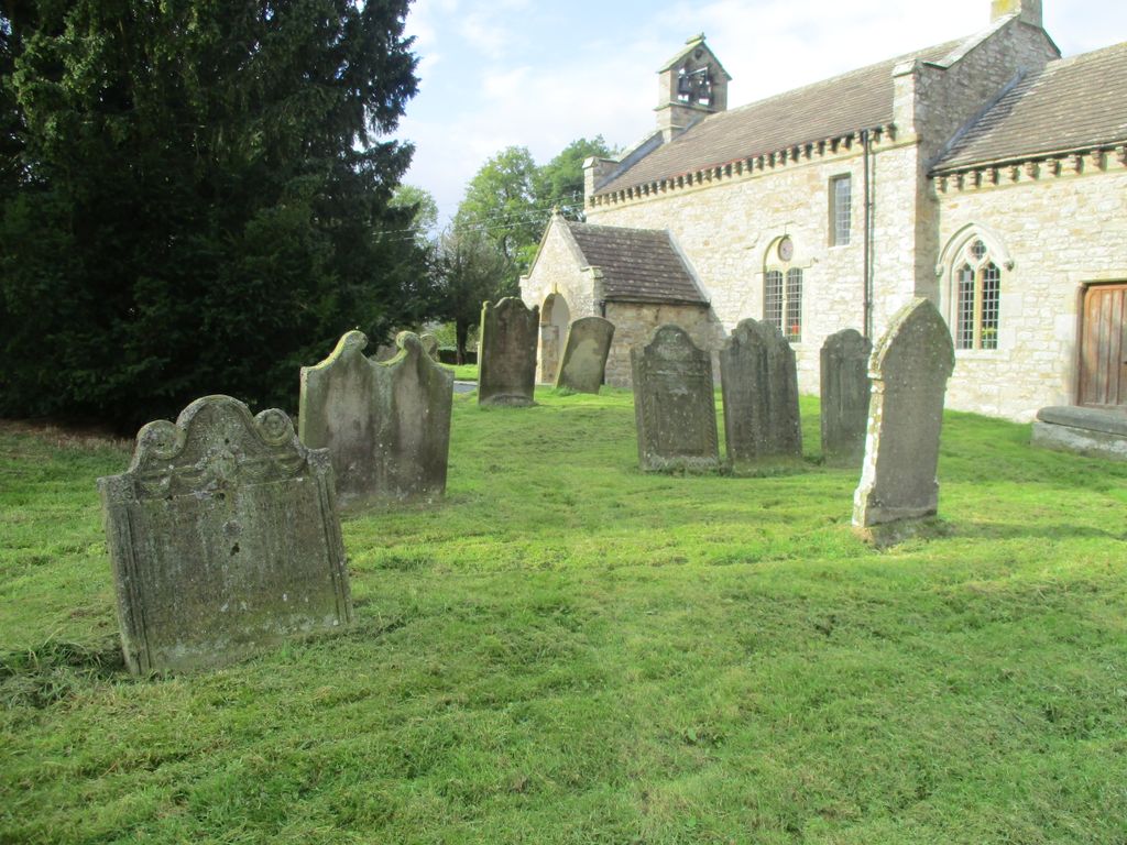
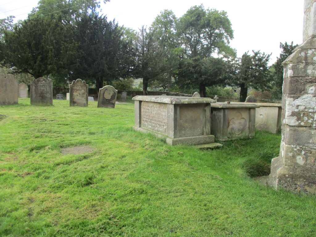
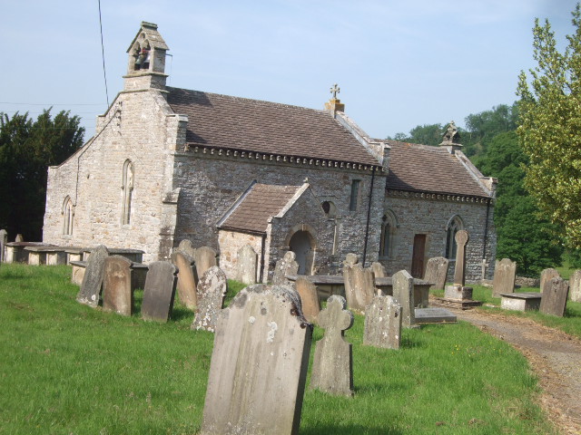
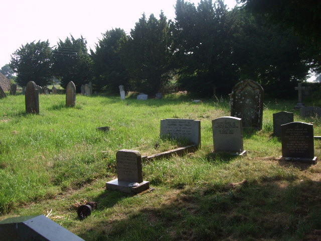
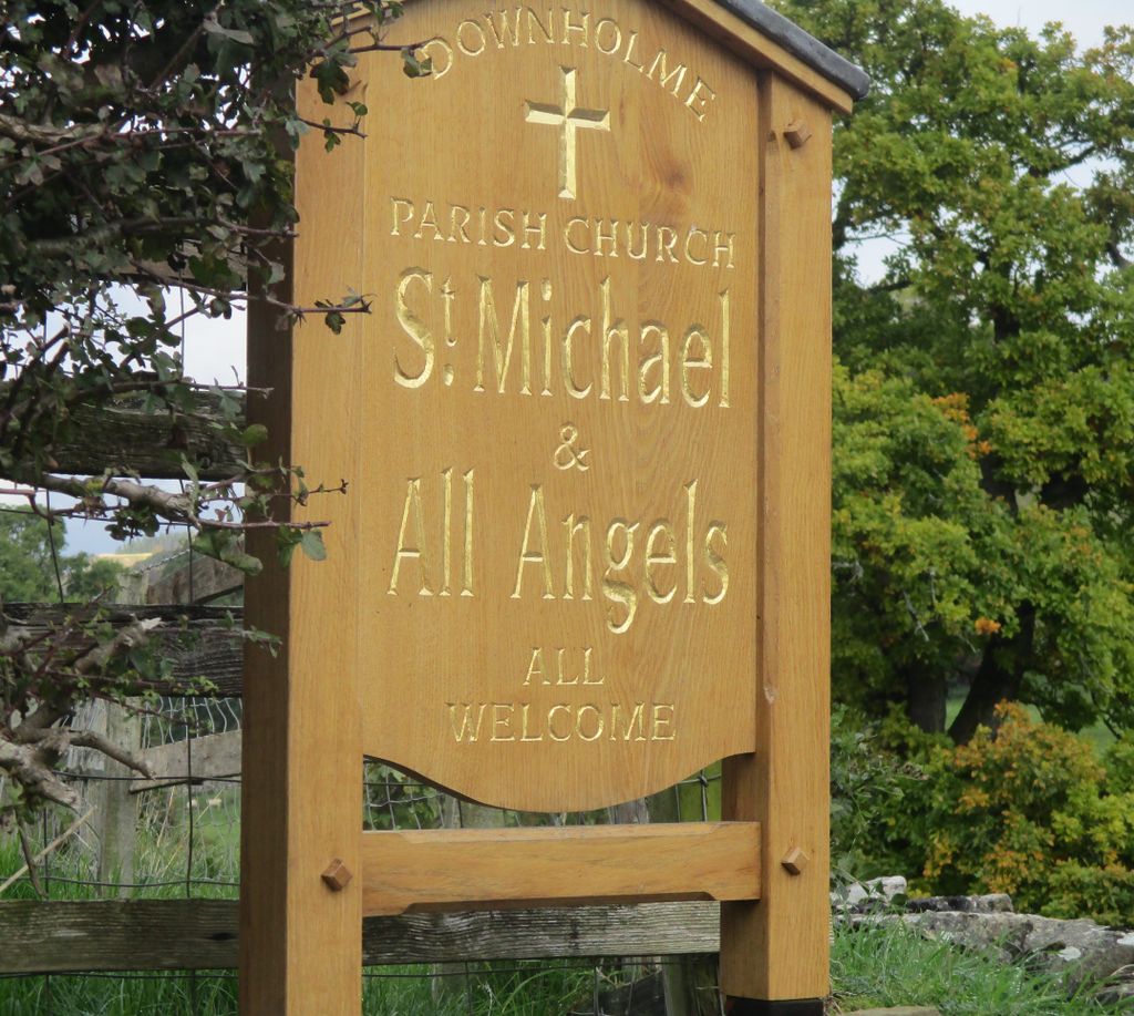
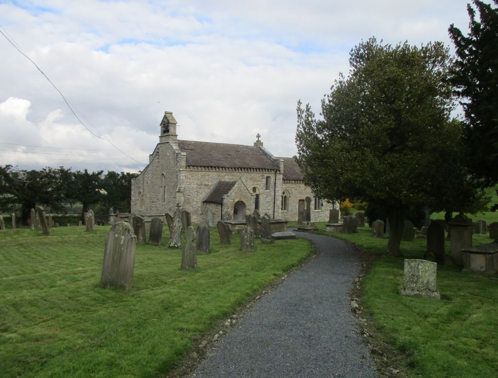
| Location | : | Downholme, Richmondshire District, England |
| Coordinate | : | 54.3799700, -1.8313400 |
| Description | : | The church dates from about 1180. The parish registers, dating from 1736, are held at the North Yorkshire County Records Office, Northallerton. |
frequently asked questions (FAQ):
-
Where is St Michael and All Angels Churchyard?
St Michael and All Angels Churchyard is located at Downholme, Richmondshire District ,North Yorkshire , DL11 6ADEngland.
-
St Michael and All Angels Churchyard cemetery's updated grave count on graveviews.com?
7 memorials
-
Where are the coordinates of the St Michael and All Angels Churchyard?
Latitude: 54.3799700
Longitude: -1.8313400
Nearby Cemetories:
1. St Edmund the Martyr Churchyard
Marske, Richmondshire District, England
Coordinate: 54.3997500, -1.8403700
2. St Michael and All Angels Churchyard
Hudswell, Richmondshire District, England
Coordinate: 54.3990300, -1.7846500
3. Marrick Priory Churchyard
Marrick, Richmondshire District, England
Coordinate: 54.3758830, -1.8977990
4. St John the Evangelist Churchyard
Bellerby, Richmondshire District, England
Coordinate: 54.3303200, -1.8239000
5. Richmond Cemetery
Richmond, Richmondshire District, England
Coordinate: 54.4053750, -1.7572010
6. Reeth and Grinton Cemetery
Grinton, Richmondshire District, England
Coordinate: 54.3800400, -1.9246700
7. St. Andrew's Churchyard
Grinton, Richmondshire District, England
Coordinate: 54.3812610, -1.9305740
8. St Mary the Virgin Churchyard
Richmond, Richmondshire District, England
Coordinate: 54.4046600, -1.7333700
9. Reeth Congregational Chapelyard
Reeth, Richmondshire District, England
Coordinate: 54.3878600, -1.9422700
10. Catterick Garrison Military Cemetery
Hipswell, Richmondshire District, England
Coordinate: 54.3803100, -1.7138300
11. St John The Evangelist Churchyard
Hipswell, Richmondshire District, England
Coordinate: 54.3798700, -1.7130100
12. St Agatha Churchyard
Easby, Richmondshire District, England
Coordinate: 54.3976010, -1.7158320
13. Leyburn Cemetery
Leyburn, Richmondshire District, England
Coordinate: 54.3093030, -1.8348630
14. St Oswald Churchyard
Hauxwell, Richmondshire District, England
Coordinate: 54.3333300, -1.7333300
15. Preston Under Scar Cemetery
Preston-under-Scar, Richmondshire District, England
Coordinate: 54.3133800, -1.8964000
16. St. Peter and St. Felix Churchyard
Kirby Hill, Richmondshire District, England
Coordinate: 54.4546050, -1.7851500
17. Wensley Cemetery
Wensley, Richmondshire District, England
Coordinate: 54.3013320, -1.8568169
18. Holy Trinity Churchyard
Wensley, Richmondshire District, England
Coordinate: 54.3014000, -1.8600000
19. Spennithorne & Harmby Cemetery
Harmby, Richmondshire District, England
Coordinate: 54.3002500, -1.7989900
20. St Mary Churchyard
Redmire, Richmondshire District, England
Coordinate: 54.3126200, -1.9227400
21. St Michael and All Angels Churchyard Spennithorne
Spennithorne, Richmondshire District, England
Coordinate: 54.2960200, -1.7910200
22. St. Agatha and St. Oswin Churchyard
Gilling West, Richmondshire District, England
Coordinate: 54.4414840, -1.7209980
23. St Paulinus Roman Catholic Churchyard
Brough with St Giles, Richmondshire District, England
Coordinate: 54.3779100, -1.6698900
24. St. Mary and St. Alkelda Churchyard
Middleham, Richmondshire District, England
Coordinate: 54.2864000, -1.8074000