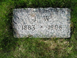
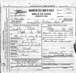
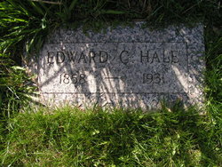
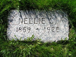
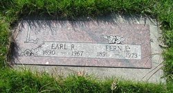
John William Hale
| Birth | : | 9 Sep 1883 Mauston, Juneau County, Wisconsin, USA |
| Death | : | 25 Apr 1908 Stevens County, Washington, USA |
| Burial | : | Mount Toby Cemetery, Leverett, Franklin County, USA |
| Coordinate | : | 42.4894810, -72.5174400 |
| Description | : | John W. Hale, aged 24, living three miles south east of Meyers Falls, died suddenly last Saturday evening. The funeral was held at the home on Monday, with burial at Meyers Falls. He had been strong and active all his life, until within a few weeks, when he contracted typhoid fever, smallpox and yellow jaundice, in succession, which finally caused his death. he was born in Manston, Wisconsin, September 9, 1883, where he lived until 18 years of age. he then, with his parents, moved to Greenwood, near Meyers Falls, where he resided until his death. He was a member... Read More |
frequently asked questions (FAQ):
-
Where is John William Hale's memorial?
John William Hale's memorial is located at: Mount Toby Cemetery, Leverett, Franklin County, USA.
-
When did John William Hale death?
John William Hale death on 25 Apr 1908 in Stevens County, Washington, USA
-
Where are the coordinates of the John William Hale's memorial?
Latitude: 42.4894810
Longitude: -72.5174400
Family Members:
Parent
Siblings
Flowers:
Nearby Cemetories:
1. Mount Toby Cemetery
Leverett, Franklin County, USA
Coordinate: 42.4894810, -72.5174400
2. Marvell Cemetery
Leverett, Franklin County, USA
Coordinate: 42.5028000, -72.5042038
3. Jackson Hill Cemetery
Leverett, Franklin County, USA
Coordinate: 42.5028000, -72.5028000
4. North Sunderland Cemetery
Sunderland, Franklin County, USA
Coordinate: 42.4972000, -72.5492020
5. North Cemetery
Leverett, Franklin County, USA
Coordinate: 42.4673720, -72.4983230
6. Mount Hope Cemetery
Leverett, Franklin County, USA
Coordinate: 42.5111008, -72.4906006
7. Plain View Cemetery
Leverett, Franklin County, USA
Coordinate: 42.4972100, -72.4751900
8. Moores Corner Cemetery
Leverett, Franklin County, USA
Coordinate: 42.4924200, -72.4730700
9. Old South Cemetery
Montague, Franklin County, USA
Coordinate: 42.5232500, -72.5360300
10. Long Plain Cemetery
Leverett, Franklin County, USA
Coordinate: 42.4510994, -72.5250015
11. Pine Nook Cemetery
Deerfield, Franklin County, USA
Coordinate: 42.5086300, -72.5661400
12. Patrick Cemetery
Leverett, Franklin County, USA
Coordinate: 42.4995800, -72.4619500
13. Chestnut Hill Cemetery
Montague, Franklin County, USA
Coordinate: 42.5228004, -72.4822006
14. Ward Cemetery
Deerfield, Franklin County, USA
Coordinate: 42.4806700, -72.5774600
15. Gardner Cemetery
Leverett, Franklin County, USA
Coordinate: 42.5036011, -72.4574966
16. Locust Hill Cemetery
Montague, Franklin County, USA
Coordinate: 42.5394700, -72.5363400
17. Elm Grove Cemetery
Montague, Franklin County, USA
Coordinate: 42.5418600, -72.5359000
18. Riverside Cemetery
Sunderland, Franklin County, USA
Coordinate: 42.4611015, -72.5864029
19. East Leverett Cemetery
Leverett, Franklin County, USA
Coordinate: 42.4357224, -72.4857788
20. Locks Village Cemetery
Shutesbury, Franklin County, USA
Coordinate: 42.5010200, -72.4364000
21. Wiley Cemetery
Leverett, Franklin County, USA
Coordinate: 42.4290200, -72.5304200
22. Bloody Brook Mass Grave
Deerfield, Franklin County, USA
Coordinate: 42.4819700, -72.6038600
23. Sugarloaf Street Cemetery
South Deerfield, Franklin County, USA
Coordinate: 42.4762800, -72.6071500
24. Holy Name of Jesus Cemetery
Deerfield, Franklin County, USA
Coordinate: 42.4706800, -72.6071300

